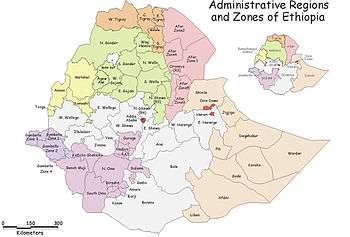
Asosa Zone
Asosa is one of the three Zones in Benishangul-Gumuz Region of Ethiopia. This Zone was named after the Asosa Sultanate, which had approximately the same boundaries. Asosa is bordered on the south by the Mao-Komo special woreda, on the west by Sudan, and on the northeast by the Kamashi. The largest town in this zone is Asosa. Its highest point is Mount Bambasi, located in the woreda of the same name.
The area Asosa occupies came under Ethiopian control in 1898, when Emperor Menelik II skillfully exploied the traditional rivalry of the three local rulers, Sheikh Hojele al-Hassan of Asosa, Sheikh Mahmud of Komosha and Sheikh Abd al-Rahman Hojele of Bela-Shangul proper. When Ethiopia and the British administration of Sudan demarcated their common border in 1902, this finalized their annexation.[1]
Demographics
Based on the 2007 Census conducted by the Central Statistical Agency of Ethiopia (CSA), this Zone has a total population of 310,822, of whom 158,932 are men and 151,890 women. 39,957 or 12.86% of population are urban inhabitants. A total of 72,879 households were counted in this Zone, which results in an average of 4.27 persons to a household, and 69,378 housing units. The four largest ethnic groups reported in the Asosa Zone were the Berta (59.95%), the Amhara (23.86%), the Oromo (10.31%), and the Tigrayans (1.5%), 1.48% of the population was from Sudan; all other ethnic groups made up 2.9% of the population. Main languages are the Berta (59.31%), Amharic (25.7%), Oromo (10.68%), and Tigrinya (1.07%). The majority of the inhabitants were Muslim, with 74.08% of the population reporting that they held that belief, while 16.51% practiced Ethiopian Orthodox Christianity, and 8.57% were Protestant.[2]
Based on figures from the Central Statistical Agency in 2005, this zone has an estimated total population of 282,596, of whom 143,544 are men and 139,052 are women; 28,264 or 10% of its population are urban dwellers. With an estimated area of 14,166.12 square kilometers, Asosa has an estimated population density of 19.95 people per square kilometer.[3]
The 1994 national census reported a total population for this Zone of 208,155 in 47,755 households, of whom 106,017 were men and 102,138 were women; 16,420 or 7.89% of its population were urban dwellers. The five largest ethnic groups reported in the Asosa Zone were the Berta (54%), the Amhara (26%), the Oromo (11%), the Tigrayans (1.5%), and the Mao (1.3%). Berta was spoken by 53.6%, Amharic is spoken as a first language by 26.7% and as a second language by another 6.2%, Oromiffa by 11.3% and as a second language by another 5.5%, Fadashi by 4.2%, and Tigrinya by 1.4%. The majority of the inhabitants were Muslim, with 78% of the population reporting they professed that religion, while 18.7% practiced Ethiopian Orthodox Christianity, and 2.7% were Protestant.[4]
According to a May 24, 2004 World Bank memorandum, 9% of the inhabitants of Asosa have access to electricity, this zone has a road density of 35.6 kilometers per 1000 square kilometers, the average rural household has 1 hectare of land (compared to the national average of 1.01 hectare of land and an average of 2.25 for pastoral Regions)[5] and the equivalent of 0.4 heads of livestock. 17.1% of the population is in non-farm related jobs, compared to the national average of 25% and a regional average of 28%. 72% of all eligible children are enrolled in primary school, and 13% in secondary schools. 34% of the zone is exposed to malaria, and 58% to Tsetse fly. The memorandum gave this zone a drought risk rating of 324.[6]
Notes
- ↑ Abdussamad H. Ahmad, "Trading in Slaves in Bela-Shangul and Gumuz, Ethiopia: Border Enclaves in History, 1897-1938", Journal of African History, 40 (1999), pp. 435f
- ↑ Census 2007 Tables: Benishangul-Gumuz Region, Tables 2.1, 2.4, 2.5, 3.1, 3.2 and 3.4.
- ↑ CSA 2005 National Statistics Archived November 23, 2006, at the Wayback Machine., Table B.3
- ↑ 1994 Population and Housing Census of Ethiopia: Results for Benishangul-Gumuz Region, Vol. 1 Archived November 20, 2008, at the Wayback Machine. Tables 2.1, 2.7, 2.11, 2.14, 2.17, 2.19 (accessed 30 December 2008). The Census takers included the numbers for Mao-Komo special woreda in the totals for the Asosa Zone.
- ↑ Comparative national and regional figures comes from the World Bank publication, Klaus Deininger et al. "Tenure Security and Land Related Investment", WP-2991 (accessed 23 March 2006). This publication defines Gambela, Afar and Somali as "pastoral Regions".
- ↑ World Bank, Four Ethiopias: A Regional Characterization (accessed 23 March 2006).
Coordinates: 10°20′N 34°40′E / 10.333°N 34.667°E
Woredas of the Benishangul-Gumuz Region | ||
|---|---|---|
| Asosa Zone | ||
| Kamashi Zone | ||
| Metekel Zone | ||
| Special woredas | ||