Ashby Magna railway station
| Ashby Magna | |
|---|---|
|
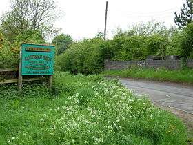
Site of Ashby Magna in 2006 | |
| Location | |
| Place | Ashby Magna |
| Area | Harborough |
| Grid reference | SP55589077 |
| Operations | |
| Pre-grouping | Great Central Railway |
| Post-grouping |
London and North Eastern Railway London Midland Region of British Railways |
| Platforms | 2 |
| History | |
| 15 March 1899 | Opened |
| 5 May 1969 | Closed |
| Disused railway stations in the United Kingdom | |
|
Closed railway stations in Britain A B C D–F G H–J K–L M–O P–R S T–V W–Z | |
|
| |
Ashby Magna was a station on the Great Central Railway, the last main line to be constructed from the north of England to London, which opened in 1899 to serve the Leicestershire village of Ashby Magna.
Architecturally, the station was very similar to Whetstone in that it comprised a single island platform designed by Alexander Ross which allowed the tracks to pass either side of a central platform, and was intended to facilitate future expansion of the railway.[1] Access to the station was via a stairway which led down from the road bridge on Station Road.[2]
History
Opened by the Great Central Railway, it became part of the London and North Eastern Railway during the Grouping of 1923. The station then passed to the London Midland Region of British Railways on nationalisation in 1948. It was then closed by the British Railways Board.
The site today
The station closed along with the railway line in 1969, and today little remains of it. The construction of the M1 motorway (which occurred whilst the line was still open) to the east of the station resulted in the demolition of the stationmaster's house and the loss of the goods yard. Today, a timber merchant occupies the site and remains of the cattle dock are still visible.[3]
| Preceding station | Disused railways | Following station | ||
|---|---|---|---|---|
| Lutterworth Line and station closed |
Great Central Railway London Extension |
Whetstone Line and station closed | ||
References
- ↑ Leicester County Council, "Lutterworth Station".
- ↑ Ashby Magna today.
- ↑ Healy, J.M.C. (1988). The Great Central Rail Tour. Paddock Wood, Kent: Unicorn Books. p. 29. ISBN 978-1-85241-005-6.
- Butt, R. V. J. (1995). The Directory of Railway Stations: details every public and private passenger station, halt, platform and stopping place, past and present (1st ed.). Sparkford: Patrick Stephens Ltd. ISBN 1-8526-0508-1. OCLC 60251199.
- Jowett, Alan (2000). Jowett's Nationalised Railway Atlas (1st ed.). Penryn, Cornwall: Atlantic Transport Publishers. ISBN 0-9068-9999-0. OCLC 228266687.
- Station on navigable O. S. map
Coordinates: 52°30′43″N 1°10′57″W / 52.51199°N 1.18246°W