Arronville
| Arronville | ||
|---|---|---|
|
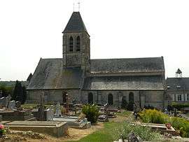
The church of Arronville | ||
| ||
 Arronville | ||
|
Location within Île-de-France region  Arronville | ||
| Coordinates: 49°10′55″N 2°06′52″E / 49.1819°N 2.1144°ECoordinates: 49°10′55″N 2°06′52″E / 49.1819°N 2.1144°E | ||
| Country | France | |
| Region | Île-de-France | |
| Department | Val-d'Oise | |
| Arrondissement | Pontoise | |
| Canton | Pontoise | |
| Intercommunality | Vallée du Sausseron | |
| Government | ||
| • Mayor (2014–2020) | François Pélegrin | |
| Area1 | 15.85 km2 (6.12 sq mi) | |
| Population (2013)2 | 663 | |
| • Density | 42/km2 (110/sq mi) | |
| Time zone | CET (UTC+1) | |
| • Summer (DST) | CEST (UTC+2) | |
| INSEE/Postal code | 95023 / 95810 | |
| Elevation | 52–140 m (171–459 ft) | |
|
1 French Land Register data, which excludes lakes, ponds, glaciers > 1 km² (0.386 sq mi or 247 acres) and river estuaries. 2 Population without double counting: residents of multiple communes (e.g., students and military personnel) only counted once. | ||
.svg.png)
Arronville is a commune in the Val-d'Oise department in Île-de-France in northern France.
Population
| Year | 1793 | 1800 | 1806 | 1821 | 1831 | 1836 | 1841 | 1846 | 1851 | 1856 |
|---|---|---|---|---|---|---|---|---|---|---|
| Population | 566 | 545 | 562 | 560 | 621 | 621 | 590 | 600 | 519 | 520 |
| Year | 1861 | 1866 | 1872 | 1876 | 1881 | 1886 | 1891 | 1896 | 1901 | 1906 |
|---|---|---|---|---|---|---|---|---|---|---|
| Population | 552 | 523 | 521 | 528 | 545 | 518 | 493 | 503 | 470 | 399 |
| Year | 1911 | 1921 | 1926 | 1931 | 1936 | 1946 | 1954 | 1962 | 1968 | 1975 |
|---|---|---|---|---|---|---|---|---|---|---|
| Population | 430 | 398 | 389 | 411 | 339 | 316 | 350 | 403 | 396 | 411 |
| Year | 1982 | 1990 | 1999 | 2008 |
|---|---|---|---|---|
| Population | 440 | 553 | 610 | 666 |
See also
References
External links
- Official website (French)
- Mérimée database - Cultural heritage (French)
- Land use (IAURIF) (English)
| Wikimedia Commons has media related to Arronville. |
This article is issued from Wikipedia - version of the 10/18/2016. The text is available under the Creative Commons Attribution/Share Alike but additional terms may apply for the media files.