Arly Airport
| Arly Airport | |||||||||||
|---|---|---|---|---|---|---|---|---|---|---|---|
| IATA: ARL – ICAO: DFER | |||||||||||
| Summary | |||||||||||
| Airport type | Public | ||||||||||
| Serves | Arly | ||||||||||
| Location |
| ||||||||||
| Elevation AMSL | 761 ft / 232 m | ||||||||||
| Coordinates | 11°35′46.9″N 1°28′49.8″E / 11.596361°N 1.480500°ECoordinates: 11°35′46.9″N 1°28′49.8″E / 11.596361°N 1.480500°E | ||||||||||
| Map | |||||||||||
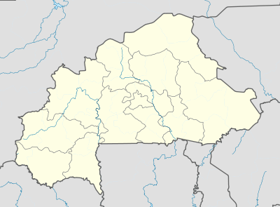 DFER Location of Arly Airport in Burkina Faso | |||||||||||
| Runways | |||||||||||
| |||||||||||
Arly Airport (IATA: ARL, ICAO: DFER) is a public use airport located near Arli National Park or Arly, Tapoa Province, Burkina Faso. While the runway outline is clearly visible, it appears overgrown with vegetation[2] and may be unusable.
See also
References
- ↑ Airport record for Arly Airport at Landings.com. Retrieved 2013-08-22
- 1 2 Google (2013-08-22). "location of Arly Airport" (Map). Google Maps. Google. Retrieved 2013-08-22.
External links
- Airport record for Arly Airport at Landings.com
This article is issued from Wikipedia - version of the 11/8/2016. The text is available under the Creative Commons Attribution/Share Alike but additional terms may apply for the media files.