Arlington, Kentucky
| Arlington, Kentucky | |
|---|---|
| City | |
 Location of Arlington, Kentucky | |
| Coordinates: 36°47′29″N 89°0′41″W / 36.79139°N 89.01139°WCoordinates: 36°47′29″N 89°0′41″W / 36.79139°N 89.01139°W | |
| Country | United States |
| State | Kentucky |
| County | Carlisle |
| Area | |
| • Total | 0.4 sq mi (1.0 km2) |
| • Land | 0.4 sq mi (1.0 km2) |
| • Water | 0.0 sq mi (0.0 km2) |
| Elevation | 351 ft (107 m) |
| Population (2010) | |
| • Total | 324 |
| • Density | 871/sq mi (336.3/km2) |
| Time zone | Central (CST) (UTC-6) |
| • Summer (DST) | CDT (UTC-5) |
| ZIP code | 42021 |
| Area code(s) | 270 & 364 |
| FIPS code | 21-02044 |
| GNIS feature ID | 0486029 |
Arlington is a 6th-class city in Carlisle County, Kentucky, in the United States. The population was 324 at the 2010 census,[1] a drop from 395 in 2000. It was formally incorporated by the state assembly in 1876.[2]
Geography
Arlington is located in southern Carlisle County at 36°47′29″N 89°00′41″W / 36.791299°N 89.011398°W.[3] U.S. Route 51 and Kentucky Route 80 intersect in the city. US 51 leads north 6 miles (10 km) to Bardwell, Kentucky, and 21 miles (34 km) to Cairo, Illinois, while leading south 23 miles (37 km) to Fulton on the Tennessee line. KY 80 leads west 6 miles (10 km) to Columbus on the Mississippi River and east 23 miles (37 km) to Mayfield.
According to the United States Census Bureau, Arlington has a total area of 0.4 square miles (1.0 km2), all of it land.[1]
Demographics
| Historical population | |||
|---|---|---|---|
| Census | Pop. | %± | |
| 1880 | 337 | — | |
| 1890 | 574 | 70.3% | |
| 1900 | 584 | 1.7% | |
| 1910 | 555 | −5.0% | |
| 1920 | 668 | 20.4% | |
| 1930 | 685 | 2.5% | |
| 1940 | 690 | 0.7% | |
| 1950 | 584 | −15.4% | |
| 1960 | 584 | 0.0% | |
| 1970 | 549 | −6.0% | |
| 1980 | 511 | −6.9% | |
| 1990 | 449 | −12.1% | |
| 2000 | 395 | −12.0% | |
| 2010 | 324 | −18.0% | |
| Est. 2015 | 310 | [4] | −4.3% |
As of the census[6] of 2000, there were 395 people, 189 households, and 109 families residing in the city. The population density was 989.1 people per square mile (381.3/km²). There were 213 housing units at an average density of 533.4 per square mile (205.6/km²). The racial makeup of the city was 95.19% White, 4.56% African American, and 0.25% from two or more races. Hispanic or Latino of any race were 1.01% of the population.
There were 189 households out of which 22.8% had children under the age of 18 living with them, 40.2% were married couples living together, 12.7% had a female householder with no husband present, and 42.3% were non-families. 39.2% of all households were made up of individuals and 23.8% had someone living alone who was 65 years of age or older. The average household size was 2.09 and the average family size was 2.77.
In the city the population was spread out with 21.0% under the age of 18, 6.1% from 18 to 24, 21.0% from 25 to 44, 27.3% from 45 to 64, and 24.6% who were 65 years of age or older. The median age was 46 years. For every 100 females there were 82.0 males. For every 100 females age 18 and over, there were 77.3 males.
The median income for a household in the city was $17,813, and the median income for a family was $28,750. Males had a median income of $17,396 versus $15,833 for females. The per capita income for the city was $13,561. About 24.1% of families and 29.3% of the population were below the poverty line, including 41.5% of those under age 18 and 33.7% of those age 65 or over.
Notable residents
- George Harper, former Major League Baseball player who performed for six teams
References
- 1 2 "Geographic Identifiers: 2010 Demographic Profile Data (G001): Arlington city, Kentucky". U.S. Census Bureau, American Factfinder. Retrieved August 6, 2014.
- ↑ Commonwealth of Kentucky. Office of the Secretary of State. Land Office. "Arlington, Kentucky". Accessed 15 Jul 2013.
- ↑ "US Gazetteer files: 2010, 2000, and 1990". United States Census Bureau. 2011-02-12. Retrieved 2011-04-23.
- ↑ "Annual Estimates of the Resident Population for Incorporated Places: April 1, 2010 to July 1, 2015". Retrieved July 2, 2016.
- ↑ "Census of Population and Housing". Census.gov. Archived from the original on May 11, 2015. Retrieved June 4, 2015.
- ↑ "American FactFinder". United States Census Bureau. Archived from the original on 2013-09-11. Retrieved 2008-01-31.
Municipalities and communities of Carlisle County, Kentucky, United States | ||
|---|---|---|
| Cities | 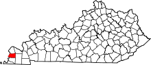 | |
| Unincorporated communities | ||