Arlington, Illinois
| Arlington, Illinois | |
| Village | |
| Country | United States |
|---|---|
| State | Illinois |
| County | Bureau |
| Township | Westfield |
| Coordinates | 41°28′20″N 89°14′49″W / 41.47222°N 89.24694°WCoordinates: 41°28′20″N 89°14′49″W / 41.47222°N 89.24694°W |
| Area | 0.40 sq mi (1 km2) |
| - land | 0.40 sq mi (1 km2) |
| - water | 0.00 sq mi (0 km2) |
| Population | 193 (2010) |
| Density | 482.5/sq mi (186/km2) |
| Timezone | CST (UTC-6) |
| - summer (DST) | CDT (UTC-5) |
| Postal code | 61312 |
| Area code | 815 & 779 |
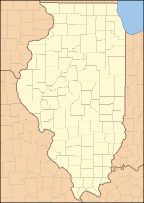 Location of Arlington within Illinois
| |
| Wikimedia Commons: Arlington, Illinois | |
Arlington is a village in Bureau County, Illinois, United States. The population was 193 at the 2010 census.[1] It is part of the Ottawa–Streator Micropolitan Statistical Area, located east of the Quad Cities, north of Peoria and Galesburg, west of LaSalle and Peru, and southwest of Rockford and Chicago.
History
In the early 1900s, Arlington, which was then called "Lost Grove", was experiencing rapid growth and development. Many companies set up shop to profit from the people flocking to the jobs at the coal mines in this area of Illinois. The businesses included a mattress factory, beer brewery, numerous restaurants, a brothel, and many others. The mayor at the time was from New York, and changed the town's name to Arlington, after the town of Arlington, New York. Arlington was about the size of Peru, Illinois.
On November 13, 1909, a fire in a mine shaft killed 259 miners, young and old, at the Cherry coal mine.[2] Authorities sealed the mine to contain the fire, trapping many rescue workers inside. When the mine was opened a week later only twenty men had survived of the hundreds involved. The 1909 Cherry Mine disaster influenced early workers' compensation laws and labor practices in the coal mining industry. At the time Illinois had no laws governing working conditions for miners. Arlington's growth slowed drastically after this occurrence.
In the 1950s a tornado destroyed most of Arlington. Many people moved away from the town at this time. Today Arlington has a population of less than 200. Many of the businesses and most of the homes have been shut down, deserted, or demolished. Many areas previously inhabited are now corn and bean fields. Some of the abandoned homes' foundations, and evidence of their former occupants, are still visible in these fields.
Geography
Arlington is located at 41°28′20″N 89°14′49″W / 41.47222°N 89.24694°W (41.472353, -89.246989).[3]
According to the 2010 census, Arlington has a total area of 0.4 square miles (1.04 km2), all land.[4]
Demographics
| Historical population | |||
|---|---|---|---|
| Census | Pop. | %± | |
| 1880 | 447 | — | |
| 1890 | 436 | −2.5% | |
| 1900 | 400 | −8.3% | |
| 1910 | 370 | −7.5% | |
| 1920 | 284 | −23.2% | |
| 1930 | 258 | −9.2% | |
| 1940 | 258 | 0.0% | |
| 1950 | 247 | −4.3% | |
| 1960 | 254 | 2.8% | |
| 1970 | 250 | −1.6% | |
| 1980 | 236 | −5.6% | |
| 1990 | 200 | −15.3% | |
| 2000 | 211 | 5.5% | |
| 2010 | 193 | −8.5% | |
| Est. 2015 | 186 | [5] | −3.6% |
As of the census[7] of 2000, there were 211 people, 78 households, and 51 families residing in the village. The population density was 493.4 people per square mile (189.5/km²). There were 88 housing units at an average density of 205.8 per square mile (79.0/km²). The racial makeup of the village was 92.42% White, 0.95% Native American, 0.95% Asian, 5.69% from other races. Hispanic or Latino of any race were 6.16% of the population.
There were 78 households out of which 33.3% had children under the age of 18 living with them, 53.8% were married couples living together, 9.0% had a female householder with no husband present, and 34.6% were non-families. 33.3% of all households were made up of individuals and 14.1% had someone living alone who was 65 years of age or older. The average household size was 2.71 and the average family size was 3.47.
In the village the population was spread out with 32.7% under the age of 18, 5.2% from 18 to 24, 27.0% from 25 to 44, 20.9% from 45 to 64, and 14.2% who were 65 years of age or older. The median age was 34 years. For every 100 females there were 93.6 males. For every 100 females age 18 and over, there were 89.3 males.
The median income for a household in the village was $27,292, and the median income for a family was $38,125. Males had a median income of $22,292 versus $18,438 for females. The per capita income for the village was $12,148. About 10.2% of families and 13.7% of the population were below the poverty line, including 23.1% of those under the age of eighteen and none of those sixty five or over.
Notable person
- Mike Prendergast, major league baseball player
References
- ↑ "Geographic Identifiers: 2010 Demographic Profile Data (G001): Arlington village, Illinois". U.S. Census Bureau, American Factfinder. Retrieved November 13, 2013.
- ↑ Trapped; The 1909 Cherry Mine Disaster by Karen Tintori
- ↑ "US Gazetteer files: 2010, 2000, and 1990". United States Census Bureau. 2011-02-12. Retrieved 2011-04-23.
- ↑ "G001 - Geographic Identifiers - 2010 Census Summary File 1". United States Census Bureau. Retrieved 2015-08-01.
- ↑ "Annual Estimates of the Resident Population for Incorporated Places: April 1, 2010 to July 1, 2015". Retrieved July 2, 2016.
- ↑ "Census of Population and Housing". Census.gov. Archived from the original on May 11, 2015. Retrieved June 4, 2015.
- ↑ "American FactFinder". United States Census Bureau. Archived from the original on 2013-09-11. Retrieved 2008-01-31.
External links
Municipalities and communities of Bureau County, Illinois, United States | ||
|---|---|---|
| Cities | ||
| Villages | ||
| Townships | ||
| Unincorporated communities | ||
| Ghost town | ||
| Footnotes | ‡This populated place also has portions in an adjacent county or counties | |