Arkansas Highway 169
| ||||
|---|---|---|---|---|
| Route information | ||||
| Maintained by AHTD | ||||
| Section 1 | ||||
| Length: | 7.82 mi[1] (12.59 km) | |||
| South end: | Sulphur Springs | |||
| North end: | Hancock Rd in Crossett | |||
| Section 2 | ||||
| Length: | 1.27 mi[1] (2.04 km) | |||
| South end: |
| |||
| North end: |
| |||
| Section 3 | ||||
| Length: | 2.21 mi[1] (3.56 km) | |||
| South end: |
| |||
| North end: | Arkansas Post National Memorial | |||
| Location | ||||
| Counties: | Arkansas | |||
| Highway system | ||||
| ||||
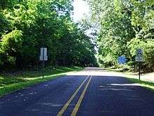
Highway 169 (AR 169, Ark. 169, and Hwy. 169) is a designation for three state highways in Southeast Arkansas. One route of 7.82 miles (12.59 km) begins at Sulphur Springs and runs northeast to Hancock Road in Crossett. A second route of 1.27 miles (2.04 km) in McGehee begins at Highway 4 and runs east to US Highway 65/US Highway 165 (US 65/US 165). A third route of 2.21 miles (3.56 km) begins at US 165 and runs east to Arkansas Post. All routes are maintained by the Arkansas State Highway and Transportation Department (AHTD).
Route description
Sulphur Springs to Crossett
Highway 169 begins at Sulphur Springs in southwestern Ashley County just over 4 miles (6.4 km) from the Louisiana state line. The route runs northeast to Crossett, passing through an industrial section of town. Continuing north, the route intersects and overlaps US&nbsbp;82 at a brief officially designated exception heading west. At Hancock Road, Highway 169 turns north and runs along the west side of a large Georgia-Pacific paper mill. State maintenance ends, with the roadway continuing north at Hancock Road.[2]
McGehee
Highway 169 begins at Highway 4 in the southeastern part of McGehee near the McGehee Cemetery. The route curves northwest to US 65/US 165, where it terminates.[3]
US 165 to Arkansas Post

The route begins at US 165 in southern Arkansas County near the Arkansas River. Highway 169 runs east toward Moore Bayou, serving the Moore Bayou Use Area owned by the Arkansas Game and Fish Commission. Continuing east, the route bridges Little Post Bayou and enters Arkansas Post National Memorial.[4] State maintenance terminates near the location of the first established European settlement in Arkansas, settled in 1868 when the area was under French dominion as French Louisiana. Arkansas Post served as the capitol of Arkansas Territory and was an important trading post in early Arkansas history.
Major intersections
| County | Location | mi[1] | km | Destinations | Notes | ||
|---|---|---|---|---|---|---|---|
| Ashley | Sulphur Springs | 0.00 | 0.00 | Begin state maintenance | Southern terminus | ||
| Crossett | 6.79– 6.98 | 10.93– 11.23 | officially designated exception | ||||
| 7.82 | 12.59 | Hancock Rd | Northern terminus | ||||
| Gap in route | |||||||
| Desha | McGehee | 0.00 | 0.00 | Southern terminus | |||
| 1.27 | 2.04 | Northern terminus | |||||
| Gap in route | |||||||
| Arkansas | | 0.00 | 0.00 | Western terminus | |||
| | 2.25 | 3.62 | Eastern terminus | ||||
1.000 mi = 1.609 km; 1.000 km = 0.621 mi
| |||||||
See also
-
 Arkansas portal
 -
 U.S. Roads portal
References
- 1 2 3 4 System Information and Research Division (2014). "Arkansas Road Log Database" (MDB). Arkansas State Highway and Transportation Department. Retrieved March 27, 2016.
- ↑ Arkansas State Highway and Transportation Department (November 16, 2007). General Highway Map, Ashley County, Arkansas (PDF) (Map). 1:62500. Arkansas State Highway and Transportation Department. Retrieved November 29, 2016.
- ↑ Arkansas State Highway and Transportation Department (February 17, 2015). General Highway Map, Desha County, Arkansas (PDF) (Map). 1:62500. Arkansas State Highway and Transportation Department. Retrieved November 29, 2016.
- ↑ Arkansas State Highway and Transportation Department (April 3, 2013). General Highway Map, Arkansas County, Arkansas (PDF) (Map). 1:62500. Arkansas State Highway and Transportation Department. Retrieved November 29, 2016.
External links
-
 Media related to Arkansas Highway 169 at Wikimedia Commons
