Aristes, Pennsylvania
| Aristes, Pennsylvania | |
|---|---|
| Census-designated place | |
|
Aristes | |
 Location within Columbia County | |
 Aristes Location within the state of Pennsylvania | |
| Coordinates: 40°49′8″N 76°20′22″W / 40.81889°N 76.33944°WCoordinates: 40°49′8″N 76°20′22″W / 40.81889°N 76.33944°W | |
| Country | United States |
| State | Pennsylvania |
| County | Columbia |
| Township | Conyngham |
| Area | |
| • Total | 0.37 sq mi (0.96 km2) |
| • Land | 0.37 sq mi (0.96 km2) |
| • Water | 0.0 sq mi (0.0 km2) |
| Elevation[1] | 1,750 ft (530 m) |
| Population (2010) | |
| • Total | 311 |
| • Density | 836/sq mi (322.6/km2) |
| Time zone | Eastern (EST) (UTC-5) |
| • Summer (DST) | EDT (UTC-4) |
| ZIP code | 17920 |
| Area code(s) | 570 Exchange: 875 |
| FIPS code | 42-02968 |
| GNIS feature ID | 1168385 |

Aristes is a census-designated place (CDP) in Conyngham Township, Columbia County, Pennsylvania, United States. The population was 311 at the 2010 census.[2] It is part of the Bloomsburg–Berwick Micropolitan Statistical Area. Aristes is next to the famous "ghost town" of Centralia, Pennsylvania.
History
Around the year 1800, the Red Tavern was built along the Old Reading Road, which ran from Catawissa to Reading. In 1865, the owner of the Red Tavern laid out a village which he called "Montana". When a post office was established here in 1897, the name of the town was changed to "Aristes", a contraction of the name Aristides, a Greek statesman.
In 1948, United Airlines Flight 624 hit a high-voltage powerline and crashed in Aristes. Notable victims of the crash included Broadway theatre impresario Earl Carroll and his girlfriend, actress Beryl Wallace; Henry L. Jackson, men's fashion editor of Collier's Weekly magazine and co-founder of Esquire magazine; and Venita Varden Oakie, the former wife of actor Jack Oakie.
Geography
Aristes is located in southern Columbia County at 40°49′8″N 76°20′22″W / 40.81889°N 76.33944°W (40.818984, -76.339374),[3] east of the center of Conyngham Township and northeast of Centralia. According to the United States Census Bureau, the Aristes CDP has a total area of 0.37 square miles (0.96 km2), all of it land.[2] Aristes is served by Pennsylvania Route 42. The CDP's southern half is mostly forested.[4]
Demographics
As of the census[5] of 2000, there were 230 people, 108 households, and 65 families residing in the CDP. The population density was 1,172.5 people per square mile (444.0/km²). There were 118 housing units at an average density of 601.5/sq mi (227.8/km²). The racial makeup of the CDP was 99.57% White, and 0.43% from two or more races.
There were 108 households, out of which 21.3% had children under the age of 18 living with them, 47.2% were married couples living together, 11.1% had a female householder with no husband present, and 39.8% were non-families. 36.1% of all households were made up of individuals, and 23.1% had someone living alone who was 65 years of age or older. The average household size was 2.13 and the average family size was 2.77.
In the CDP the population was spread out, with 17.0% under the age of 18, 6.1% from 18 to 24, 23.9% from 25 to 44, 27.8% from 45 to 64, and 25.2% who were 65 years of age or older. The median age was 48 years. For every 100 females there were 79.7 males. For every 100 females age 18 and over, there were 78.5 males.
The median income for a household in the CDP was $21,607, and the median income for a family was $27,500. Males had a median income of $31,875 versus $21,875 for females. The per capita income for the CDP was $13,302. About 15.6% of families and 18.8% of the population were below the poverty line, including 63.3% of those under the age of eighteen and 6.5% of those sixty five or over.
See also
References
- ↑ http://www.city-data.com/city/Aristes-Pennsylvania.html
- 1 2 "Geographic Identifiers: 2010 Census Summary File 1 (G001): Aristes CDP, Pennsylvania". U.S. Census Bureau, American Factfinder. Retrieved May 27, 2015.
- ↑ "US Gazetteer files: 2010, 2000, and 1990". United States Census Bureau. 2011-02-12. Retrieved 2011-04-23.
- ↑ maps.google.com
- ↑ "American FactFinder". United States Census Bureau. Archived from the original on 2013-09-11. Retrieved 2008-01-31.
Municipalities and communities of Columbia County, Pennsylvania, United States | ||
|---|---|---|
| Town | 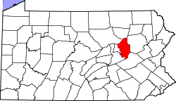 | |
| Boroughs | ||
| Townships | ||
| CDPs | ||
| Unincorporated communities | ||
| Ghost Towns | ||
| Footnotes | ‡This populated place also has portions in an adjacent county or counties | |