Arica Province (Peru)
The Province of Arica was a historical territorial division of Peru, which existed between 1823 and 1883. It was populated by pre-Hispanic peoples for a long period of time before Spanish colonisation in the early 16th century saw the transformation of a small town into a thriving port.[1] Trade in both gold and silver, especially the latter, was facilitated through Arica after the precious metals were first extracted in Bolivia from the City of Potosi, one of the world's highest cities. Following the War of the Pacific, the province was transferred to Chile and became an official Chilean territory in 1929.[2]
History
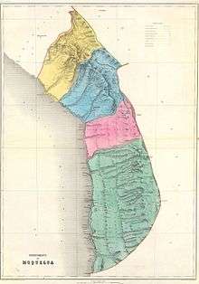
Arica was established in 1823, as part of the Department of Arequipa. In 1828, the capital city of the province was changed from Arica to Tacna. In 1837, the province joined the established Department Litoral with capital at Tacna. In 1853, the province was moved to the newly established Department of Moquegua, along with the provinces of Moquegua, Tacna and Tarapacá. In 1855, the province was divided into two, forming the provinces of Tacna and Arica. In 1875, Arica was transferred to the newly established Department of Tacna, along with the provinces of Tacna and Tarata. In 1875, the province itself was divided into six districts: Arica, Belén, Codpa, Livilcar, Lluta, and Socoroma.
Borders
Arica is bordered to the north by the province of Tacna, to the east by Bolivia, to the south by the Department of Tarapacá, and to the west by the Pacific Ocean.
References
- ↑ "Arica History" (Web page). lonelyplanet.com. Lonely Planet. 2011. Retrieved 27 March 2012.
- ↑ "ARICA". welcomechile.com. Interpatagonia. Retrieved 27 March 2012.
External links
- Providing that the city of Tacna, is the capital of the province of Arica
- Providing that in the provinces of Tacna and Tarapaca, forming a departamento litoral
- Again creating the province of Arica in the department of Moquegua