Argentoratum
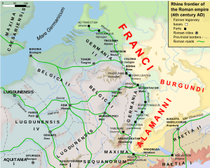 Geographic and strategic location of Argentoratum | |
 Shown within France | |
| Location | France |
|---|---|
| Region | Grand Est |
| Coordinates | 48°34′58″N 7°45′04″E / 48.5827°N 7.751°E |

Argentoratum or Argentorate was the ancient name of the French city of Strasbourg.
History
The Romans under Nero Claudius Drusus established a military outpost belonging to the Germania Superior Roman province close to a Gaulish village near the banks of the Rhine, at the current location of Strasbourg, and named it Argentoratum. Its name was first mentioned in 12 BC but "Argentorate" is the toponym of the Gaulish settlement that preceded it before being latinised, though it is not known by how long.[1]
From 90 AD the Legio VIII Augusta was permanently stationed in Argentoratum.[2] The Roman camp of Argentoratum then included a cavalry section and covered an area of approximately 20 hectares (49 acres), from approximately 6 hectares (15 acres) in Tiberian times.[3] Other Roman legions temporarily stationed in Argentoratum were the Legio XIV Gemina and the Legio XXI Rapax, the latter during the reign of Nero.[4]

The Alemanni fought a Battle of Argentoratum against Rome in 357 AD. They were defeated by Julian, later Emperor of Rome, and their king Chnodomar was taken prisoner. On 2 January 366 the Alemanni crossed the frozen Rhine in large numbers, to invade the Roman Empire.
From the 4th century, Strasbourg was the seat of the Bishopric of Strasbourg (made an Archbishopric in 1988).
Early in the 5th century the Alemanni appear to have crossed the Rhine, conquered, and then settled what is today Alsace and a large part of Switzerland. From this period on Argentoratum disappears from historical records and is replaced by the toponym "Stratisburgum".
The Site
The centre of the camp of Argentoratum proper was situated on the Grande Île, with the Cardo being the current Rue du Dôme and the Decumanus, the current Rue des Hallebardes.[5]
As systematic archaeological studies between 1947 and 1953,[6] conducted by Jean-Jacques Hatt, archaeologist and director of the Musée archéologique de Strasbourg, have shown, Argentoratum was destroyed by fire and rebuilt six times between the first and the 5th century AD: in 70, 97, 235, 355, in the last quarter of the 4th century, and in the early years of the 5th century. It was under Trajan and after the fire of 97 that Argentoratum received its most extended and fortified shape.[7]
Many Roman artifacts have also been found along the current Route des Romains in the suburb of Kœnigshoffen, on the road that lead to it.[8] This was where the largest burial places (necropoleis) were situated as well as the densest concentration of civilian dwelling places (vicus) and commerces next to the camp.[9]
Among the most outstanding finds in Kœnigshoffen were (found in 1911–12 by Robert Forrer, Hatt's predecessor at the head of the Musée archéologique) the fragments of a grand Mithraeum that had been shattered by early Christians in the 4th century.[10]
Archaeological digs by J.-J. Hatt below the current Église Saint-Étienne in 1948 and 1956 have unearthed the apse of a church dating back to the late 4th century or early 5th century, and considered the oldest church in Alsace. It is supposed that this was the first seat of the Roman Catholic Diocese of Strasbourg.[11]
References
- ↑ Petit historique de Strasbourg (French)
- ↑ Le camp de la Legio VIII Augusta à Strasbourg (French)
- ↑ 4 rue Brûlée (French)
- ↑ Argentorate sous Néron (French)
- ↑ Argentorate : description (French)
- ↑ Favoured by the destructions the city had suffered, especially from British and American bombings in August 1944.
- ↑ Résultats historiques et topographiques des dernières fouilles de Strasbourg, de 1949 à 1951 (French); Les fouilles de Strasbourg et de Seltz en 1952 et 1953 (French)
- ↑ Argentoratum.com: Les fouilles archéologiques (French)
- ↑ Le vicus et les canabae (French)
- ↑ The Roman Cult of Mithras: The God and His Mysteries
- ↑ Fouilles romaines sous l'église Saint-Étienne à Strasbourg (French)
External links
| Wikimedia Commons has media related to Argentoratum. |
- www.argentoratum.com (French)
- Histoire de Strasbourg : quand Strasbourg était Argentorate (French)
- Argentorate, Strasbourg, by Jean-Jacques Hatt (French)
Coordinates: 48°34′58″N 7°45′04″E / 48.5827°N 7.7510°E