Argentina–Brazil border

The Argentina–Brazil border is the line that limits the territories of Argentina and Brazil. It is approximately 1,224 kilometres (761 miles) long.[1]
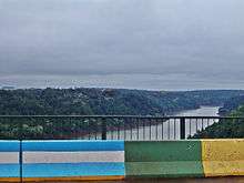
Starting at the confluence of Paraná and Iguaçu, It passes through the Iguaçu Falls and follows the thalweg of that river to the mouth of Santo Antônio River, then running upstream the course of this river until its source. From there the boundary runs 25.1 km by land until reaching the source of the Peperi-Guaçu River and from there along the channel of that river to its confluence with then the Uruguay River to the mouth of river Quaraí.
It was definied by the Treaty of 1898 (which is based on a Arbitration Award 1895), referred by US President Grover Cleveland, and is perfectly demarcated. The characterisation work is in charge of the so-called "Joint Commission for Inspecting the Mark of the Brazil-Argentina" (created in 1970), which has deployed 310 boundary markers.
Its total length is 1,224 kilometres by rivers and only 24 km by land.[2]