Arboles, Colorado
| Arboles, Colorado | |
|---|---|
| census-designated place | |
 Location in Archuleta County and the State of Colorado | |
| Coordinates: 37°1′15″N 107°25′17″W / 37.02083°N 107.42139°WCoordinates: 37°1′15″N 107°25′17″W / 37.02083°N 107.42139°W | |
| Country |
|
| State |
|
| County | Archuleta County[1] |
| Government | |
| • Type | unincorporated community |
| Area | |
| • Total | 5.4 sq mi (13.8 km2) |
| • Land | 5.3 sq mi (13.6 km2) |
| • Water | 0.1 sq mi (0.2 km2) |
| Elevation[1] | 6,279 ft (1,914 m) |
| Population (2010) | |
| • Total | 280 |
| • Density | 43/sq mi (16.8/km2) |
| Time zone | MST (UTC-7) |
| • Summer (DST) | MDT (UTC-6) |
| ZIP Code | 81121[2] |
| Area code(s) | 970 |
| FIPS code | 08-02905 |
| GNIS feature ID | 0184512 |
Arboles is a census-designated place (CDP) in Archuleta County, Colorado, United States. The population was 280 at the 2010 census.[3][4] The Arboles Post Office has the ZIP Code 81121.[2] The town's name means "trees" in Spanish.[5]
Geography
Arboles is located at 37°1′15″N 107°25′17″W / 37.02083°N 107.42139°W (37.020918, -107.421517).[6]
According to the United States Census Bureau, the CDP has a total area of 5.3 square miles (14 km2), of which, 5.3 square miles (14 km2) of it is land and 0.1 square miles (0.26 km2) of it (1.31%) is water.
Demographics
As of the census[4] of 2000, there were 232 people, 104 households, and 79 families residing in the CDP. The population density was 44.1 people per square mile (17.0/km²). There were 169 housing units at an average density of 32.1 per square mile (12.4/km²). The racial makeup of the CDP was 68.10% White, 1.29% Native American, 15.95% from other races, and 14.66% from two or more races. Hispanic or Latino of any race were 25.00% of the population.
There were 104 households out of which 25.0% had children under the age of 18 living with them, 66.3% were married couples living together, 6.7% had a female householder with no husband present, and 23.1% were non-families. 23.1% of all households were made up of individuals and 12.5% had someone living alone who was 65 years of age or older. The average household size was 2.23 and the average family size was 2.59.
In the CDP the population was spread out with 20.7% under the age of 18, 2.6% from 18 to 24, 20.7% from 25 to 44, 35.8% from 45 to 64, and 20.3% who were 65 years of age or older. The median age was 48 years. For every 100 females there were 112.8 males. For every 100 females age 18 and over, there were 109.1 males.
The median income for a household in the CDP was $33,125, and the median income for a family was $37,813. Males had a median income of $35,000 versus $25,833 for females. The per capita income for the CDP was $19,384. About 11.5% of families and 8.0% of the population were below the poverty line, including 3.6% of those under the age of eighteen and 22.9% of those sixty five or over.
See also
References
- 1 2 "US Board on Geographic Names". United States Geological Survey. 2007-10-25. Retrieved 2008-01-31.
- 1 2 "ZIP Code Lookup". United States Postal Service. December 14, 2006. Archived from the original (JavaScript/HTML) on 14 December 2006. Retrieved December 14, 2006.
- ↑ Colorado Trend Report 2: State and Complete Places (Sub-state 2010 Census Data). Missouri Census Data Center. Accessed 2011-02-25.
- 1 2 "American FactFinder". United States Census Bureau. Archived from the original on 2013-09-11. Retrieved 2008-01-31.
- ↑ Dawson, John Frank (1954). Place names in Colorado: why 700 communities were so named, 150 of Spanish or Indian origin. Denver, CO: The J. Frank Dawson Publishing Co. p. 7.
- ↑ "US Gazetteer files: 2010, 2000, and 1990". United States Census Bureau. 2011-02-12. Retrieved 2011-04-23.
External links
| Wikimedia Commons has media related to Arboles, Colorado. |
Municipalities and communities of Archuleta County, Colorado, United States | ||
|---|---|---|
| Town | 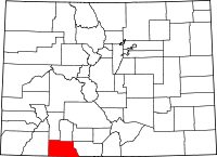 | |
| CDP | ||
| Unincorporated communities | ||
| Indian reservation | ||