Aqraba
| Aqraba | |
|---|---|
| Other transcription(s) | |
| • Arabic | عقربة |
| • Also spelled |
'Aqraba (official) Akraba (unofficial) |
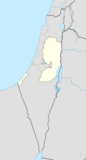 Aqraba Location of Aqraba within the Palestinian territories | |
| Coordinates: 32°07′35.17″N 35°20′36.82″E / 32.1264361°N 35.3435611°ECoordinates: 32°07′35.17″N 35°20′36.82″E / 32.1264361°N 35.3435611°E | |
| Palestine grid | 182/170 |
| Governorate | Nablus |
| Government | |
| • Type | Municipality |
| • Head of Municipality | Jawdat 'Abd al-Hadi |
| Area | |
| • Jurisdiction | 34,659 dunams (34.7 km2 or 13.4 sq mi) |
| Population (2007) | |
| • Jurisdiction | 8,180 |
| Name meaning | Scorpion[1] |
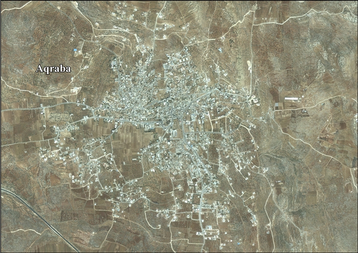
Aqraba (Arabic: عقربة) is a Palestinian town in the Nablus Governorate, located eighteen kilometers southeast of Nablus in the northern West Bank. According to the Palestinian Central Bureau of Statistics (PCBS), Aqraba had a population of approximately 8,180 inhabitants in 2007.[2]
Nearby hamlets surrounding Aqraba for natural extensions of the town; they are the khirbets of al-Arama, al-Kroom, Abu al-Reisa, al-Rujman, Firas al-Din and Tel al-Khashaba. The total population of these hamlets is estimated to be 500. The prominent families of Aqraba are Al Dayriyeh, Bani Jaber, Al-Mayadima, Bani Jame', and Bani Fadel.[3]
Etymology
The origin of the name is Semitic - Canaanite or Aramaic. Aqraba Arabic translation is "scorpion".[1][4]
History and archeology
Cisterns dug into rock have been found in Aqraba.[5]
Pottery sherds from Iron Age II, Hellenistic, Roman, Byzantine, Umayyad and Crusader/Ayyubid era have also been found.[6]
The town has a mosque built of ancient stones with Greek inscriptions and contained a cross. According to local tradition and a number of British scholars believe the mosque was originally a Byzantine-era church. To the north of the village there is a fort called Qal'at al-Hosn consisting of a block of buildings put on the hill. The masonry is drafted with a rustic boss. A cistern exists within the enclosure which still holds water. A birkeh ("pool") stands in the middle of Aqraba, while on the hillside nearby are some kokhim, tombs carved from the rock.[4][7][8]
Pottery sherds from the Mamluk era[6] and a construction inscription in Arabic from 1414 have been found in the village.[6][7][9]
Ottoman era
Aqraba, like the rest of Palestine, was incorporated into the Ottoman Empire in 1517, and in the census of 1596 the village appeared under the name Aqraba as being in the Nahiya (Subdistrict) of Jabal Qubal of the Liwa (District) of Nablus. It had a population of 102 households, all Muslim. They paid a fixed tax-rate of 33.3% on agricultural products, including wheat, barley, summer crops, olive trees, goats and bee-hives; vineyards and fruit trees, in addition to occasional revenues, and a press for olive oil or grape syrup.[10]
During his travels in the region in 1838 Edward Robinson mentions it, believing it was ancient Acrabi.[11] Victor Guérin visited in 1870, and described as a large town with 2000 inhabitants. He further noted that it consisted of four quarters, each with their own sheikh.[12]
In 1873-4 Clermont-Ganneau visited, and were told of the governor el Kadery, who resided in Aqraba at the time of Jezzar Pasha. He is said to have erected considerable buildings in the town.[13]
In 1882, the Palestine Exploration Fund's Survey of Western Palestine described it as "A large village, surrounded with olives, of houses better built than most in the country. It stands on a saddle between two hills, one of which rises north of it 700 feet, the village standing at the mouth of a pass, through which the main road runs. The place crescent-shaped, whence perhaps its name, ' carved.' On south is the fertile plain (Jehir 'Akrabeh). There is a mosque in the east part of the village, founded on the remains of a Christian church, and a second sacred place (er Rafai) on the south. The inhabitants used to number, according to their own account, 2,000 guns, but the present population appears to be about 600 to 800 souls."[14]
British Mandate era
In the 1922 census of Palestine conducted by the British Mandate authorities, Aqraba had a population of 1,160; 1,158 Muslims and 2 Christians,[15] increasing in the 1931 census, where Aqraba (together with the smaller location Kh. Fasayil) had a population of 1,478, all Muslims, in a total of 309 houses.[16]
In 1945 Aqraba (including Kh. Fasayil) had a population of 2,060, all Arabs, with 142,530 dunams of land, according to an official land and population survey.[17] Of this, 3,383 dunams were plantations and irrigable land, 19,732 used for cereals,[18] while 55 dunams were built-up land.[19]
Jordanian rule
In the wake of the 1948 Arab–Israeli War, and after the 1949 Armistice Agreements, Aqraba came under Jordanian rule.
Israeli rule
After the Six-Day War in 1967, Aqraba had been under Israeli occupation, transformed into Civil administration ruling system in 1982.
Palestinian rule
After 1994, the town came under the Palestinian National Authority.
Economy
The village's total land area is 34,700 dunams, of which 1,783 is built-up area. Around 62% of the remaining land is covered with olive and almond groves, 8% with other fruits and vegetables and the remaining 30% for grazing purposes.[20]
Aqraba's unemployment rate is above 50%. Because the Palestinian labor force is unable to work in Israeli localities, the town's workers currently hold public and private jobs. Some also depend on agriculture and industrial workshops as main sources of income.[20]
Some farmland near Yanun owned by 300 Aqraba villagers was defined as an IDF firing range in 1967, but exercises were customarily suspended for brief periods in the past to allow the villagers access to their lands,according to local Palestinians. Since then they claim, the area has not been used in as a fire range for two decades. Recently these villagers, who either farm or live there have been denied access. They claim that this restriction does not apply equally to an outpost, Givat 777, of the Israeli settlement of Itamar. They complain of settler harassment, the burning of vehicles, and of settler sheep flocks being led to greaze on their wheat fields. The IDF has replied that both Palestinians and Israeli settlers are treated in the same way.[21]
In August 2014, the IDF brought in bulldozers to demolish 4 Palestinian homes on the outskirts of the town, in the al-Taweel neighbourhood, apparently claiming that they were built without a permit. The villagers claimed that the houses have been there for a century.[22]
Government
Aqraba is located in Area B, giving the Palestinian National Authority control over its administration and civil affairs. The town is governed by a municipal council, consisting of eleven members including the mayor. In the 2005 Palestinian municipal elections, the Fatah-backed Future Palestine list won the majority of the seats (six) while the Hamas-backed al-Islamiya list won five seats. Jawdat 'Abd al-Hadi was elected mayor.[23]
References
- 1 2 Palmer, 1881, p. 251
- ↑ 2007 PCBS Census. Palestinian Central Bureau of Statistics. p.110.
- ↑ Aqraba Village: General Information Archived March 27, 2011, at the Wayback Machine. Land Research Center. 2008-10-20.
- 1 2 Acraba, the last village adjacent to the desert Studium Biblicum Franciscanum - Jerusalem. 2000-12-19.
- ↑ Dauphin, 1998, p. 849.
- 1 2 3 Finkelstein and Lederman, 1997, p. 818
- 1 2 Sharon, 1997, pp. 110-111
- ↑ Conder and Kitchener, 1882, SWP II, pp. 389-390
- ↑ Ellenblum, 2003, p. 245
- ↑ Hütteroth and Abdulfattah, 1977, p. 131
- ↑ Robinson and Smith, 1841, vol 3, p. 103
- ↑ Guérin, 1875, pp. 3-5
- ↑ Clermont-Ganneau, 1896, pp. 302-3
- ↑ Conder and Kitchener, 1882, SWP II, p. 386
- ↑ Barron, 1923, Table IX, Sub-district of Nablus, p. 25
- ↑ Mills, 1932, p. 59
- ↑ Government of Palestine, Department of Statistics. Village Statistics, April, 1945. Quoted in Hadawi, 1970, p. 59
- ↑ Government of Palestine, Department of Statistics. Village Statistics, April, 1945. Quoted in Hadawi, 1970, p. 105
- ↑ Government of Palestine, Department of Statistics. Village Statistics, April, 1945. Quoted in Hadawi, 1970, p. 155
- 1 2 A new Expansion in the colony of Itamar on the Lands of the Palestinian Town of Aqraba: General Information about Aqraba Archived June 8, 2008, at the Wayback Machine. The Land Research Center via POICA. ARIJ and LRC 2007-10-21
- ↑ Amira Hass,'IDF bars Palestinian farmers, but not settler outpost, from land in disputed firing range,' at Haaretz 3 July 2012.
- ↑ 'Israel demolishes 4 Palestinian homes near Nablus,' Ma'an News Agency 20 August 2014.
- ↑ Local Elections (Round Three)- Successful lists by local authority and No. of votes obtained Central Elections Commission - Palestine. p.4.
Bibliography
| Wikimedia Commons has media related to Aqraba. |
- Barron, J. B., ed. (1923). Palestine: Report and General Abstracts of the Census of 1922. Government of Palestine.
- Clermont-Ganneau, Charles Simon (1896). [ARP] Archaeological Researches in Palestine 1873-1874, translated from the French by J. McFarlane. 2. London: Palestine Exploration Fund.
- Conder, Claude Reignier; Kitchener, H. H. (1882). The Survey of Western Palestine: Memoirs of the Topography, Orography, Hydrography, and Archaeology. 2. London: Committee of the Palestine Exploration Fund.
- Dauphin, Claudine (1998). La Palestine byzantine, Peuplement et Populations. BAR International Series 726 (in French). III : Catalogue. Oxford: Archeopress.
- Ellenblum, Ronnie (2003). Frankish Rural Settlement in the Latin Kingdom of Jerusalem. Cambridge University Press. ISBN 9780521521871. (pp. 228, 266-7)
- Finkelstein, Israel; Lederman, Zvi, eds. (1997). Highlands of many cultures. Tel Aviv: Institute of Archaeology of Tel Aviv University Publications Section. ISBN 965-440-007-3.
- Guérin, Victor (1875). Description Géographique Historique et Archéologique de la Palestine (in French). 2: Samarie, pt. 2. Paris: L'Imprimerie Nationale.
- Hadawi, Sami (1970). Village Statistics of 1945: A Classification of Land and Area ownership in Palestine. Palestine Liberation Organization Research Center.
- Hütteroth, Wolf-Dieter; Abdulfattah, Kamal (1977). Historical Geography of Palestine, Transjordan and Southern Syria in the Late 16th Century. Erlanger Geographische Arbeiten, Sonderband 5. Erlangen, Germany: Vorstand der Fränkischen Geographischen Gesellschaft. ISBN 3-920405-41-2.
- Mills, E., ed. (1932). Census of Palestine 1931. Population of Villages, Towns and Administrative Areas. Jerusalem: Government of Palestine.
- Palmer, E. H. (1881). The Survey of Western Palestine: Arabic and English Name Lists Collected During the Survey by Lieutenants Conder and Kitchener, R. E. Transliterated and Explained by E.H. Palmer. Committee of the Palestine Exploration Fund.
- Robinson, Edward; Smith, Eli (1841). Biblical Researches in Palestine, Mount Sinai and Arabia Petraea: A Journal of Travels in the year 1838. 3. Boston: Crocker & Brewster.
- Sharon, Moshe (1997). Corpus Inscriptionum Arabicarum Palaestinae, A. 1. BRILL. ISBN 90-04-10833-5.
External links
- Aqraba municipality
- Welcome To 'Aqraba
- Survey of Western Palestine, Map 15: IAA, Wikimedia commons
- Aqraba Town Profile (including Yanun Locality), ARIJ
- Aqraba, aerial photo, ARIJ
- March 2009 demolitions orders for Aqraba homes and mosque
| Cities |
|  |
|---|---|---|
| Municipalities | ||
| Villages |
| |
| Refugee camps | ||