Apiacás
| Apiacás | |
|---|---|
| Municipality | |
| The Municipality of Apiacás | |
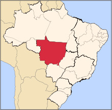
 Location of Apiacás | |
 Apiacás Location of Apiacás | |
| Coordinates: 09°32′38″S 57°26′56″W / 9.54389°S 57.44889°WCoordinates: 09°32′38″S 57°26′56″W / 9.54389°S 57.44889°W | |
| Country |
|
| Region | Central-West |
| State |
|
| Founded | January 1, 2001 |
| Government | |
| • Mayor | Silda Kochemborger |
| Area | |
| • Total | 20,364.204 km2 (7,862.663 sq mi) |
| Elevation | 200 m (700 ft) |
| Population (2012) | |
| • Total | 8,855 |
| • Density | 0.3/km2 (0.8/sq mi) |
| [1] | |
| Time zone | UTC-4 (UTC-4) |
| • Summer (DST) | UTC-3 (UTC-3) |
| HDI (2000) | 0.713 – medium[2] |
Apiacás is the northernmost municipality in the Brazilian state of Mato Grosso. It is the only city in a territorial "edge" of Mato Grosso that "pierce" the boundary between Amazonas and Pará.
The municipality contains part of the 19,582 square kilometres (7,561 sq mi) Juruena National Park, one of the largest conservation units in Brazil.[3]
References
- ↑ "2012 Populational Estimate" (PDF). Censo Populacional 2012. Instituto Brasileiro de Geografia e Estatística (IBGE). July 2012. Retrieved September 8, 2012.
- ↑ "Archived copy". Archived from the original on 2009-10-03. Retrieved 2009-12-17. - UNDP
- ↑ Unidade de Conservação: Parque Nacional do Juruena (in Portuguese), MMA: Ministério do Meio Ambiente, retrieved 2016-05-23
Capital: Cuiabá | |||||||||||||||||||||||||||||||
| Centro-Sul Mato-Grossense |
|  | |||||||||||||||||||||||||||||
| Nordeste Mato-Grossense |
| ||||||||||||||||||||||||||||||
| Norte Mato-Grossense |
| ||||||||||||||||||||||||||||||
| Sudeste Mato-Grossense |
| ||||||||||||||||||||||||||||||
| Sudoeste Mato-Grossense |
| ||||||||||||||||||||||||||||||
This article is issued from Wikipedia - version of the 10/16/2016. The text is available under the Creative Commons Attribution/Share Alike but additional terms may apply for the media files.