Aphrodite Terra
|
Topography of Aphrodite Terra | |
| Coordinates | 10°S 100°E / 10°S 100°ECoordinates: 10°S 100°E / 10°S 100°E |
|---|---|
| Diameter | 10,000 km |
| Eponym | Aphrodite |

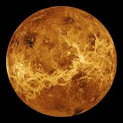

Aphrodite Terra is a highland region on Venus, near the equator.
Description
Aphrodite Terra is named after the goddess of love, the Greek equivalent of the Roman goddess Venus.
It is about the same size as Africa, and much rougher than Ishtar Terra.
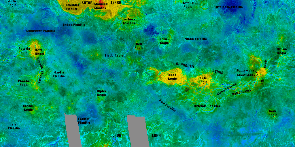
The surface appears buckled and fractured which suggests large compressive forces. There are also numerous extensive lava flows. Channels cross this terrain and some have an interesting bow shape to them. Aphrodite Terra also has mountain ranges but they are only about half the size of the mountains on Ishtar.
Aphrodite Terra has two main regions: Ovda Regio in the west and Thetis Regio in the east. Ovda Regio has ridges running in two directions, suggesting that the compressive forces are acting in several directions. There are dark regions that appear to be solidified lava flows. There are series of cracks where lava has welled up through the surface and flooded the surrounding terrain.
See also
References
1. D. A. Senske, "Geology of the Venus equatorial region from Pioneer Venus radar imaging," Part 3 Regional Geology, Earth, Moon, and Planets, July 1990, Volume 50, Issue 1, Springer, pp 305–327.
2. L. S. Crumpler, "Eastern Aphrodite Terra on Venus: Characteristics, structure, and mode of origin," Part 3 Regional Geology, Earth, Moon, and Planets, July 1990, Volume 50, Issue 1, Springer, pp 343–388. (Page 1).
External links
| Geography |  | ||||||||||||||||||||||
|---|---|---|---|---|---|---|---|---|---|---|---|---|---|---|---|---|---|---|---|---|---|---|---|
| Moons | |||||||||||||||||||||||
| Astronomy |
| ||||||||||||||||||||||
| Exploration |
| ||||||||||||||||||||||
| Related | |||||||||||||||||||||||
| |||||||||||||||||||||||