Antrim County Airport
| Antrim County Airport | |||||||||||
|---|---|---|---|---|---|---|---|---|---|---|---|
| IATA: ACB – ICAO: KACB – FAA LID: ACB | |||||||||||
| Summary | |||||||||||
| Airport type | Public | ||||||||||
| Owner | Antrim County | ||||||||||
| Serves | Bellaire, Michigan | ||||||||||
| Elevation AMSL | 623 ft / 190 m | ||||||||||
| Coordinates | 44°59′19″N 085°11′54″W / 44.98861°N 85.19833°W | ||||||||||
| Map | |||||||||||
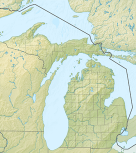 ACB  ACB Location of airport in Michigan/United States | |||||||||||
| Runways | |||||||||||
| |||||||||||
| Statistics (2006) | |||||||||||
| |||||||||||
Antrim County Airport (IATA: ACB, ICAO: KACB, FAA LID: ACB) is a county-owned public-use airport located one mile (2 km) northeast of the central business district of Bellaire, a village in Antrim County, Michigan, United States.[1] It is included in the Federal Aviation Administration (FAA) National Plan of Integrated Airport Systems for 2017–2021, in which it is categorized as a local general aviation facility.[2]
Facilities and aircraft
Antrim County Airport covers an area of 363 acres (147 ha) which contains one asphalt paved runway (2/20) measuring 5,000 x 100 ft (1,524 x 30 m). For the 12-month period ending December 31, 2006, the airport had 11,516 aircraft operations, an average of 31 per day: 99% general aviation and 1% military.[1]
References
- 1 2 3 FAA Airport Master Record for ACB (Form 5010 PDF), effective 2007-10-25
- ↑ "List of NPIAS Airports" (PDF). FAA.gov. Federal Aviation Administration. 21 October 2016. Retrieved 25 November 2016.
External links
- Antrim County Airport
- Resources for this airport:
- FAA airport information for ACB
- AirNav airport information for KACB
- ASN accident history for ACB
- FlightAware airport information and live flight tracker
- NOAA/NWS latest weather observations
- SkyVector aeronautical chart, Terminal Procedures