Antoine-Labelle Regional County Municipality
| Antoine-Labelle | |
|---|---|
| Regional county municipality | |
 | |
| Coordinates: 46°53′N 75°20′W / 46.883°N 75.333°WCoordinates: 46°53′N 75°20′W / 46.883°N 75.333°W[1] | |
| Country |
|
| Province |
|
| Region | Laurentides |
| Effective | January 1, 1983 |
| County seat | Mont-Laurier |
| Government[2] | |
| • Type | Prefecture |
| • Prefect | Roger Lapointe |
| Area[2][3] | |
| • Total | 16,229.50 km2 (6,266.24 sq mi) |
| • Land | 14,969.05 km2 (5,779.58 sq mi) |
| Population (2011)[3] | |
| • Total | 35,159 |
| • Density | 2.3/km2 (6/sq mi) |
| • Pop 2006-2011 |
|
| • Dwellings | 23,139 |
| Time zone | EST (UTC−5) |
| • Summer (DST) | EDT (UTC−4) |
| Area code(s) | 819 |
| Website |
www antoine-labelle |
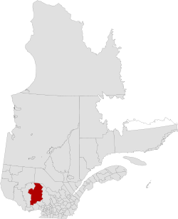
Antoine-Labelle is a regional county municipality located in the Laurentides region of Quebec, Canada. Its seat is Mont-Laurier.[2] It is named for Antoine Labelle.
Subdivisions
There are 28 subdivisions within the RCM:[2]
- Cities & Towns (2)
- Municipalities (14)
- Villages (1)
- Unorganized Territory (11)
Demographics
Population
| Canada census – Antoine-Labelle Regional County Municipality community profile | |||
|---|---|---|---|
| 2011 | 2006 | 2001 | |
| Population: | 35,159 (+0.5% from 2006) | 34,999 (+4.6% from 2001) | 33,456 (-1.3% from 1996) |
| Land area: | 14,969.05 km2 (5,779.58 sq mi) | 14,954.44 km2 (5,773.94 sq mi) | 14,954.60 km2 (5,774.00 sq mi) |
| Population density: | 2.3/km2 (6.0/sq mi) | 2.3/km2 (6.0/sq mi) | 2.2/km2 (5.7/sq mi) |
| Median age: | 49.6 (M: 49.6, F: 49.5) | 46.3 (M: 46.2, F: 46.3) | 42.5 (M: 42.4, F: 42.6) |
| Total private dwellings: | 23,139 | 21,811 | 20,803 |
| Median household income: | $40,301 | $38,334 | $32,707 |
| References: 2011[4] 2006[5] 2001[6] | |||
| Historical Census Data - Antoine-Labelle Regional County Municipality, Quebec[7] | ||||||||||||||||||||||||||
|---|---|---|---|---|---|---|---|---|---|---|---|---|---|---|---|---|---|---|---|---|---|---|---|---|---|---|
|
|
| ||||||||||||||||||||||||
Language
| Canada Census Mother Tongue - Antoine-Labelle Regional County Municipality, Quebec[7] | ||||||||||||||||||
|---|---|---|---|---|---|---|---|---|---|---|---|---|---|---|---|---|---|---|
| Census | Total | French |
English |
French & English |
Other | |||||||||||||
| Year | Responses | Count | Trend | Pop % | Count | Trend | Pop % | Count | Trend | Pop % | Count | Trend | Pop % | |||||
| 2011 |
34,530 |
33,590 | |
97.28% | 495 | |
1.43% | 170 | |
0.49% | 275 | |
0.80% | |||||
| 2006 |
34,535 |
33,445 | |
96.84% | 455 | |
1.32% | 115 | |
0.33% | 520 | |
1.51% | |||||
| 2001 |
32,355 |
31,605 | |
97.68% | 405 | |
1.25% | 95 | |
0.29% | 250 | |
0.77% | |||||
| 1996 |
32,830 |
32,105 | n/a | 97.79% | 415 | n/a | 1.26% | 115 | n/a | 0.35% | 195 | n/a | 0.59% | |||||
Transportation
Access Routes
Highways and numbered routes that run through the municipality, including external routes that start or finish at the county border:[8]
|
|
|
Airports
- Rivière-Rouge/Mont-Tremblant International Airport (La Macaza)
- Aéroport de Mont-Laurier (Mont-Laurier)
- Hydrobase Ste-Véronique (Rivière-Rouge, secteur Sainte-Véronique)
Protected Areas
Mont-Tremblant National Park
Information Centers/ Camp Areas:
- Lac Cache
- Post d'accueil de la Cache
Papineau-Labelle Wildlife Reserve
Information Centers/ Camp Areas:
- Accueil Pie IX
- Benjamin
- Camp de gardien
- Camp du gardien (on Lac Joinville)
- Camp du gardien (on Lac Ernest)
- Caragana
- Corbeau
- De l'Averse
- De l'Hote
- Desaulniers
- Du Sourd
- Entree Benjamin
- Entree Corbeau
- Entree Du Sourd
- Entree Louvigny
- Fascinant
- Flood
- Heron
- Lac-du-Sourd
- Lac-Ernest
- Lac-Joinville
- Lagace
- Leclerc
- Le Mesange/Vieux Foyer
- Letourneau
- Quatre-Temps
- Sept Freres
- Tarte
- Travers
- Wisik/Calliergon/Trille
Rouge-Matawin Wildlife Reserve
Information Centers/ Camp Areas:
- Entree de La Macaza
- Poste d'accueil de La Macaza
- Poste d'accueil de l'Ascension
Zones d'exploitation contrôlée:
- ZEC Le Sueur
- ZEC Mitchinamecus
- ZEC Normandie
- ZEC Petawaga
Attractions
- Armand-Lachaine Covered Bridge [1906] (Chute-Saint-Philippe)
- Exposition de Mont-Laurier Centre (Mont-Laurier)
- Ferme-Rouge Covered Bridge [1903] (Kiamika/Saint-Aimé-du-Lac-des-Îles)
- La Gare Centre of Exposition [1903] (L'Annonciation)
- Macaza Covered Bridge [1904] (La Macaza)
- Mont-Laurier Airport (Des Ruisseaux)
- P'tit-train du Nord trail
See also
Related articles
- List of regional county municipalities and equivalent territories in Quebec
- Rouge-Matawin Wildlife Reserve
- Mont-Tremblant National Park
- Rouge River (Quebec)
References
- ↑ Reference number 141123 of the Commission de toponymie du Québec (French)
- 1 2 3 4 Geographic code 790 in the official Répertoire des municipalités (French)
- 1 2 "(Code 2479) Census Profile". 2011 census. Statistics Canada. 2012.
- ↑ "2011 Community Profiles". Canada 2011 Census. Statistics Canada. July 5, 2013. Retrieved 2014-03-06.
- ↑ "2006 Community Profiles". Canada 2006 Census. Statistics Canada. March 30, 2011. Retrieved 2014-03-06.
- ↑ "2001 Community Profiles". Canada 2001 Census. Statistics Canada. February 17, 2012. Retrieved 2014-03-06.
- 1 2 Statistics Canada: 1996, 2001, 2006, 2011 census
- ↑ Official Transport Quebec Road Map
External links
 |
La Tuque TE | | ||
| La Vallée-de-la-Gatineau RCM | |
Matawinie RCM | ||
| ||||
| | ||||
| Papineau RCM | Les Laurentides RCM |
This article is issued from Wikipedia - version of the 10/23/2016. The text is available under the Creative Commons Attribution/Share Alike but additional terms may apply for the media files.