Antoine, Arkansas
| Antoine, Arkansas | |
|---|---|
| Town | |
 Location in Pike County and the state of Arkansas | |
| Coordinates: 34°2′10″N 93°25′18″W / 34.03611°N 93.42167°WCoordinates: 34°2′10″N 93°25′18″W / 34.03611°N 93.42167°W | |
| Country | United States |
| State | Arkansas |
| County | Pike |
| Area | |
| • Total | 0.5 sq mi (1.3 km2) |
| • Land | 0.5 sq mi (1.3 km2) |
| • Water | 0 sq mi (0 km2) |
| Elevation | 299 ft (91 m) |
| Population (2000) | |
| • Total | 156 |
| • Density | 312/sq mi (120/km2) |
| Time zone | Central (CST) (UTC-6) |
| • Summer (DST) | CDT (UTC-5) |
| ZIP code | 71922 |
| Area code(s) | 870 |
| FIPS code | 05-01540 |
| GNIS feature ID | 0076183 |
Antoine is a town in Pike County, Arkansas, United States, along the Antoine River. The population was 156 according to the 2000 census.
Geography
Antoine is located at 34°2′10″N 93°25′18″W / 34.03611°N 93.42167°W (34.036183, -93.421787).[1] It is located on hills immediately west of the Antoine River.
According to the United States Census Bureau, the town has a total area of 1.3 km² (0.5 mi²), all land.
Elevation is 300 feet (91 m) above sea level.
History
The town of Antoine began as a stopping point on the old Southwest Trail to Texas in the early 19th century. It was named for a French trapper who was found dead at his camp along the road (the site of the present town cemetery). The only identification found on the man was his first name, "Antoine". He was buried on the hill by the river and the gravesite became a landmark for travelers. Eventually, the name was given to the river and to the town that grew up beside it. Antoine's grave is located within the bounds of the town cemetery, although the marker has disappeared over time. There are also two Bois-D'Arc marker-trees from the Southwest Trail that remain alive within the town, both located on what is now Main Street/Arkansas Highway 29.
In spite of a nearby skirmish, the town suffered only minor damage during the Civil War, remaining in Confederate hands until 1865. In the late 1860s and early 1870s, a major railroad line was established across Southwest Arkansas. This event was of critical importance to the history of Antoine but the new route was established about 20 miles (32 km) southeast of the former main artery of commerce (the Southwest Trail), and thereby bypassed Antoine. As a result, businesses and settlers abandoned towns along the old route, and the town began a slow decline from which it ultimately never recovered.
In the 1890s and early 20th century, there was a logging and railroad boom in the area that lasted up through the Great Depression years. During this time, railroad connections were established with Gurdon to the south, Amity to the north, and Delight to the west. The historic railroad trestle over the Antoine River was built in 1908 and remains in use today.
During the Great Depression and afterwards, Antoine experienced a slow but steady decline in population.
Today, the main activities include: logging, ranching, trucking, farming, and tourism. Most residents work in the nearby cities of: Arkadelphia, Hope, or Nashville.
Demographics
| Historical population | |||
|---|---|---|---|
| Census | Pop. | %± | |
| 1930 | 210 | — | |
| 1940 | 233 | 11.0% | |
| 1950 | 209 | −10.3% | |
| 1960 | 163 | −22.0% | |
| 1970 | 182 | 11.7% | |
| 1980 | 194 | 6.6% | |
| 1990 | 160 | −17.5% | |
| 2000 | 156 | −2.5% | |
| 2010 | 117 | −25.0% | |
| Est. 2015 | 112 | [2] | −4.3% |
2014 Estimate[4] | |||
According to the census[5] of 2000, there were 156 people, 64 households, and 44 families residing in the town. The population density was 118.1/km² (305.3/mi²). There were 74 housing units at an average density of 56.0/km² (144.8/mi²). The racial makeup of the town was 93.59% White, 5.77% Black or African American, and 0.64% of people with two or more races. 0.00% of the population was Hispanic or Latino.
There were 64 households, out of which 31.3% had children under the age of 18 living with them, 59.4% were married couples living together, 7.8% had a female head of the household with no husband present, and 29.7% were non-families. 29.7% of all households were made up of individuals and 17.2% had someone living alone who was 65 years of age or older. The average household size was 2.44 and the average family size was 3.02.
The age of the local population was spread out-- with 26.3% under the age of 18, 8.3% from 18 to 24, 21.2% from 25 to 44, 26.3% from 45 to 64, and 17.9% who were 65 years of age or older. The median age was 42 years. For every 100 females, there were 83.5 males. For every 100 females age 18 and over, there were 88.5 males.
The median income for a household in the town was $23,750 and the median income for a family was $24,583. Males had a median income of $14,583, versus $13,333 for females. The per capita income for the town was $13,191. About 7.3% of families and 12.8% of the population were below the poverty line, including 15.9% of those under the age of eighteen and 18.2% of those sixty five or over.
References
- ↑ "US Gazetteer files: 2010, 2000, and 1990". United States Census Bureau. 2011-02-12. Retrieved 2011-04-23.
- ↑ "Annual Estimates of the Resident Population for Incorporated Places: April 1, 2010 to July 1, 2015". Retrieved July 2, 2016.
- ↑ "Census of Population and Housing". Census.gov. Archived from the original on May 11, 2015. Retrieved June 4, 2015.
- ↑ "Annual Estimates of the Resident Population for Incorporated Places: April 1, 2010 to July 1, 2014". Retrieved June 4, 2015.
- ↑ "American FactFinder". United States Census Bureau. Archived from the original on 2013-09-11. Retrieved 2008-01-31.
Encyclopedia of Arkansas History & Culture
Municipalities and communities of Pike County, Arkansas, United States | ||
|---|---|---|
| Cities | 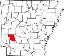 | |
| Towns | ||
| CDP | ||
| Unincorporated communities | ||
| Footnotes | ‡This populated place also has portions in an adjacent county or counties | |