Comarca de Antequera
| Comarca de Antequera | |
|---|---|
| Comarca | |
|
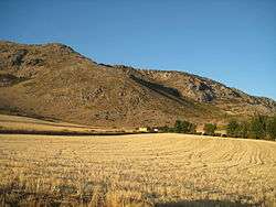
Countryside in the Comarca de Antequera. | |
 | |
| Country |
|
| Autonomous community |
|
| Province | Málaga |
| Capital | Antequera |
| Municipalities | |
| Area | |
| • Total | 1,072 km2 (414 sq mi) |
| Population (2013) | |
| • Total | 117,356 |
| • Density | 110/km2 (280/sq mi) |
| Time zone | CET (UTC+1) |
| • Summer (DST) | CEST (UTC+2) |
The Comarca de Antequera is a comarca (currently with no administrative role) in Andalusia, southern Spain.
It is located in the area of the Surco Intrabético range, on the boundary with the province of Córdoba. The landscape is largely plain (Hoya de Antequera), run by the higher valley of the Guadalhorce river.
The present-day comarca was established in 2003 by the Government of Andalusia.[1]
Municipalities
The comarca originally included six municipalities, a further municipality, Villanueva de la Concepción, was segregated from Antequera municipality on 17 March 2009:[2]
References
- ↑ Orden de 14 de marzo de 2003, por la que se aprueba el mapa de comarcas de Andalucía a efectos de la planificación de la oferta turística y deportiva, Boletín Oficial de la Junta de Andalucía; Bulletin of the Government of Andalusia, No 59; 27 March 2003, p. 6248
- ↑ Villanueva de la Concepción
External links
 Media related to Comarca de Antequera at Wikimedia Commons
Coordinates: 37°04′47″N 4°37′25″W / 37.07972°N 4.62361°W
This article is issued from Wikipedia - version of the 9/2/2016. The text is available under the Creative Commons Attribution/Share Alike but additional terms may apply for the media files.