Anoka, Minnesota
| Anoka | |
|---|---|
| City | |
| Anoka, Minnesota | |
|
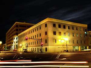
Main Street in downtown Anoka, July 2009 | |
| Motto: "Halloween Capital of the World"[1] | |
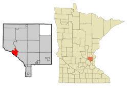 Location of the city of Anoka within Anoka County, Minnesota | |
| Coordinates: 45°11′52″N 93°23′14″W / 45.19778°N 93.38722°W | |
| Country | United States |
| State | Minnesota |
| County | Anoka |
| Founded | 1844 |
| Incorporated | 1878 |
| Government | |
| • Mayor | Phil Rice |
| Area[2] | |
| • Total | 7.21 sq mi (18.67 km2) |
| • Land | 6.70 sq mi (17.35 km2) |
| • Water | 0.51 sq mi (1.32 km2) 7.07% |
| Elevation | 879 ft (268 m) |
| Population (2010)[3] | |
| • Total | 17,142 |
| • Estimate (2015)[4] | 17,350 |
| • Density | 2,558.5/sq mi (987.8/km2) |
| Time zone | Central (UTC-6) |
| • Summer (DST) | Central (UTC-5) |
| ZIP code | 55303 |
| Area code(s) | 763 |
| FIPS code | 27-01720[5] |
| GNIS feature ID | 0639396[6] |
| Website | City of Anoka |

Anoka (/əˈnoʊkə/ ə-NOH-kə) is a city in Anoka County, Minnesota. The population was 17,142 at the 2010 census.[7] It is the county seat. Anoka is also the "Halloween Capital of the World", because it hosted one of the first Halloween parades in 1920.[8] It continues to celebrate the holiday each year with several parades. Anoka is a northern suburb of the Twin Cities.
U.S. Highways 10 / 169 and State Highway 47 are three of the main routes, and a station on the Northstar Commuter Rail line to downtown Minneapolis is located in the city.
History
The site which is now Anoka was first settled by immigrants in 1844. By the mid-1850s Anoka had grown to include a school, a store and a flour mill. In 1856, C. C. Andrews described Anoka as a "large and handsome village" and noted that pine logs were floated down the Rum River to sawmills there.[9] The city was formally incorporated in 1878. The name Anoka was derived from two Indian words. The native Dakota used A-NO-KA-TAN-HAN, meaning "on both sides", or "from both sides", referring to its location on the banks of the Rum River. The native Ojibwa used ON-O-KAY, meaning "working waters".[10]
Anoka makes a strong claim for providing the first volunteers to the Union Army during the Civil War, noted by a small historical plaque standing at the corner of West Main Street and Park Street. Alexander Ramsey, Minnesota's governor in 1861, was in Washington, D.C. when Fort Sumter was fired upon. He immediately offered a regiment to the War Department, and telegraphed former governor Willis Gorman and Lieutenant Governor Ignatius L. Donnelly that same morning. Gorman, attending a district court session in Anoka, received the note by messenger from St. Paul and called a court recess, asking for volunteers. Aaron Greenwald, who has an "island" named after him on Lake George, and five others stepped forward; Greenwald was the first to sign. He died July 2, 1863, during the 1st Minnesota Regiment's famous charge at Gettysburg.
Geography
Anoka lies at the confluence of the Rum and Mississippi Rivers, about 20 miles (30 km) northwest of Minneapolis. According to the United States Census Bureau, the city has a total area of 7.21 square miles (18.67 km2), of which, 6.70 square miles (17.35 km2) is land and 0.51 square miles (1.32 km2) is water.[2] Adjacent communities include Dayton, Ramsey, Andover, Coon Rapids, and Champlin. The USGS tracks the city by the ID 639396 and the coordinates of 45°11′52″N, 093°23′14″W.[11] Coordinates: 45°11′52″N 093°23′14″W / 45.19778°N 93.38722°W
Demographics
| Historical population | |||
|---|---|---|---|
| Census | Pop. | %± | |
| 1880 | 2,766 | — | |
| 1890 | 4,252 | 53.7% | |
| 1900 | 3,769 | −11.4% | |
| 1910 | 3,972 | 5.4% | |
| 1920 | 4,287 | 7.9% | |
| 1930 | 4,851 | 13.2% | |
| 1940 | 6,426 | 32.5% | |
| 1950 | 7,396 | 15.1% | |
| 1960 | 10,562 | 42.8% | |
| 1970 | 13,298 | 25.9% | |
| 1980 | 15,634 | 17.6% | |
| 1990 | 17,192 | 10.0% | |
| 2000 | 18,076 | 5.1% | |
| 2010 | 17,142 | −5.2% | |
| Est. 2015 | 17,350 | [12] | 1.2% |
| U.S. Decennial Census[13] 2015 Estimate[4] | |||
2010 census
As of the census[3] of 2010, there were 17,142 people, 7,060 households, and 4,202 families residing in the city. The population density was 2,558.5 inhabitants per square mile (987.8/km2). There were 7,493 housing units at an average density of 1,118.4 per square mile (431.8/km2). The racial makeup of the city was 88.0% White, 4.7% African American, 1.0% Native American, 1.8% Asian, 1.6% from other races, and 3.0% from two or more races. Hispanic or Latino of any race were 4.2% of the population.
There were 7,060 households of which 29.4% had children under the age of 18 living with them, 40.6% were married couples living together, 13.7% had a female householder with no husband present, 5.2% had a male householder with no wife present, and 40.5% were non-families. 32.2% of all households were made up of individuals and 11.8% had someone living alone who was 65 years of age or older. The average household size was 2.34 and the average family size was 2.95.
The median age in the city was 37.6 years. 21.9% of residents were under the age of 18; 9.4% were between the ages of 18 and 24; 28.7% were from 25 to 44; 26.3% were from 45 to 64; and 13.7% were 65 years of age or older. The gender makeup of the city was 49.8% male and 50.2% female.
2000 census
At the 2000 census,[5] there were 18,076 people, 7,262 households and 4,408 families residing in the city. The population density was 2,709.0 per square mile (1,046.4/km²). There were 7,398 housing units at an average density of 1,108.7 per square mile (428.2/km²). The racial makeup of the city was 86.1% White, 4.6% African American, 0.9% Native American, 1.7% Asian, 0.01% Pacific Islander, 0.02% from other races, and 2.5% from two or more races. Hispanic or Latino of any race were 4.2% of the population.
There were 7,262 households of which 30.9% had children under the age of 18 living with them, 44.5% were married couples living together, 12.0% had a female householder with no husband present, and 39.3% were non-families. 31.9% of all households were made up of individuals and 11.2% had someone living alone who was 65 years of age or older. The average household size was 2.38 and the average family size was 3.03. Age was represented as: 24.6% under the age of 18, 11.1% from 18 to 24, 32.2% from 25 to 44, 20.5% from 45 to 64, and 11.6% who were 65 years of age or older. The median age was 34 years. For every 100 females there were 99.2 males. For every 100 females age 18 and over, there were 97.1 males.
The median household income was $42,659 and the median family income was $55,311. Males had a median income of $37,930 versus $27,753 for females. The per capita income for the city was $21,367. About 4.7% of families and 6.8% of the population were below the poverty line, including 9.2% of those under age 18 and 5.4% of those age 65 or over.
Economy
Top employers
According to Anoka's 2010 Comprehensive Annual Financial Report, the top employers in the city were:
| # | Employer | # of Employees |
|---|---|---|
| 1 | Federal Cartridge | 1,242 |
| 2 | Anoka-Hennepin School District 11 | 1,221 |
| 3 | Hoffman | 1,217 |
| 4 | Anoka County Government Center | 1,140 |
| 5 | Anoka Metro Regional Treatment Center | 479 |
| 6 | Rural Community Insurance Services | 373 |
| 7 | Anoka Technical College | 324 |
| 8 | Mate Precision Tooling | 300 |
| 9 | DecoPac | 205 |
| 10 | Firestone Metal Products | 201 |
Arts and culture
Museums and other points of interest
- Anoka County Historical Society
- Anoka Metro Regional Treatment Center
- Anoka County Library
- Goodrich Field
- Windego Park Auditorium/Open Air Theater
- Anoka Nature Preserve
- Greenhaven Golf Course
- Anoka Aquatic Center
- Colonial Hall and Masonic Lodge No. 30
Government
In 2000, Anoka elected 22-year-old Bjorn Skogquist as mayor, re-electing him again in 2002, 2004 and 2006. He was the 2nd youngest mayor ever elected in Minnesota (one year older than John Gibeau, who was elected mayor of Ceylon in 1998 at the age of 21). Skogquist worked from 2000-2008 for open government, code reform, protection of historic housing and open space and encouraged young people to become involved in civics. In 2010, Anoka elected Phil Rice as mayor of Anoka, re-electing him again in 2012.
Education
Higher education institutions in Anoka include Anoka Technical College.
Most Anoka elementary and secondary students attend schools in Anoka-Hennepin School District 11. District 11 secondary schools in Anoka are Anoka High School and Secondary Technical Education Program or S.T.E.P. High School. The Middle School is Anoka Middle School for the Arts, formerly known as Fred Moore Middle School for the Performing Arts. Anoka Middle School for the Arts has two campuses. Fred Moore Campus (formerly Fred Moore Middle School for the Performing Arts), and Washington Campus (formerly Washington Elementary School.) District 11 elementary schools in Anoka are Franklin Elementary School, Lincoln Elementary School, and Wilson Elementary School. District 11 is the largest school district in the state of Minnesota and includes parts of twelve other municipalities besides Anoka.[14] Some students attend public schools in other school districts chosen by their families under Minnesota's open enrollment statute,[15] or students come from places such as Brooklyn Park under the NWISD Magnet Program.
Private schools in Anoka includes St. Stephens Catholic School.[16]
Infrastructure
Transportation
U.S. Highways 10 / 169 and State Highway 47 are three of the main routes in Anoka, and a station on the Northstar Commuter Rail line to downtown Minneapolis is located in the city.
Anoka Station is served by the Northstar Commuter Rail line connecting the northwest suburbs and downtown Minneapolis; the line opened in November 2009.[17]
Notable people
- Stub Allison, American college football coach.
- Michele Bachmann, U.S. Representative from Minnesota's 6th District, was raised in Anoka and graduated from Anoka High School in 1974
- Gretchen Carlson, former Fox News Channel anchor, 1989's Miss America, and celebrity spokesperson for March of Dimes
- Larry Constantine, computer software pioneer and author, was raised in Anoka and graduated from Anoka High School in 1961
- Ellie Dehn, soprano opera singer[18]
- Jake Deitchler, Olympic wrestler, graduated from Anoka High School in 2008
- Herbert Funk Goodrich, a former judge on the United States Court of Appeals for the Third Circuit, was born in Anoka
- Alan Haskvitz, inducted into the National Teachers Hall of Fame
- Anna Arnold Hedgeman First African American to earn a B.A. from Hamline University. Also, the first African American woman to hold a mayoral cabinet position in the history of New York.
- Garrison Keillor, radio host of A Prairie Home Companion and author, was born in Anoka and graduated from Anoka High School
- Ethan Rusin, packaging captain at Half Acre Beer Company in Chicago, IL. A graduate of Anoka High School
- Steve Nelson, son of Anoka High School Head Football Coach Stan Nelson, linebacker for the NFL New England Patriots in the late 1970s
- Brandon Paulson, U.S. Olympic wrestler 1996 silver medalist, graduated from Anoka High School in 1992
- Briana Scurry, U.S. national women's soccer goalie, graduated from Anoka High School in 1990
- Sean Sherk, former UFC lightweight champion
- Richard K. Sorenson, master sergeant, USMC, was awarded the Medal of Honor for his heroism in the Marshall Islands of the South Pacific in February 1944[19] Rick Sorensen Park in downtown Anoka is named for him.
- Matt Sorteberg (born 1986), professional ice hockey defenceman
- Robert Stewart Sparks, Los Angeles, California, City Council member, 1925–27
- Bill Tuttle, major league baseball player of the 1950s and 1960s
- Dick Wildung, NFL player for the Green Bay Packers
See also
References
- ↑ "Anoka Halloween Inc". Anoka Halloweeen Inc. Retrieved October 14, 2012.
- 1 2 "US Gazetteer files 2010". United States Census Bureau. Archived from the original on 2012-01-24. Retrieved 2012-11-13.
- 1 2 "American FactFinder". United States Census Bureau. Retrieved 2012-11-13.
- 1 2 "Population Estimates". United States Census Bureau. Retrieved June 13, 2016.
- 1 2 "American FactFinder". United States Census Bureau. Archived from the original on 2013-09-11. Retrieved 2008-01-31.
- ↑ "US Board on Geographic Names". United States Geological Survey. 2007-10-25. Retrieved 2008-01-31.
- ↑ "2010 Census Redistricting Data (Public Law 94-171) Summary File". American FactFinder. U.S. Census Bureau, 2010 Census. Archived from the original on 26 July 2011. Retrieved 23 April 2011.
- ↑ "Anoka Halloween Inc". Anoka Halloween Inc. Retrieved October 14, 2012.
- ↑ Andrews, C. C. (1857). Minnesota and Dacotah.
- ↑ "Profile for Anoka, Minnesota, MN". ePodunk. Retrieved October 16, 2012.
- ↑ USGS's Geographic Names Information System entry for Anoka, MN, ID#639396, Entry date 11-Jan-1980
- ↑ "Annual Estimates of the Resident Population for Incorporated Places: April 1, 2010 to July 1, 2015". Retrieved July 2, 2016.
- ↑ United States Census Bureau. "Census of Population and Housing". Archived from the original on May 11, 2015. Retrieved November 25, 2014.
- ↑ "General Information (Anoka-Hennepin Public Schools)". Anoka-Hennepin School District. Archived from the original on 30 October 2010. Retrieved 19 November 2010.
- ↑ "Open Enrollment". Minnesota Department of Education. Archived from the original on 26 August 2010. Retrieved 19 November 2010.
- ↑ "St. Stephen's School Home".
- ↑ Paul Levy, Northstar set to roll, but how far?, Star Tribune, December 11, 2007.
- ↑ "Blossoming at the Metropolitan Opera, with roots in Anoka".
- ↑ Richard K. Sorenson, USMC History Division, web site accessed 20 January 2007
External links
| Wikivoyage has a travel guide for Anoka. |
| Wikimedia Commons has media related to Anoka, Minnesota. |
- Anoka official city website
- Anoka's Halloween celebration
- Anoka County Union newspaper site
- USACE Mississippi River Real Time Data for Anoka
- Windego Park Society's website, dedicated to restoring Anoka's outdoor amphitheatre
- Friends of the Anoka Nature Preserve
Municipalities and communities of Anoka County, Minnesota, United States | ||
|---|---|---|
| Cities | 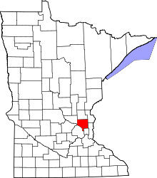 | |
| Township | ||
| CDP | ||
| Unincorporated community | ||
| Ghost town | ||
| Footnotes | ‡This populated place also has portions in an adjacent county or counties | |