Ankeny, Iowa
| Ankeny, Iowa | ||
|---|---|---|
| City | ||
|
Ankeny City Hall | ||
| ||
| Motto: "Bringing it all together" | ||
 Location in the State of Iowa | ||
 Ankeny, Iowa Location in the United States | ||
| Coordinates: 41°43′36″N 93°36′15″W / 41.72667°N 93.60417°WCoordinates: 41°43′36″N 93°36′15″W / 41.72667°N 93.60417°W | ||
| Country |
| |
| State |
| |
| County | Polk | |
| Incorporated | February 28, 1903 | |
| Government | ||
| • Mayor | Gary Lorenz | |
| Area[1] | ||
| • Total | 29.33 sq mi (75.96 km2) | |
| • Land | 29.33 sq mi (75.96 km2) | |
| • Water | 0 sq mi (0 km2) | |
| Elevation | 909 ft (277 m) | |
| Population (2010)[2] | ||
| • Total | 45,582 | |
| • Estimate (2014[3]) | 54,598 | |
| • Rank | 11th in Iowa | |
| • Density | 1,554.1/sq mi (600.0/km2) | |
| Time zone | CST (UTC-6) | |
| • Summer (DST) | CDT (UTC-5) | |
| ZIP codes | 50015, 50021, 50023 | |
| Area code(s) | 515 | |
| FIPS code | 19-02305 | |
| GNIS feature ID | 0454194 | |
| Website | City of Ankeny | |


Ankeny is a city in Polk County, Iowa, United States. The population was 45,562 in the 2010 census, an increase of 68% from the 27,117 population in the 2000 census.[4][5] It is part of the Des Moines–West Des Moines Metropolitan Statistical Area. It is one of the most affluent cities in all of Iowa.
History

Ankeny was founded by John and Sarah Ankeny in 1875 and was incorporated on February 28, 1903.[6] A railroad link from Des Moines through Ankeny to Ames was completed in 1874 and passenger service established in 1880.[7]
Coal mining became an important activity in the Ankeny area in the early 20th century. The Anderson Coal Company sank a shaft 2 miles (3 km) southeast of Ankeny in 1908. Enterprise, 4 miles (6 km) east of Ankeny, was the company town of the Enterprise Coal Company, with two large mines opened in 1903 and 1907.[8] In 1914, the Enterprise Coal Company produced over 100,000 tons of coal, ranking among the top 24 coal producers in the state.[9] In 1912, United Mine Workers Local 2476 in Ankeny had 246 members, over half of the total population at the time, and Local 2511 in Enterprise had 395 members.[10]
Ankeny started off as just one square mile, and just 445 people. Electricity was first introduced in 1907. Ankeny's first fire department was established in 1907 and was volunteer-based. They had only three ladders and 14 water pails when the department started.[11]
During World War II Ankeny was home to a federal ordnance plant that manufactured ammunition. After the war, Deere & Company purchased the plant for its Des Moines Works, while Iowa State University used the remainder of the land for its research farm. In June 2005 ISU sold the land to the city of Ankeny, which plans to develop it into a mixed-use development known as "Prairie Trail."[12]
Geography
Ankeny is located at 41°43′36″N 93°36′15″W / 41.72667°N 93.60417°W (41.726788, −93.604283).[13] It is along Interstate 35 and U.S. Route 69 about 7 miles (11 km) north of downtown Des Moines.
According to the United States Census Bureau, the city has a total area of 29.33 square miles (75.96 km2), all of it land.[1]
Demographics
| Historical population | |||
|---|---|---|---|
| Census | Pop. | %± | |
| 1910 | 445 | — | |
| 1920 | 648 | 45.6% | |
| 1930 | 632 | −2.5% | |
| 1940 | 779 | 23.3% | |
| 1950 | 1,229 | 57.8% | |
| 1960 | 2,964 | 141.2% | |
| 1970 | 9,151 | 208.7% | |
| 1980 | 15,429 | 68.6% | |
| 1990 | 18,482 | 19.8% | |
| 2000 | 27,117 | 46.7% | |
| 2010 | 45,582 | 68.1% | |
| Est. 2015 | 56,764 | [14] | 24.5% |
In 1940 Ankeny had a population of 779, but its population began to grow with the rest of the Des Moines suburbs after World War II.[11] The 2010 census of 45,582 makes Ankeny the third-largest city in Polk County, behind Des Moines and West Des Moines. The City of Ankeny reached a population of over 50,000 in 2014.[16]
2010 census
As of the census[2] of 2010, there were 45,582 people, 17,433 households, and 12,087 families residing in the city. The population density was 1,554.1 inhabitants per square mile (600.0/km2). There were 18,339 housing units at an average density of 625.3 per square mile (241.4/km2). The racial makeup of the city was 94.7% White, 1.2% African American, 0.1% Native American, 2.0% Asian, 0.1% Pacific Islander, 0.6% from other races, and 1.3% from two or more races. Hispanic or Latino of any race were 2.3% of the population.
There were 17,433 households of which 38.4% had children under the age of 18 living with them, 58.9% were married couples living together, 7.2% had a female householder with no husband present, 3.2% had a male householder with no wife present, and 30.7% were non-families. 22.6% of all households were made up of individuals and 6.2% had someone living alone who was 65 years of age or older. The average household size was 2.58 and the average family size was 3.08.
The median age in the city was 31.9 years. 27.7% of residents were under the age of 18; 9.1% were between the ages of 18 and 24; 33.7% were from 25 to 44; 21.1% were from 45 to 64; and 8.3% were 65 years of age or older. The gender makeup of the city was 49.0% male and 51.0% female.
It is one of the most affluent cities in the state of Iowa, with a GDP per capita of $48,143 (the average Iowa GPD per capita being $25,335).
2000 census
As of the census[17] of 2000, there were 27,117 people, 10,339 households, and 7,278 families residing in the city. The population density was 1,616.5 people per square mile (624.3/km²). There were 10,882 housing units at an average density of 648.7 per square mile (250.5/km²). The racial makeup of the city was 96.94% White, 0.76% African American, 0.15% Native American, 0.94% Asian, 0.03% Pacific Islander, 0.38% from other races, and 0.81% from two or more races. Hispanic or Latino of any race were 1.08% of the population.
There were 10,339 households out of which 38.1% had children under the age of 18 living with them, 60.7% were married couples living together, 7.3% had a female householder with no husband present, and 29.6% were non-families. 21.8% of all households were made up of individuals and 5.8% had someone living alone who was 65 years of age or older. The average household size was 2.57 and the average family size was 3.05.
Age spread: 27.1% under the age of 18, 11.4% from 18 to 24, 33.4% from 25 to 44, 20.1% from 45 to 64, and 8.0% who were 65 years of age or older. The median age was 32 years. For every 100 females there were 94.0 males. For every 100 females age 18 and over, there were 91.4 males.
In 2008, the median income for a household in the city was $70,197, and the median income for a family was $88,231.[18] Males had a median income of $54,532 versus $41,507 for females. The per capita income for the city was $31,527. About 1.6% of families and 2.8% of the population are below the poverty line, including 2.5% of those under age 18 and 5.0% of those age 65 or over.
Economy

Major employers in Ankeny include the Ankeny Community School District, Des Moines Area Community College, Deere & Company's Des Moines Works, Perishable Distributors of Iowa (a Hy-Vee subsidiary), Tone's Spices, Casey's General Stores, the City of Ankeny, Sysco Food Services of Iowa, Praxair, and Mrs. Clark's Foods.[19]
Over the past two decades, commercial expansion has been significant throughout much of the growing city.
On the city's eastern edge running parallel to Interstate 35, Delaware Avenue was one of the first major roadways to receive commercial development. As of late 2016, it boasts large box stores such as a Wal-Mart SuperCenter, SuperTarget, Home Depot, Kohl's, Menards, Staples, Sportsman's Warehouse, Mills Fleet Farm, Sam's Club, and Best Buy, many medium-sized specialty stores, such as Michael's, Jo Ann Fabric and Crafts, Petsmart, and TJ Maxx, and plentiful smaller businesses ranging from restaurants and boutiques to cell phone retailers and salons. South of Oralabor Road, there are many large car dealerships, such as Karl Chevrolet, Bob Brown Pontiac-GMC-Buick, Dewey Ford, and Dewey Dodge-Jeep.
In December 2008 the city received attention from news organizations across the United States when it was revealed that Tone's Spices had donated 18,000 lbs of expired garlic salt for use in melting ice and snow on its roadways.[20]
In 2008, Ankeny was recognized as one of the top ten towns for families by Family Circle.[21] In 2009, Ankeny was ranked No. 62 in MONEY Magazine's top 100 places to live list.[22] In 2015, it was designated a Playful City USA by the KaBoom! Foundation for the ninth consecutive year.[23]
Education
| School name | School mascot | Grades |
|---|---|---|
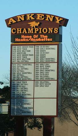
| Ankeny Centennial High School | Jaguars | 10th–12th Grades |
| Ankeny High School | Hawks/Hawkettes | 10th–12th Grades |
| Northview Middle School | Jaguars | 8th & 9th Grades |
| Southview Middle School | Hawks/Hawkettes | 8th & 9th Grades |
| Parkview Middle School | Hawks/Hawkettes | 6th & 7th Grades |
| Prairie Ridge Middle School | Jaguars | 6th & 7th Grades |
| Ashland Ridge Elementary | Jaguars | Kindergarten – 5th Grade |
| Crocker Elementary | Hawks | Kindergarten – 5th Grade |
| East Elementary | Hawks | Kindergarten – 5th Grade |
| Northeast Elementary | Jaguars | Kindergarten – 5th Grade |
| Northwest Elementary | Jaguars | Kindergarten – 5th Grade |
| Southeast Elementary | Hawks | Kindergarten – 5th Grade |
| Terrace Elementary | Hawks | Kindergarten – 5th Grade |
| Westwood Elementary | Jaguars | Kindergarten – 5th Grade |
| Prairie Trail Elementary | Hawks | Kindergarten – 5th Grade |
| Rock Creek Elementary | Jaguars | Kindergarten – 5th Grade |
| Ankeny Christian Academy | Eagles | Preschool – 12th Grade |
The post-secondary institutions are the primary Des Moines Area Community College (DMACC) campus and Faith Baptist Bible College and Theological Seminary. Simpson College and Upper Iowa University also operate extension facilities there.
The Ankeny Community School District consists of ten elementary schools, four middle schools, and two high schools.
The Ankeny Community School District is located in Polk County, Iowa, in the heart of the State of Iowa. Six miles from the capitol city of Des Moines, the district:
- Had a 2014 state-certified enrollment of 10,346.43 students (View certified & projected enrollment here.)
- Is the 8th largest district in the state (total students served)
- Has been one of the fastest-growing school districts in Iowa for more than a decade, averaging growth of 365 students annually for the last ten years
- Encompasses 16 school buildings in 51.93 square miles
- Has a K-5, 6-7, 8-9, 10-12 grade level structure
- Has more than 360,540 miles driven by buses per year
Ankeny Christian Academy is a private Preschool-12th grade school. ACA is a non-denominational Christian school and is accredited by the State of Iowa.[24]
In December 2010, the Diocese of Des Moines announced a new parish to be built that will include a school on the western side of the community on NW Weigel Drive, just north of West 5th St. Initial plans are for the school to house grades K-8[25] and will open in fall 2015.[26]
Notable people
- Carmine Boal (born 1956), Republican Iowa State Representative
- Chris Fehn (born 1972), won a Grammy Award as a musician in the heavy metal band Slipknot
- James Root (born 1971), is the rhythm/lead guitarist of the heavy metal band Slipknot, and the lead guitarist for the rock band Stone Sour.
- Jeff Lamberti (born 1962), Republican Iowa Senator and State Representative
- Larry Noble, a Republican Iowa Senator
- Chelsea Lynn Gauger, Miss Iowa USA 2009
- Paul Rhoads (born 1967), college football coach, head coach at Iowa State University from 2009 to 2015. [27]
- Connie Yori (born 1963), As of 2010 head coach of the Nebraska Cornhuskers women's basketball team[28]
Tourism
- Historic Uptown Shopping District
- Big Creek State Park
- Saylorville Recreation Area
- Ankeny Summer Fest
- Santa's North Pole Village
- DMACC Kite Festival
- Ankeny Art in the Park
- High Trestle Trail
- Haubert Park[29]
References
- 1 2 "US Gazetteer files 2010". United States Census Bureau. Archived from the original on January 24, 2012. Retrieved 2012-05-11.
- 1 2 "American FactFinder". United States Census Bureau. Retrieved 2012-05-11.
- ↑ http://www.desmoinesregister.com/story/news/local/ankeny/2015/07/23/ankeny-fastest-growing-census-population/30595037/
- ↑ "Population & Housing Occupancy Status 2010". United States Census Bureau American FactFinder. Archived from the original on July 26, 2011. Retrieved 2011-08-14.
- ↑ "Data from the 2010 Census". State Data Center of Iowa. Archived from the original on July 26, 2011. Retrieved 2011-08-14.
- ↑ City of Ankeny, Iowa. "City of Ankeny: History of Ankeny". Retrieved 2010-07-18.
- ↑ City of Ankeny, Iowa. "City of Ankeny: Late 1800's". Retrieved 2010-07-18.
- ↑ Henry Hinds, The Coal Deposits of Iowa, Chapter I of Iowa Geological Survey Annual Report, 1908, Des Moines, 1909, page 132, 143.
- ↑ Frederick E. Saward, The Coal Trade, 1915, page 65.
- ↑ Tally Sheet, Proceedings of the 23rd Annual Convention of the United Mine Workers of America Jan 16 – February 2, 1912, Indianapolis; Volume 2, page 184A.
- 1 2 City of Ankeny, Iowa. "City of Ankeny: The 1900s". Retrieved 2010-07-18.
- ↑ Urban Design Associates. "Prairie Trail Ankeny: Site History" (PDF). Archived (PDF) from the original on June 29, 2007. Retrieved 2006-10-02.
- ↑ "US Gazetteer files: 2010, 2000, and 1990". United States Census Bureau. February 12, 2011. Retrieved 2011-04-23.
- ↑ "Annual Estimates of the Resident Population for Incorporated Places: April 1, 2010 to July 1, 2015". Retrieved July 2, 2016.
- ↑ "Census of Population and Housing". Census.gov. Archived from the original on May 11, 2015. Retrieved June 4, 2015.
- ↑ City of Ankeny, Iowa. "City of Ankeny: Population Basics". Retrieved 2010-07-18.
- ↑ "American FactFinder". United States Census Bureau. Archived from the original on September 11, 2013. Retrieved 2008-01-31.
- ↑ "Archived copy". Archived from the original on February 8, 2010. Retrieved 2010-02-22.
- ↑ City of Ankeny CAFR Archived March 14, 2012, at the Wayback Machine.
- ↑ "Iowa town's roads well seasoned". Associated Press. Archived from the original on January 23, 2009. Retrieved 2009-01-29.
- ↑ "Archived copy". Archived from the original on July 19, 2011. Retrieved 2011-02-02.
- ↑ "Best Places to Live 2009". CNN.
- ↑ http://kaboom.org/playability/playful_city_usa/communities
- ↑ Ankeny Christian Academy, Ankeny, Iowa, 1604 West 1st Street, Ankeny, IA 50023-2525 515-965-8114 Ankeny Christian Academy. Accessed 2007-08-13.
- ↑ New Catholic parish, school planned in Ankeny. Accessed 2014-05-11.
- ↑ Principally Speaking – St. Luke the Evangelist. Accessed 2014-05-11.
- ↑ "Paul Rhoads". Rivals.com. Retrieved 2011-01-03.
- ↑ "Connie Yori". Coach biography. University of Nebraska. Retrieved 2010-01-03.
- ↑ "Archived copy". Archived from the original on January 9, 2011. Retrieved 2010-07-18.
External links
| Wikivoyage has a travel guide for Ankeny. |
| Wikimedia Commons has media related to Ankeny, Iowa. |
- Official Ankeny City Website
- Ankeny Chamber of Commerce
- Ankeny Community School District
- Ankeny Area Historical Society
- Ankeny Economic Development Corporation
- Ankeny Community Online Resource
- City Data Comprehensive Statistical Data and more about Ankeny
Municipalities and communities of Polk County, Iowa, United States | ||
|---|---|---|
| Cities | ||
| Townships | ||
| CDP | ||
| Other communities | ||
| Footnotes | ‡This populated place also has portions in an adjacent county or counties | |