Aniwa, Wisconsin
| Aniwa, Wisconsin | |
|---|---|
| Village | |
|
Aniwa post office | |
 Location of Aniwa, Wisconsin | |
| Coordinates: 44°59′2″N 89°8′59″W / 44.98389°N 89.14972°WCoordinates: 44°59′2″N 89°8′59″W / 44.98389°N 89.14972°W | |
| Country | United States |
| State | Wisconsin |
| County | Shawano |
| Area[1] | |
| • Total | 2.13 sq mi (5.52 km2) |
| • Land | 2.09 sq mi (5.41 km2) |
| • Water | 0.04 sq mi (0.10 km2) |
| Elevation[2] | 1,348 ft (411 m) |
| Population (2010)[3] | |
| • Total | 260 |
| • Estimate (2012[4]) | 254 |
| • Density | 124.4/sq mi (48.0/km2) |
| Time zone | Central (CST) (UTC-6) |
| • Summer (DST) | CDT (UTC-5) |
| FIPS code | 55-02100[5] |
| GNIS feature ID | 1582698[2] |

Aniwa is a village in Shawano County, Wisconsin, United States. The population was 260 at the 2010 census. The village is located within the Town of Aniwa. U.S. Route 45 runs north-south through the village.
Name origin
The name Aniwa is of Ojibwe origin. It is derived from aniwi, aniwa "those".[6][7]
Geography
Aniwa is located at 45°0′36″N 89°12′45″W / 45.01000°N 89.21250°W (45.010062, -89.212767).[8]
According to the United States Census Bureau, the village has a total area of 2.13 square miles (5.52 km2), of which, 2.09 square miles (5.41 km2) of it is land and 0.04 square miles (0.10 km2) is water.[1]
Demographics
| Historical population | |||
|---|---|---|---|
| Census | Pop. | %± | |
| 1900 | 367 | — | |
| 1910 | 274 | −25.3% | |
| 1920 | 250 | −8.8% | |
| 1930 | 296 | 18.4% | |
| 1940 | 283 | −4.4% | |
| 1950 | 257 | −9.2% | |
| 1960 | 247 | −3.9% | |
| 1970 | 233 | −5.7% | |
| 1980 | 273 | 17.2% | |
| 1990 | 249 | −8.8% | |
| 2000 | 272 | 9.2% | |
| 2010 | 260 | −4.4% | |
| Est. 2015 | 246 | [9] | −5.4% |
2010 census
As of the census[3] of 2010, there were 260 people, 111 households, and 71 families residing in the village. The population density was 124.4 inhabitants per square mile (48.0/km2). There were 126 housing units at an average density of 60.3 per square mile (23.3/km2). The racial makeup of the village was 99.2% White and 0.8% from two or more races. Hispanic or Latino of any race were 0.8% of the population.
There were 111 households of which 32.4% had children under the age of 18 living with them, 47.7% were married couples living together, 11.7% had a female householder with no husband present, 4.5% had a male householder with no wife present, and 36.0% were non-families. 29.7% of all households were made up of individuals and 8.1% had someone living alone who was 65 years of age or older. The average household size was 2.34 and the average family size was 2.92.
The median age in the village was 40.3 years. 25.4% of residents were under the age of 18; 3.8% were between the ages of 18 and 24; 30.4% were from 25 to 44; 22.3% were from 45 to 64; and 18.1% were 65 years of age or older. The gender makeup of the village was 50.0% male and 50.0% female.
2000 census
As of the census[5] of 2000, there were 272 people, 114 households, and 79 families residing in the village. The population density was 130.2 people per square mile (50.2/km²). There were 127 housing units at an average density of 60.8 per square mile (23.5/km²). The racial makeup of the village was 97.06% White, 0.37% Native American, and 2.57% from two or more races. 1.10% of the population were Hispanic or Latino of any race.
There were 114 households out of which 24.6% had children under the age of 18 living with them, 55.3% were married couples living together, 7.0% had a female householder with no husband present, and 30.7% were non-families. 23.7% of all households were made up of individuals and 8.8% had someone living alone who was 65 years of age or older. The average household size was 2.39 and the average family size was 2.80.
In the village the population was spread out with 22.8% under the age of 18, 9.9% from 18 to 24, 30.1% from 25 to 44, 20.6% from 45 to 64, and 16.5% who were 65 years of age or older. The median age was 36 years. For every 100 females there were 110.9 males. For every 100 females age 18 and over, there were 118.8 males.
The median income for a household in the village was $28,542, and the median income for a family was $30,833. Males had a median income of $26,094 versus $21,875 for females. The per capita income for the village was $13,203. About 7.5% of families and 15.6% of the population were below the poverty line, including 25.5% of those under the age of eighteen and 17.1% of those sixty five or over.
References
- 1 2 "US Gazetteer files 2010". United States Census Bureau. Retrieved 2012-11-18.
- 1 2 "US Board on Geographic Names". United States Geological Survey. 2007-10-25. Retrieved 2008-01-31.
- 1 2 "American FactFinder". United States Census Bureau. Retrieved 2012-11-18.
- ↑ "Population Estimates". United States Census Bureau. Retrieved 2013-06-24.
- 1 2 "American FactFinder". United States Census Bureau. Retrieved 2008-01-31.
- ↑ Verwyst, Chrysostom. 1892. "Geographical Names in Wisconsin, Minnesota, and Michigan, Having a Chippewa Origin". Collections of the State Historical Society of Wisconsin 12: 390–398.
- ↑ Chicago and North Western Railway Company (1908). A History of the Origin of the Place Names Connected with the Chicago & North Western and Chicago, St. Paul, Minneapolis & Omaha Railways. p. 37.
- ↑ "US Gazetteer files: 2010, 2000, and 1990". United States Census Bureau. 2011-02-12. Retrieved 2011-04-23.
- ↑ "Annual Estimates of the Resident Population for Incorporated Places: April 1, 2010 to July 1, 2015". Retrieved July 2, 2016.
- ↑ "Census of Population and Housing". Census.gov. Retrieved June 4, 2015.
Municipalities and communities of Shawano County, Wisconsin, United States | ||
|---|---|---|
| Cities | 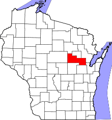 | |
| Villages | ||
| Towns | ||
| CDPs | ||
| Unincorporated communities | ||
| Indian reservations | ||
| Footnotes | ‡This populated place also has portions in an adjacent county or counties | |