Anhua County
| Anhua County 安化县 | |
|---|---|
| County | |
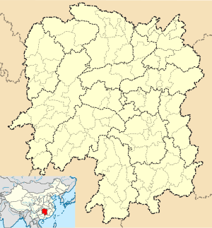 Anhua Location in Hunan | |
| Coordinates: 28°18′25″N 111°21′14″E / 28.307°N 111.354°ECoordinates: 28°18′25″N 111°21′14″E / 28.307°N 111.354°E[1] | |
| Country | People's Republic of China |
| Province | Hunan |
| Prefecture-level city | Yiyang |
| Time zone | China Standard (UTC+8) |
| Postal code | 413500 |
Anhua County (simplified Chinese: 安化县; traditional Chinese: 安化縣; pinyin: Ānhuà Xiàn) is under the administration of Yiyang, Hunan province, China. It borders the prefecture-level cities of Loudi to the south and Changde to the north. It is both the southernmost and westernmost county-level division of Yiyang. Anhua and its neighborhood have a very distinct indigenous culture - Meishan culture, which has quite long history and profound religious content, influenced by mainstream Han-Chinese culture and also some neighbor cultures during its developing process.
Administrative Divisions
Anhua has under its jurisdiction, 18 towns and 5 townships: Dongping, Qingtangpu, Meicheng, Xianxi, Dafu, Zhangtang, Yangjiaotang, Lengshi, Xiaoyan, Jiangnan, Zhexi, Malukou, Kuixi, Yanxi, Qujiang, Pingkou, Lean, Taoxi, Gaoming Township, Longtang Township, Tianzhuang Townships, Nanjin Township, Gulou Township, Deng Township.
References
- ↑ Google (2014-07-02). "Anhua" (Map). Google Maps. Google. Retrieved 2014-07-02.
- www.xzqh.org (Chinese)