Angelniemi
| Angelniemi | ||
|---|---|---|
| Former Municipality | ||
| Angelniemen kunta | ||
| ||
 | ||
| Country | Finland | |
| Region | Southwest Finland | |
| Sub-region | Salo | |
| Established | 1916 | |
| Merged | 1967 | |
| Area | ||
| • Urban | 63.7 km2 (24.6 sq mi) | |
| Population | ||
| • Density | 0/km2 (0/sq mi) | |
| • Urban density | 16.5/km2 (43/sq mi) | |
| • Metro | 1,051 | |
| statistics from 1961[1] | ||
| Time zone | EET (UTC+2) | |
| • Summer (DST) | EEST (UTC+3) | |
| Climate | Dfb | |

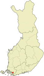
Angelniemi is a former municipality of Finland. It became part of Halikko in 1967. It was located on partly on the continent by the Halikonlahti Bay and partly on Kimito Island and is still nowadays the only part of the island where Finnish is the primary language. Today the population of the area is 398, but it rises during the summer because of the summer cottages.[2]

The center of the municipality was Kokkila, which lies on the continent. There is a cable ferry which connects Kokkila to the Kimito Island. Other isles of Angelniemi are Angelansaari, Kokkilansaari, Pikkusaari and Karhusaari.
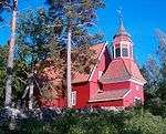
Angelniemi congregation was established 1657 as a chapel of Halikko. Angelniemi became independent 1916 and it reached its high in 1957 at 1,217 people.[1] In 1967 Angelniemi was merged back to Halikko.
Villages
Ahtmaa, Angela, Asila, Esselpää, Isokylä, Kanamäki, Karviainen, Kokkila, Myllyperä, Paatelmaa, Peksala, Päärnäspää, Pöylä, Sapalahti, Tammenpää, Toppjoki, Torkkila, Tuiskula, Valttila
References
- 1 2 Statistics of Angelniemi (Finnish)
- ↑ Angelniemen kyläyhdistys (Finnish)]
| Municipalities |  | |
|---|---|---|
| Former municipalities |
| |
Coordinates: 60°18′N 22°54′E / 60.300°N 22.900°E