Andringitra Massif
| Andringitra Massif | |
|---|---|
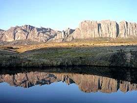 A view of the massif. | |
| Highest point | |
| Peak | Pic Boby[1][2] |
| Elevation | 2,658 m (8,720 ft) |
| Geography | |
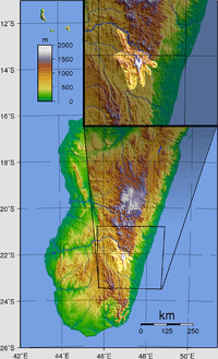 | |
| Country | Madagascar |
| State/Province | Fianarantsoa Province |
| Range coordinates | 22°12′S 46°53′E / 22.2°S 46.89°ECoordinates: 22°12′S 46°53′E / 22.2°S 46.89°E |
| Geology | |
| Age of rock | Precambrian |
| Type of rock | Igneous, metamorphic |
The Andringitra Massif is a granite massif located within Andringitra National Park in Madagascar. Pic Boby, the highest peak, is at 2658 meters (8,720 ft) high. Today, it is mainly occupied by herders and shepherds who are constantly moving in order to find the freshest grazing grounds for their livestock.[3] Lately, many tourists and adventurers have visited the area as it provides both numerous hiking and backpacking opportunities, as well as stunning views and geological formations.
Geology
The massif is located in a relatively geologically-stable area, on solid precambrian ground, which is evidence of the fact that these mountains were formed by a relatively sudden volcanic event. The mountains have many sharp cliffs and rises, as well as several volcanic formations. The Andringitra Massif contains many spectacular granite erosion sites, which have been formed over millions of years.
References
- ↑ "Archived copy". Archived from the original on 2009-10-13. Retrieved 2009-11-27.
- ↑ http://www.wildmadagascar.org/conservation/parks/Andringitra.html
- ↑ "Archived copy" (PDF). Archived from the original (PDF) on 2011-07-22. Retrieved 2009-11-28.