Andel, Netherlands
| Andel | |
|---|---|
| Village | |
|
14th century Romboutstoren (Rombouts tower) in Andel | |
| Coordinates: 51°47′2″N 5°3′14″E / 51.78389°N 5.05389°E | |
| Country | Netherlands |
| Province | North Brabant |
| Municipality | Woudrichem |
| Population (1 January 2004) | 2,511 |
| Major roads | N267, N322 |

Andel is a village in the municipality of Woudrichem, in the Netherlands. It is located about 7 km southeast of Gorinchem. The village itself had 2330 inhabitants as of 2006; together with the surrounding countryside that belong to the village, the population is about 2520.[1] This includes the small hamlet of Bronkhorst.
Until 1973, Andel was a separate municipality. The village used to consist of two parts: an upstream part named Op-Andel (51°46′57″N 5°3′40″E / 51.78250°N 5.06111°E), and a downstream part named Neer-Andel (51°47′3″N 5°3′15″E / 51.78417°N 5.05417°E), both on the river Meuse.
References
- ↑ Statistics Netherlands, 2007. Figures are for the year 2006. Statistics are available in Google Earth format.
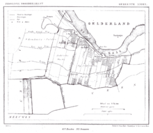
1865 map of the municipality.
Coordinates: 51°47′0″N 5°3′30″E / 51.78333°N 5.05833°E
This article is issued from Wikipedia - version of the 10/26/2015. The text is available under the Creative Commons Attribution/Share Alike but additional terms may apply for the media files.