Anamur
| Anamur | |
|---|---|
 Anamur | |
| Coordinates: TR 36°04′39″N 32°49′58″E / 36.07750°N 32.83278°ECoordinates: TR 36°04′39″N 32°49′58″E / 36.07750°N 32.83278°E | |
| Country |
|
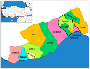
| Province | Mersin |
| Government | |
| • Mayor | Mehmet Türe (MHP) |
| • Kaymakam | Haluk Sımsek |
| Area[1] | |
| • District | 1,337.86 km2 (516.55 sq mi) |
| Population (2012)[2] | |
| • Urban | 35,082 |
| • District | 62,610 |
| • District density | 47/km2 (120/sq mi) |
| Post code | 336xx |
| Website |
www |
Anamur is a town and district of the province of Mersin, on the Mediterranean coast of southern Turkey, between Antalya and the city of Mersin.
Anamur is Anatolia's southernmost point,[3] a coastal resort famous for its bananas and peanuts.
Etymology
Anamur has mutated from the Ancient Greek "Anemourion" (Ἀνεμούριον), Latinized as "Anemurium", meaning "windmill".[4]
History
Founded by the Phoenicians, Anemurium was then occupied by the Assyrians and Hittites. During the Hittite period in the twelfth century BC, the ruler Tuthalia IV, granted Anemurium to Mattuvata who had taken refuge in his kingdom. Mattuvata took advantage of the Hittites’ weakness, establishing his own kingdom with Anemurium as its capital. His rule extended as far as Afyon, in central Anatolia. At the end of the twelfth century the area was occupied by a nomadic tribe that had come from across the Caucasus mountains. The tribe was called by the ancient Greeks the "Wind people" (Ἀνέμου γένος) after whom the city was named. The exact reasons behind this name are lost in time. The most probable explanation however, is that they worshiped a god of wind, perhaps similar to the Greek Aeolus, as their main deity. Then the city came under the control of the Phoenicians again, and later Persians. In 333 BC Alexander the Great brought this coast within his Macedonian Empire, and he was succeeded by Seleucids and then Ancient Romans. The coast was given by Mark Anthony to Cleopatra as a wedding present and Roman coins have been discovered in the course of excavation, dating to the years between Emperors Titus (AD 79-81) and Valevianus (AD 253–259). The Romans were succeeded by the Byzantines.
The city was first occupied by an Islamic Army in the time of Umar ibn al-Khattab. Turkish people reached the city in the eleventh and twelfth centuries. In the thirteenth century, the Karamanids, a clan in Central Anatolia, expanded their borders towards the city, building the Alaköprü bridge (which can still be seen on the road to Ankara) and conquering the city in 1290 from Cilicia Armenians. It was also ruled by Sultanate of Rum between 1075 and 1099 and again between 1230 and 1246.
Climate
Anamur has a Mediterranean climate with long, hot and dry summers and cool and rainy winters.
| Climate data for Anamur | |||||||||||||
|---|---|---|---|---|---|---|---|---|---|---|---|---|---|
| Month | Jan | Feb | Mar | Apr | May | Jun | Jul | Aug | Sep | Oct | Nov | Dec | Year |
| Record high °C (°F) | 21.5 (70.7) |
23.2 (73.8) |
26.4 (79.5) |
31.2 (88.2) |
37.0 (98.6) |
41.0 (105.8) |
42.0 (107.6) |
40.0 (104) |
38.2 (100.8) |
34.6 (94.3) |
30.3 (86.5) |
25.9 (78.6) |
42 (107.6) |
| Average high °C (°F) | 15.7 (60.3) |
15.9 (60.6) |
18.2 (64.8) |
21.4 (70.5) |
25.3 (77.5) |
29.6 (85.3) |
32.8 (91) |
33.0 (91.4) |
30.9 (87.6) |
26.9 (80.4) |
21.6 (70.9) |
17.3 (63.1) |
24.05 (75.28) |
| Average low °C (°F) | 8.1 (46.6) |
8.1 (46.6) |
9.6 (49.3) |
12.3 (54.1) |
15.8 (60.4) |
19.8 (67.6) |
23.0 (73.4) |
23.0 (73.4) |
20.1 (68.2) |
16.8 (62.2) |
12.8 (55) |
9.6 (49.3) |
14.92 (58.84) |
| Record low °C (°F) | 0.3 (32.5) |
−0.8 (30.6) |
−0.7 (30.7) |
3.6 (38.5) |
8.6 (47.5) |
12.2 (54) |
16.2 (61.2) |
15.8 (60.4) |
10.8 (51.4) |
8.2 (46.8) |
2.3 (36.1) |
1.2 (34.2) |
−0.8 (30.6) |
| Average precipitation mm (inches) | 186.0 (7.323) |
140.9 (5.547) |
87.7 (3.453) |
52.7 (2.075) |
22.6 (0.89) |
5.6 (0.22) |
0.9 (0.035) |
3.7 (0.146) |
13.7 (0.539) |
72.6 (2.858) |
138.1 (5.437) |
199.4 (7.85) |
923.9 (36.373) |
| Average rainy days | 13.2 | 11.5 | 9.5 | 7.4 | 4.1 | 1.9 | 1.0 | 1.1 | 2.5 | 5.5 | 8.4 | 12.5 | 78.6 |
| Mean monthly sunshine hours | 145.7 | 154 | 213.9 | 246 | 303.8 | 327 | 344.1 | 337.9 | 306 | 251.1 | 192 | 145.7 | 2,967.2 |
| Source: Devlet Meteoroloji İşleri Genel Müdürlüğü [5] | |||||||||||||
Anamur today
The local economy depends on agriculture, especially bananas and strawberries. The weather here is very, very hot and this is the only part of Turkey that can sustain bananas, there are banana plants everywhere and now other tropical fruits such as papaya, pineapples and avocados are being planted here too. Anamur produces 40% of Turkey's strawberries. A traditional local speciality is taro (known locally as gölevez).
Although there are places of historical interest, long beaches and a clean sea there is no large scale tourism on this part of the coast as the coast road in both directions is winding and really slow to drive. But there are major road works now into the direction of Mersin and Antalya. Many kilometers have four lanes now. It takes 5 hours to get here by bus from either Mersin or Antalya. Gazipasa Airport (near Alanya) has opened mid-2011. Direct charter flights from Amsterdam (Netherlands) take place twice a week. In 2012 also German airliners will fly to this airport. Other airports are in Antalya or in Adana. Although some people from central Anatolia as well as foreigners from Europe (Germans/Austrians/Dutch) have holiday homes here, Anamur itself is a quiet, isolated town with no night life, and in winter is very quiet indeed. Anamur Iskele is the beach resort of this area. A lot of holiday flats and villa's are situated near the beach or more inland. Plenty of small and some bigger hotels offer good quality as well as the restaurants near the small boulevard. The beaches are important nesting grounds for the sea turtle caretta caretta and the rocky areas of coastline are inhabited by the Mediterranean monk seal. The military have a base here, on the coast. The island of Cyprus is a way offshore and there are no sea crossings to Kyrenia/Girne anymore. The Tasucu Ferryboat companies blocked it. Now you can only go from Tasucu with Fergun Company. Every day there are several crossings to Girne. The fast Deniz Otobusu at 11:30 hours (2.5 hours crossing) and the slow ferryboat (takes also cars) at 24:00 hours (7 hours crossing). Tasucu is 3 hours east from Anamur. The silhouette of the island of Cyprus is visible if there is no sea fog. It is just 40 miles away from Anamur.
Sites to visit

- Mamure Castle, the medieval castle, well-preserved, about 7 km (4 mi) south east of Anamur. Originally built by the Romans in the third or fourth century AD, it was enlarged by the Byzantine Empire and the Crusaders. After the Seljuk Turkish Sultan `Ala' ad-Din Kay-Qubad captured the castle in 1221, he had it rebuilt in its present form. It consists of three courtyards with 39 towers, surrounded by a moat. In one courtyard there is an ancient mosque with a minaret – built by Mahmud Bey of Karaman in 1300-1308 – which is still open for prayer. There are the ruins of a bathhouse on the opposite side. The castle is in two sections with two lines of ramparts between them, a walkway along the ramparts links the two sides.
- Anemurium, the remains of the ancient city, built between c. 100 BC and AD 600 6 km (4 mi) southwest of Anamur, on the coast. The stone walls of the city are still partly intact and there are many mosaics. The small theatre or odeion is still largely intact across from the more poorly preserved large theatre and there are several bath buildings. Enough left of the city’s two-storey Roman bathhouse to give a good impression of what it was in its heyday, with changing rooms, a hot section, a warm section, and a hall with a pool. On the entrance gate a sign written Latin says “Welcome to the baths, have a good bath.” The city had an elaborate water supply system, as illustrated by the remains of the aqueducts. There is also an acropolis containing the ruins of a palace, which had its own private water supply. Around the city walls there are many Roman built tombs, which even have small entrance halls for visitors. The site has been excavated by Canadian teams from the University of Toronto and the University of British Columbia.
- Many caves including Çukurpınar, one of the longest in the world, (1420 m) and Köşekbükü (the air is said to be treatment for asthma or malaria).
See also
- Çarıklar
- Ören
- Bozdoğan
- Gercebahşiş
- Karalarbahşiş
- Köprübaşı
- Malaklar
- Northern Cyprus Water Supply Project
References
- ↑ "Area of regions (including lakes), km²". Regional Statistics Database. Turkish Statistical Institute. 2002. Retrieved 2013-03-05.
- ↑ "Population of province/district centers and towns/villages by districts - 2012". Address Based Population Registration System (ABPRS) Database. Turkish Statistical Institute. Retrieved 2013-02-27.
- ↑ The southernmost point of Turkey's Hatay Province is slightly more to the south.
- ↑ ἀνεμούριον, Henry George Liddell, Robert Scott, A Greek-English Lexicon, on Perseus project
- ↑ "Archived copy". Archived from the original on 2010-10-23. Retrieved 2011-03-19.
External links
| Wikimedia Commons has media related to Anamur. |
| Wikivoyage has a travel guide for Anamur. |
- District governor's official website (Turkish)
- District municipality's official website (Turkish)
- About Mersin City and Anamur
- Anamur
- Mersin University
- Anamur and Anemurium
- Anamurluca, Anamur cultur pages(Turkish)
- Anamur
- Pictures of Anamur including its castle and Anemurion
| Settlements |
| ||||||||||||||||||
|---|---|---|---|---|---|---|---|---|---|---|---|---|---|---|---|---|---|---|---|
| Culture |
| ||||||||||||||||||
| Buildings and structures |
| ||||||||||||||||||
| Geographical features |
| ||||||||||||||||||