Amroha
| Amroha अमरोहा امروہہ | |
|---|---|
| Town | |
 Amroha Location in Uttar Pradesh, India | |
| Coordinates: IN 28°54′15.95″N 78°28′3.10″E / 28.9044306°N 78.4675278°ECoordinates: IN 28°54′15.95″N 78°28′3.10″E / 28.9044306°N 78.4675278°E | |
| Country |
|
| State | Uttar pradesh |
| District | Amroha |
| Languages | |
| • Official | Urdu, Hindi, English |
| Time zone | IST (UTC+5:30) |
| PIN | 244221[1] |
| Telephone code | 05922 |
| Website |
www |
Amroha is a town in north-western Uttar Pradesh state in northern India, located north-west of Moradabad, near the Sot River. It is the administrative headquarters of the Amroha district.
History
The name of Amroha drove out from the word (Urdu) Aam Mango and Rohu Fish.The author of Tarikh-i-Amroha states that Amroha was ruled by Bhardwaj Tagas between 676 and 1141 AD. Mahmud of Ghazni conquered Amroha in 589 AH/1093 AD. Behram Shah (1240–42) appointed Malik Jalaluddin to the position of Hakim of Amroha in 1242. Ghiyasuddin Balban crushed a rebellion in this region, and so ruthless was his repression that the territory of Badaun and Amroha remained quiescent till the reign of Jalaluddin Khalji. Ambar Sultani built a mosque at Amroha. During Alauddin Khalji's reign, Malik Tughluq and Malik marched through the city to confront the Mongols at the Battle of Amroha. Saiyid Salim was assigned Amroha and Sirsi as an iqta and after his death, the iqta was assigned to his sons. It is also recorded that Khizr Khan was punished by Alauddin Khalji with an enforced stay at Amroha with Hisamuddin.
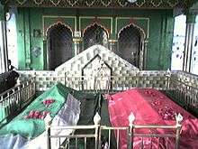
The historical architecture of Amroha begins with the fort wall, remnants of which still stand. The Moradabadi Darwaza, built by Saiyid Abdul Maajid in 1642 AD, is the only extant gate. The wall was constructed during the reign of Shah Jahan, by Siyadat Maab Saiyid Abdul Maajid, who had constructed this fort under the supervision of Kamal Khan Khanazad in 1652 AD. It is fifty feet high with three parallel arches, covered with a roof. Other monuments from this period include mosques, Idgahs, khanqah, dargahs, Imambaras, Diwan khana, madrasas and mandirs. Some of these are of the Delhi Sultanate period, others of the Mughal period. Viqar-ul-mulk gate was constructed in modern amroha in memory of nawab Viqar ul mulk. Aligarh Muslim University also has Viqarul Mulk Hall in memory of Nawab of Viqar ul Mulk who was friend of Sir Syed Ahmad Khan.
The town of Amroha is home to one of the oldest Naqvi Sadat settlements in India. Naqvis in Sadaat Amroha arrived from Wasit, Iraq and have resided in the town of Amroha since the 1190s A.D
the last ruling Nawab Sheikh Anwar ul Haq . And his son Anzar ul haq siddique were dead .
Geography
Amroha is located north-west of Moradabad, near the Sot River. Being just 130 km away, Amroha's weather is very similar to Delhi. The city is divided into localities and blocks. The climate of the Amroha is similar to other districts of Western Uttar Pradesh situated at the base of Himalaya which becomes hot in summer and dry & cold in winter.
Demographics
Amroha is a Muslim dominated city in UP. As per the final data of 2011 census, Amroha had a population of 198,471. Population of Children with age of 0-6 is 28323 which is 14.27% of total population of Amroha (NPP). In Amroha Nagar Palika Parishad, Female Sex Ratio is of 925 against state average of 912. Moreover Child Sex Ratio in Amroha is around 950 compared to Uttar Pradesh state average of 902. Literacy rate of Amroha city is 62.36% lower than state average of 67.68%. In Amroha, Male literacy is around 66.73% while female literacy rate is 57.61%.
Economy
Amroha is known for its production of mangoes;.[3] Some of the industries in Amroha include pottery making, hand-loom weaving, sugar milling and secondary ones are carpet manufacturing, wood handicrafts, dholak manufacturing and small-scale production of cotton cloth.
Connectivity
Amroha is well connected through Railways and Road with Indian capital New Delhi. Amroha railway station is situated on Delhi-Moradabad line and all passenger trains & most of the express trains stop here. Amroha railway station is on a line built by Oudh and Rohilkhand Railway, 868 miles from Kolkata. Amroha is about 5 km away from NH 24, a four-lane highway which connects New Delhi to Lucknow. Nadeem Ahmed(politician)
Notable people
References
- ↑ "Amroha Pin code". citypincode.in. Retrieved 2014-03-21.
- ↑ "Amroha Religion Census 2011". Office of the Registrar General and Census Commissioner, India. Retrieved 2015-11-16.
- ↑ BBC report