Amritsar district
| Amritsar district ਅੰਮ੍ਰਿਤਸਰ ਜ਼ਿਲ੍ਹਾ | |
|---|---|
| District | |
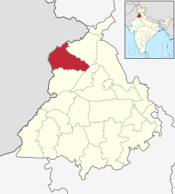 Location in Punjab, India | |
| Coordinates: 31°35′N 74°59′E / 31.583°N 74.983°ECoordinates: 31°35′N 74°59′E / 31.583°N 74.983°E | |
| Country |
|
| State | Punjab |
| Named for | Suffice of Amrit |
| Headquarters | Amritsar |
| Government | |
| • Commissioner of Police | Sardar Jatinder Singh Aulakh IPS |
| Area | |
| • Total | 2,683 km2 (1,036 sq mi) |
| Population (2011)‡[›] | |
| • Total | 2,490,891 |
| • Density | 930/km2 (2,400/sq mi) |
| Languages | |
| • Official | Punjabi |
| Time zone | IST (UTC+5:30) |
| Literacy | 76.27% |
| Website |
amritsar |
Amritsar district (Punjabi: ਅੰਮ੍ਰਿਤਸਰ ਜ਼ਿਲ੍ਹਾ) is one of 22 districts located in the Majha region of the state of Punjab in North India. The city of Amritsar is headquarters of this district.
As of 2011 it is the second most populous district of Punjab (out of 22), after Ludhiana.[1]
History
During British Rule Amritsar was part of Lahore Division and was administratively subdivided into 3 tehsils namely - Amritsar, and Ajnala. Tarn Taran has itself formed into a district headquarters.[2] However, as part of the partition of India in 1947 Amritsar district was separated from the rest of the division and awarded to India. During the partition period, the Muslim population of the district, some 30%, left for Pakistan while Hindus and Sikhs from West Punjab in newly created Pakistan migrated in the opposite direction.
The Sikhs were a majority in the Amritsar district constituting about 60% of the population before the partition of 1947. According to 2001 census, Sikhs make up about 77% while Hindus make 21% of the total population of the district.[3]
The Majha Region is the Birthplace of the Sikh religion, and the Birthplace of the Sikh Misls (Sikh Confederacy).
Demographics
According to the 2011 census Amritsar district has a population of 2,490,891,[1] roughly equal to the nation of Kuwait[4] or the US state of Nevada.[5] This gives it a ranking of 175th in India (out of a total of 640).[1] The district has a population density of 932 inhabitants per square kilometre (2,410/sq mi) .[1] Its population growth rate over the decade 2001-2011 was 15.48%.[1] Amritsar has a sex ratio of 884 females for every 1000 males,[1] and a literacy rate of 77.2%.[1]
District administration
| Amritsar | ||||||||||||||||||||||||||||||||||||||||||||||||||||||||||||
|---|---|---|---|---|---|---|---|---|---|---|---|---|---|---|---|---|---|---|---|---|---|---|---|---|---|---|---|---|---|---|---|---|---|---|---|---|---|---|---|---|---|---|---|---|---|---|---|---|---|---|---|---|---|---|---|---|---|---|---|---|
| Climate chart (explanation) | ||||||||||||||||||||||||||||||||||||||||||||||||||||||||||||
| ||||||||||||||||||||||||||||||||||||||||||||||||||||||||||||
| ||||||||||||||||||||||||||||||||||||||||||||||||||||||||||||
- The Deputy Commissioner, an officer belonging to the Indian Administrative Service is in charge of general administration of the district. He is generally a middle-level IAS officer of Punjab Cadre. As the District Magistrate, he also effectively the head of the police force.
- Administration of departments such as public works, health, education, agriculture, animal husbandry, etc. is headed by district officers who belong to various Punjab state services.
- The Commissioner of Police, an officer belonging to the Indian Police Service is responsible for maintaining law and order in the district. He is assisted by officers of the Punjab Police Service and other Punjab Police officials.
- The Divisional Forest Officer, an officer belonging to the Indian Forest Service is responsible for the management of forests and wildlife in the district. He is assisted by officers of the Punjab Forest Service, other Punjab Forest officials and Punjab Wildlife officials.
- A Municipal corporation is responsible for the management of public works and health systems in the city of Amritsar. The municipal corporation is a democratic body of councillors and is presided over by the Mayor, who is elected by the councillors. At present, there are more than 70 councillors.
Amritsar District Borders the Pakistani Punjab Districts of Lahore, Kasur, Shiekhupura along the Ravi River Firozpur District to the South along Sutlej River, Kapurthala District along the Beas River and Gurdaspur District to the North.
References
- 1 2 3 4 5 6 7 "District Census 2011". Census2011.co.in. 2011. Retrieved 2011-09-30.
- ↑ "Imperial Gazetteer2 of India, Volume 5, page 319 -- Imperial Gazetteer of India -- Digital South Asia Library".
- ↑ "Census of India: District Profile".
- ↑ US Directorate of Intelligence. "Country Comparison:Population". Retrieved 2011-10-01.
Kuwait 2,595,62
- ↑ "2010 Resident Population Data". U. S. Census Bureau. Archived from the original on 19 October 2013. Retrieved 2011-09-30.
Nevada 2,700,551
- ↑ "Amritsar District Population Census 2011, Punjab literacy sex ratio and density".
External links
| Wikimedia Commons has media related to Amritsar district. |
 |
Gurdaspur district | | ||
| Pakistan | |
|||
| ||||
| | ||||
| Taran Taran district | Kapurthala district |
| Topics |
|  |
|---|---|---|
| Regions | ||
| Districts | ||
| Major Cities | ||