Rong Kham District
| Rong Kham ร่องคำ | |
|---|---|
| Amphoe | |
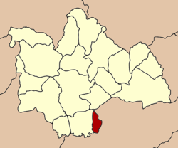 Amphoe location in Kalasin Province | |
| Coordinates: 16°16′0″N 103°44′26″E / 16.26667°N 103.74056°ECoordinates: 16°16′0″N 103°44′26″E / 16.26667°N 103.74056°E | |
| Country |
|
| Province | Kalasin |
| Seat | Rong Kham |
| Area | |
| • Total | 82.137 km2 (31.713 sq mi) |
| Population (2005) | |
| • Total | 16,444 |
| • Density | 200.3/km2 (519/sq mi) |
| Time zone | ICT (UTC+7) |
| Postal code | 46210 |
| Geocode | 4604 |
Rong Kham (Thai: ร่องคำ) is a district (amphoe) in the southern part of Kalasin Province, northeastern Thailand.
Geography
Neighboring districts are (from the west clockwise) Kamalasai of Kalasin Province, Pho Chai, and Chiang Khwan of Roi Et Province.
History
The minor district (king amphoe) was created on 1 February 1973, when the tambon Rong Kham and Samakkhi were split off from the district Kamalasai.[1] It was upgraded to a full district on 10 Oct 1993.[2]
Administration
The district is subdivided into three subdistricts (tambon), which are further subdivided into 40 villages (muban). Rong Kham is a township (thesaban tambon) which covers parts of tambon Rong Kham. There are further two tambon administrative organizations (TAO).
| No. | Name | Thai name | Villages | Inh. | |
|---|---|---|---|---|---|
| 1. | Rong Kham | ร่องคำ | 13 | 6,191 | |
| 2. | Samakkhi | สามัคคี | 15 | 5,448 | |
| 3. | Lao Oi | เหล่าอ้อย | 12 | 4,805 |
References
- ↑ ประกาศกระทรวงมหาดไทย เรื่อง แบ่งท้องที่อำเภอกมลาไสย จังหวัดกาฬสินธุ์ ตั้งเป็นกิ่งอำเภอร่องคำ (PDF). Royal Gazette (in Thai). 90 (13 ง): 239. 6 Feb 1973.
- ↑ พระราชกฤษฎีกาตั้งอำเภอลำทับ อำเภอร่องคำ อำเภอเวียงแหง อำเภอนาโยง อำเภอแก้งสนามนาง อำเภอโนนแดง อำเภอบ้านหลวง อำเภอกะพ้อ อำเภอศรีบรรพต อำเภอแก่งกระจาน อำเภอหนองสูง อำเภอสบเมย อำเภอเมยวดี อำเภอโคกเจริญ อำเภอทุ่งหัวช้าง อำเภอผาขาว อำเภอวังหิน อำเภอดอนพุด อำเภอบึงโขงหลง และอำเภอห้วยคต พ.ศ. ๒๕๓๖ (PDF). Royal Gazette (in Thai). 110 (179 ก special): 1–3. 3 Nov 1993.
External links
This article is issued from Wikipedia - version of the 1/19/2015. The text is available under the Creative Commons Attribution/Share Alike but additional terms may apply for the media files.