Rattaphum District
| Rattaphum รัตภูมิ | |
|---|---|
| Amphoe | |
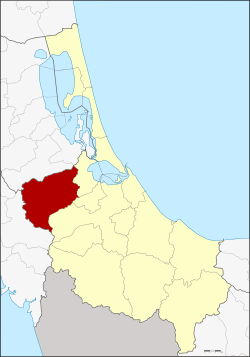 Amphoe location in Songkhla Province | |
| Coordinates: 7°8′6″N 100°16′24″E / 7.13500°N 100.27333°ECoordinates: 7°8′6″N 100°16′24″E / 7.13500°N 100.27333°E | |
| Country |
|
| Province | Songkhla |
| Seat | Kamphaeng Phet |
| Tambon | 5 |
| Muban | 63 |
| Area | |
| • Total | 591.8 km2 (228.5 sq mi) |
| Population (2014) | |
| • Total | 73,744 |
| • Density | 114.8/km2 (297/sq mi) |
| Time zone | THA (UTC+7) |
| Postal code | 90180 |
| Geocode | 9009 |
Rattaphum (Thai: รัตภูมิ) is a district (Amphoe) of Songkhla Province, southern Thailand.
Geography
Neighboring districts are (from the east clockwise) Khuan Niang, Bang Klam and Hat Yai of Songkhla Province, Khuan Kalong of Satun Province and Pa Bon of Phatthalung Province.
History
The district was renamed from Kamphaeng Phet to Rattaphum in 1939.[1]
Administration
Central administration
The district Rattaphum is subdivided into 5 subdistricts (Tambon), which are further subdivided into 63 administrative villages (Muban).
| No. | Name | Thai | Villages | Pop.[2] |
|---|---|---|---|---|
| 1. | Kamphaeng Phet | กำแพงเพชร | 13 | 21,302 |
| 2. | Tha Chamuang | ท่าชะมวง | 15 | 17,674 |
| 3. | Khuha Tai | คูหาใต้ | 14 | 11,923 |
| 4. | Khuan Ru | ควนรู | 9 | 6,041 |
| 9. | Khao Phra | เขาพระ | 12 | 16,804 |
Missing numbers are tambon which now form Khuan Niang district.
Local administration
There is one town (Thesaban Mueang) in the district:
- Kamphaeng Phet (Thai: เทศบาลเมืองกำแพงเพชร) consisting of parts of the subdistrict Kamphaeng Phet.
There are 3 subdistrict municipalities (Thesaban Tambon) in the district:
- Kamphaeng Phet (Thai: เทศบาลตำบลกำแพงเพชร) consisting of parts of the subdistrict Kamphaeng Phet.
- Na Si Thong (Thai: เทศบาลตำบลนาสีทอง) consisting of parts of the subdistrict Khao Phra.
- Khuha Tai (Thai: เทศบาลตำบลคูหาใต้) consisting of the complete subdistrict Khuha Tai.
There are 3 subdistrict administrative organizations (SAO) in the district:
- Tha Chamuang (Thai: องค์การบริหารส่วนตำบลท่าชะมวง) consisting of the complete subdistrict Tha Chamuang.
- Khuan Ru (Thai: องค์การบริหารส่วนตำบลควนรู) consisting of the complete subdistrict Khuan Ru.
- Khao Phra (Thai: องค์การบริหารส่วนตำบลเขาพระ) consisting of parts of the subdistrict Khao Phra.
References
- ↑ พระราชกฤษฎีกาเปลี่ยนนามอำเภอ กิ่งอำเภอ และตำบลบางแห่ง พุทธศักราช ๒๔๘๒ (PDF). Royal Gazette (in Thai). 56 (0 ก): 354–364. April 17, 1939.
- ↑ "Population statistics 2014" (in Thai). Department of Provincial Administration. Retrieved 2015-06-10.
External links
This article is issued from Wikipedia - version of the 6/10/2015. The text is available under the Creative Commons Attribution/Share Alike but additional terms may apply for the media files.