Pho Prathap Chang District
| Pho Prathap Chang โพธิ์ประทับช้าง | |
|---|---|
| Amphoe | |
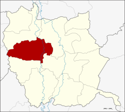 Amphoe location in Phichit Province | |
| Coordinates: 16°18′40″N 100°16′30″E / 16.31111°N 100.27500°ECoordinates: 16°18′40″N 100°16′30″E / 16.31111°N 100.27500°E | |
| Country |
|
| Province | Phichit |
| Area | |
| • Total | 378.561 km2 (146.163 sq mi) |
| Population (2005) | |
| • Total | 43,684 |
| • Density | 115.4/km2 (299/sq mi) |
| Time zone | ICT (UTC+7) |
| Postal code | 66190 |
| Geocode | 6603 |
Pho Prathap Chang (Thai: โพธิ์ประทับช้าง) is a district (amphoe) in the western part of Phichit Province, northern Thailand.
History
The government split off some parts of Mueang Phichit and Pho Thale Districts and formed the new Pho Prathap Chang minor district (king amphoe) on 24 June 1967. It was upgraded to be full district on 3 September 1973.
The district was named after the temple (Wat) Pho Prathap Chang, which was built by King Suea (Tiger King, Sanpet VIII, Suriyenthrathibodi) of Ayutthaya at his birthplace.
Geography
Neighboring districts are (from the north clockwise) Sam Ngam, Mueang Phichit, Taphan Hin, Bueng Na Rang of Phichit Province and Bueng Samakkhi of Kamphaeng Phet Province.
The important water resource is the Yom River.
Administration
The district is divided into seven sub-districts (tambon), which are further subdivided into 99 villages (muban). Pho Prathap Chang is a township (thesaban tambon) and covers parts of the tambon Pho Prathap Chang, Phai Tha Pho and Wang Chik. There are a further seven tambon administrative organizations (TAO).
| No. | Name | Thai name | Villages | Pop. | |
|---|---|---|---|---|---|
| 1. | Pho Prathap Chang | โพธิ์ประทับช้าง | 12 | 6,126 | |
| 2. | Phai Tha Pho | ไผ่ท่าโพ | 12 | 6,241 | |
| 3. | Wang Chik | วังจิก | 10 | 4,744 | |
| 4. | Phai Rop | ไผ่รอบ | 18 | 7,795 | |
| 5. | Dong Suea Lueang | ดงเสือเหลือง | 12 | 5,378 | |
| 6. | Noen Sawang | เนินสว่าง | 16 | 6,057 | |
| 7. | Thung Yai | ทุ่งใหญ่ | 19 | 7,343 |
References
External links
- amphoe.com (Thai)