Huai Rat District
| Huai Rat ห้วยราช | |
|---|---|
| Amphoe | |
|
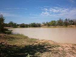
Reservoir Mueang Pho | |
 Amphoe location in Buriram Province | |
| Coordinates: 14°57′36″N 103°11′18″E / 14.96000°N 103.18833°ECoordinates: 14°57′36″N 103°11′18″E / 14.96000°N 103.18833°E | |
| Country | Thailand |
| Province | Buriram |
| Seat | Huai Rat |
| Area | |
| • Total | 147.1 km2 (56.8 sq mi) |
| Population (2005) | |
| • Total | 35,941 |
| • Density | 244.3/km2 (633/sq mi) |
| Time zone | ICT (UTC+7) |
| Postal code | 31000 |
| Geocode | 3116 |
Huai Rat (Thai: ห้วยราช, pronounced [hûa̯j râːt]) is a district (amphoe) of Buriram Province, northeastern Thailand.
Geography
Neighboring districts are (from the east clockwise) Krasang, Mueang Buriram, Ban Dan and Satuek of Buriram Province.
History
The minor district (king amphoe) Huai Rat was created on 1 April 1990, when the five tambon Huai Rat, Sam Waeng, Ta Sao, Ban Tako, and Sanuan were split off from Mueang Buriram District.[1] It was upgraded to a full district on 8 September 1995.[2]
Administration
The district is divided into eight districts (tambon), which are further subdivided into 85 villages (muban). Huai Rat is a township (thesaban tambon) which covers parts of tambon Huai Rat and the whole tambon Huai Racha. There are a further seven tambon administrative organizations (TAO).
| No. | Name | Thai name | Villages | Pop. | |
|---|---|---|---|---|---|
| 1. | Huai Rat | ห้วยราช | 15 | 4,439 | |
| 2. | Sam Waeng | สามแวง | 9 | 4,250 | |
| 3. | Ta Sao | ตาเสา | 10 | 4,784 | |
| 4. | Ban Tako | บ้านตะโก | 9 | 3,248 | |
| 5. | Sanuan | สนวน | 12 | 5,334 | |
| 6. | Khok Lek | โคกเหล็ก | 11 | 6,154 | |
| 7. | Mueang Pho | เมืองโพธิ์ | 9 | 3,558 | |
| 8. | Huai Racha | ห้วยราชา | 10 | 4,174 |
References
- ↑ ประกาศกระทรวงมหาดไทย เรื่อง แบ่งเขตท้องที่อำเภอเมืองบุรีรัมย์ จังหวัดบุรีรัมย์ ตั้งเป็นกิ่งอำเภอห้วยราช (PDF). Royal Gazette (in Thai). 107 (25 ง): 1353. February 13, 1999.
- ↑ พระราชกฤษฎีกาตั้งอำเภอด่านมะขามเตี้ย อำเภอแก่งหางแมว อำเภอภักดีชุมพล อำเภอเวียงแก่น อำเภอแม่วาง อำเภอถ้ำพรรณรา อำเภอบ่อเกลือ อำเภอโนนสุวรรณ อำเภอห้วยราช อำเภอแม่ลาน อำเภอบางแก้ว อำเภอป่าพะยอม อำเภอหนองม่วงไข่ อำเภอยางสีสุราช อำเภอจังหาร อำเภอบ้านธิ อำเภอภูสิงห์ อำเภอบางกล่ำ อำเภอวังม่วง และอำเภอนายูง พ.ศ. ๒๕๓๘ (PDF). Royal Gazette (in Thai). 112 (32 ก): 1–3. August 8, 1995.