Ampelakia
| Ampelakia Αμπελάκια | |
|---|---|
|
Ampelakia | |
 Ampelakia | |
|
Location within the regional unit  | |
| Coordinates: 37°57′N 23°31′E / 37.950°N 23.517°ECoordinates: 37°57′N 23°31′E / 37.950°N 23.517°E | |
| Country | Greece |
| Administrative region | Attica |
| Regional unit | Islands |
| Municipality | Salamis |
| • Municipal unit | 15.169 km2 (5.857 sq mi) |
| Highest elevation | 18 m (59 ft) |
| Lowest elevation | 0 m (0 ft) |
| Population (2011)[1] | |
| • Municipal unit | 7,507 |
| • Municipal unit density | 490/km2 (1,300/sq mi) |
| Community[1] | |
| • Population | 4,998 (2011) |
| Time zone | EET (UTC+2) |
| • Summer (DST) | EEST (UTC+3) |
| Postal code | 189 02 |
| Area code(s) | 22980 |
| Vehicle registration | Z |
| Website | www.ampelakia.gr |
Ampelakia (Greek: Αμπελάκια, meaning vineyards) is a town and a former municipality of Salamis Island, Greece. Since the 2011 local government reform it is part of the municipality Salamis, of which it is a municipal unit.[2]
It lies on the central east coast of the island and has a land area of 15.169 km²,[3] comprising about one-sixth of the island's area (with the balance belonging to the Salamina (city)). It has a population of 7,507 inhabitants (2011 census). Its largest town is also named Ampelakia, and has a population of 4,710. The other significant town is Selínia (pop. 2,509). The only other settlements are Kynosoúra (pop. 152) and Spithári (136).

History
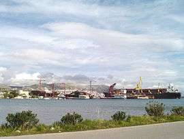
The city of Ampelakia has a long history. It was at Ampelakia Bay where the famous Battle of Salamis occurred in 480 BC, during which the Greek ships defeated the Persian fleet of Xerxes. Moreover, there are many remnants of the ancient town of Salamina which was a significant economic power between 350 and 318 BC when the town minted coins bearing the shield of the legendary hero Ajax. There are also churches which date back to the 16th century, for example the churches of St. John and St. Peter. Today Ambelakia is a nice city for a walk. The majority of the citizens are sailors. However, excavations are taking place at the ancient port, which is full of shipwrecks of old ships from the last 20 years. There are also a couple of large ship repair yards at Ambelakia. There is an effort by the Greek government to clean up the port and continue the excavations but the shipyard owners are against it because they would have to move. The biggest supermarket in the area is Kanakis.
Geography
Much of the area is made up of rocky landscapes with a few bushes, while some farmlands lie within the sea. The rest of the area is made up of residential areas. A panorama of the Attica peninsula including the Piraeus part of Athens can be seen during clear days.
Historical population
| Year | Town population | Municipal unit population |
|---|---|---|
| 1981 | 4,180 | 5,187 |
| 1991 | 4,174 | 6,760 |
| 2001 | 4,537 | 7,060 |
| 2011 | 4,710 | 7,507 |
Subdivisions
The municipal unit Ampelakia is subdivided into the following communities (constituent villages in brackets):
- Ampelakia (Ampelakia, Kynosoura, Spithari)
- Selinia
See also
References
- 1 2 "Απογραφή Πληθυσμού - Κατοικιών 2011. ΜΟΝΙΜΟΣ Πληθυσμός" (in Greek). Hellenic Statistical Authority.
- ↑ Kallikratis law Greece Ministry of Interior (Greek)
- ↑ "Population & housing census 2001 (incl. area and average elevation)" (PDF) (in Greek). National Statistical Service of Greece.
External links
- Official website (Greek)
 |
Salamina | Salamina and Saronic Gulf | Saronic Gulf | |
| Salamina | |
Saronic Gulf | ||
| ||||
| | ||||
| Salamina | Salamina and Saronic Gulf | Saronic Gulf |