American Falls, Idaho
| American Falls, Idaho | |
|---|---|
| City | |
|
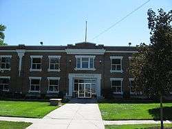
Power County Courthouse in American Falls | |
 Location of American Falls, Idaho | |
| Coordinates: 42°46′52″N 112°51′20″W / 42.78111°N 112.85556°WCoordinates: 42°46′52″N 112°51′20″W / 42.78111°N 112.85556°W | |
| Country | United States |
| State | Idaho |
| County | Power |
| Area[1] | |
| • Total | 1.69 sq mi (4.38 km2) |
| • Land | 1.69 sq mi (4.38 km2) |
| • Water | 0 sq mi (0 km2) |
| Elevation | 4,406 ft (1,343 m) |
| Population (2010)[2] | |
| • Total | 4,457 |
| • Estimate (2012[3]) | 4,421 |
| • Density | 2,637.3/sq mi (1,018.3/km2) |
| Time zone | Mountain (MST) (UTC-7) |
| • Summer (DST) | MDT (UTC-6) |
| ZIP code | 83211 |
| Area code(s) | 208 |
| FIPS code | 16-01900 |
| GNIS feature ID | 0396035 |
American Falls is a city in and the county seat of Power County, Idaho, United States.[4] The population was 4,457 at the 2010 census.
History
American Falls was a landmark waterfall on the Snake River, named after a party of American trappers whose boat went over the falls. The Wilson Price Hunt expedition in 1811 camped at the falls one night and the expedition of John C. Frémont was here in 1843. The Oregon Trail passed north of town, through the present-day reservoir. Power plants first sprang up at the falls in 1901. American Falls was the first town in the U.S. to be entirely rerelocated [citation needed]; it was moved in 1925 to facilitate construction of the nearby American Falls Dam. The old townsite sits at the bottom of the reservoir, northwest of the present city. A larger dam was completed in 1978, downstream from the deteriorating 1927 structure, which was later demolished.[5]
Geography and climate
American Falls is located at 42°46′52″N 112°51′20″W / 42.78111°N 112.85556°W (42.781121, -112.855694),[6] at an elevation of 4,406 feet (1,343 m).[7]
According to the United States Census Bureau, the city has a total area of 1.69 square miles (4.38 km2), all of it land.[1]
| Climate data for American Falls, Idaho (1981–2010) | |||||||||||||
|---|---|---|---|---|---|---|---|---|---|---|---|---|---|
| Month | Jan | Feb | Mar | Apr | May | Jun | Jul | Aug | Sep | Oct | Nov | Dec | Year |
| Average high °F (°C) | 35.0 (1.7) |
36.7 (2.6) |
47.0 (8.3) |
59.1 (15.1) |
67.2 (19.6) |
74.4 (23.6) |
88.0 (31.1) |
87.3 (30.7) |
80.4 (26.9) |
61.2 (16.2) |
46.9 (8.3) |
33.5 (0.8) |
59.7 (15.4) |
| Average low °F (°C) | 19.2 (−7.1) |
17.7 (−7.9) |
26.6 (−3) |
33.6 (0.9) |
39.8 (4.3) |
49.3 (9.6) |
53.7 (12.1) |
53.2 (11.8) |
45.1 (7.3) |
35.3 (1.8) |
26.7 (−2.9) |
18.9 (−7.3) |
34.9 (1.6) |
| Average precipitation inches (mm) | 0.85 (21.6) |
0.41 (10.4) |
0.42 (10.7) |
1.50 (38.1) |
1.10 (27.9) |
3.31 (84.1) |
0.04 (1) |
0.18 (4.6) |
0.34 (8.6) |
1.19 (30.2) |
1.13 (28.7) |
1.25 (31.8) |
11.71 (297.4) |
| Average snowfall inches (cm) | 7.2 (18.3) |
5.6 (14.2) |
3.7 (9.4) |
2.0 (5.1) |
0.0 (0) |
0.0 (0) |
0.0 (0) |
0.0 (0) |
0.0 (0) |
0.5 (1.3) |
5.1 (13) |
11.1 (28.2) |
35.2 (89.4) |
| Source: NOAA[8] | |||||||||||||
Demographics
| Historical population | |||
|---|---|---|---|
| Census | Pop. | %± | |
| 1910 | 953 | — | |
| 1920 | 1,547 | 62.3% | |
| 1930 | 1,280 | −17.3% | |
| 1940 | 1,439 | 12.4% | |
| 1950 | 1,874 | 30.2% | |
| 1960 | 2,123 | 13.3% | |
| 1970 | 2,769 | 30.4% | |
| 1980 | 3,626 | 30.9% | |
| 1990 | 3,757 | 3.6% | |
| 2000 | 4,111 | 9.4% | |
| 2010 | 4,457 | 8.4% | |
| Est. 2015 | 4,321 | [9] | −3.1% |
2010 census
As of the census[2] of 2010, there were 4,457 people, 1,474 households, and 1,104 families residing in the city. The population density was 2,637.3 inhabitants per square mile (1,018.3/km2). There were 1,612 housing units at an average density of 953.8 per square mile (368.3/km2). The racial makeup of the city was 70.2% White, 0.4% African American, 0.9% Native American, 0.5% Asian, 0.1% Pacific Islander, 25.1% from other races, and 2.8% from two or more races. Hispanic or Latino of any race were 39.0% of the population.
There were 1,474 households of which 44.6% had children under the age of 18 living with them, 55.9% were married couples living together, 13.0% had a female householder with no husband present, 6.0% had a male householder with no wife present, and 25.1% were non-families. 21.6% of all households were made up of individuals and 10.3% had someone living alone who was 65 years of age or older. The average household size was 3.00 and the average family size was 3.51.
The median age in the city was 30.2 years. 33.1% of residents were under the age of 18; 10.3% were between the ages of 18 and 24; 23.5% were from 25 to 44; 21.3% were from 45 to 64; and 11.9% were 65 years of age or older. The gender makeup of the city was 50.9% male and 49.1% female.
2000 census
As of the census[11] of 2000, there were 4,111 people, 1,429 households, and 1,063 families residing in the city. The population density was 2,674.5 people per square mile (1,030.7/km²). There were 1,557 housing units at an average density of 1,012.9 per square mile (390.4/km²). The racial makeup of the city was 81.56% White, 0.15% African American, 1.00% Native American, 0.41% Asian, 0.02% Pacific Islander, 15.15% from other races, and 1.70% from two or more races. Hispanic or Latino of any race were 27.83% of the population.
There were 1,429 households out of which 40.9% had children under the age of 18 living with them, 58.1% were married couples living together, 11.8% had a female householder with no husband present, and 25.6% were non-families. 22.6% of all households were made up of individuals and 11.3% had someone living alone who was 65 years of age or older. The average household size was 2.84 and the average family size was 3.34.
In the city the population was spread out with 33.7% under the age of 18, 8.9% from 18 to 24, 24.8% from 25 to 44, 20.3% from 45 to 64, and 12.2% who were 65 years of age or older. The median age was 30 years. For every 100 females there were 95.6 males. For every 100 females age 18 and over, there were 92.0 males.
The median income for a household in the city was $30,955, and the median income for a family was $35,435. Males had a median income of $27,317 versus $21,209 for females. The per capita income for the city was $12,891. About 12.7% of families and 17.3% of the population were below the poverty line, including 19.0% of those under age 18 and 16.3% of those age 65 or over.
Bird Watching Opportunities
Birding in the American Falls area is excellent. With habitats such as marshes, lakes, ponds and riverine riparian the birder has much to choose from. American Falls is one of Idaho's most interesting birding areas with good birding year around. The Dam and cemetery overviews are good for viewing water birds and the local reservoir is excellent for shorebirds. The American Falls Reservoir has one of the highest concentrations of shorebirds in the state and is best visited in the fall for migratory species. The American Falls Fish Hatchery has a .75 mile nature and birding trail through Russian Olive trees along the Snake River. The birder has excellent opportunities to see many bird species at Audubon maintained feeding stations during the winter. This trail is particularly interesting during the winter months when many birds are seeking protection from wind and harsh weather.
Education
American Falls High School is a secondary school in American Falls. In 2012, it was designated as a five star school.
In 2004, Randy Jensen, Principal of William Thomas Middle School in American Falls, was awarded the National Principal of Secondary Schools Award.
References
- 1 2 "US Gazetteer files 2010". United States Census Bureau. Archived from the original on 2012-01-24. Retrieved 2012-12-18.
- 1 2 "American FactFinder". United States Census Bureau. Retrieved 2012-12-18.
- ↑ "Population Estimates". United States Census Bureau. Archived from the original on 2013-06-17. Retrieved 2013-06-03.
- ↑ "Find a County". National Association of Counties. Archived from the original on 2011-05-31. Retrieved 2011-06-07.
- ↑ "Idaho for the Curious", by Cort Conley, ©1982, ISBN 0-9603566-3-0, p.261-263
- ↑ "US Gazetteer files: 2010, 2000, and 1990". United States Census Bureau. 2011-02-12. Retrieved 2011-04-23.
- ↑ U.S. Geological Survey Geographic Names Information System: American Falls, Idaho
- ↑ "NOWData - NOAA Online Weather Data". National Oceanic and Atmospheric Administration. Retrieved May 5, 2013.
- ↑ "Annual Estimates of the Resident Population for Incorporated Places: April 1, 2010 to July 1, 2015". Retrieved July 2, 2016.
- ↑ "Census of Population and Housing". Census.gov. Archived from the original on May 11, 2015. Retrieved June 4, 2015.
- ↑ "American FactFinder". United States Census Bureau. Archived from the original on 2013-09-11. Retrieved 2008-01-31.
External links
Municipalities and communities of Power County, Idaho, United States | ||
|---|---|---|
| Cities | ||
| CDP | ||
| Unincorporated communities | ||
| Indian reservation | ||
| Footnotes | ‡This populated place also has portions in an adjacent county or counties | |