Ambrose, North Dakota
| Ambrose, North Dakota | |
|---|---|
| City | |
|
Buildings in Ambrose | |
 Location of Ambrose, North Dakota | |
| Coordinates: 48°57′15″N 103°28′59″W / 48.95417°N 103.48306°WCoordinates: 48°57′15″N 103°28′59″W / 48.95417°N 103.48306°W | |
| Country | United States |
| State | North Dakota |
| County | Divide |
| Area[1] | |
| • Total | 1.07 sq mi (2.77 km2) |
| • Land | 1.07 sq mi (2.77 km2) |
| • Water | 0 sq mi (0 km2) |
| Elevation | 2,070 ft (631 m) |
| Population (2010)[2] | |
| • Total | 26 |
| • Estimate (2014)[3] | 27 |
| • Density | 24.3/sq mi (9.4/km2) |
| Time zone | Central (CST) (UTC-6) |
| • Summer (DST) | CDT (UTC-5) |
| ZIP code | 58833 |
| Area code(s) | 701 |
| FIPS code | 38-01860 |
| GNIS feature ID | 1027690[4] |

Ambrose is a city in Divide County, North Dakota, United States. The population was 26 at the 2010 census.[5] Ambrose was founded in 1906.
History
Ambrose was laid out in 1906 on the Soo Railway.[6] The city was named in honor of a railroad worker.[7] A post office has been in operation at Ambrose since 1906.[8]
Geography
Ambrose is located at 48°57′15″N 103°28′59″W / 48.95417°N 103.48306°W (48.954219, -103.482933).[9]
According to the United States Census Bureau, the city has a total area of 1.07 square miles (2.77 km2), all of it land.[1]
Demographics
| Historical population | |||
|---|---|---|---|
| Census | Pop. | %± | |
| 1910 | 320 | — | |
| 1920 | 389 | 21.6% | |
| 1930 | 334 | −14.1% | |
| 1940 | 294 | −12.0% | |
| 1950 | 286 | −2.7% | |
| 1960 | 220 | −23.1% | |
| 1970 | 109 | −50.5% | |
| 1980 | 60 | −45.0% | |
| 1990 | 48 | −20.0% | |
| 2000 | 23 | −52.1% | |
| 2010 | 26 | 13.0% | |
| Est. 2015 | 27 | [10] | 3.8% |
| U.S. Decennial Census[11] 2014 Estimate[3] | |||
2010 census
As of the census[2] of 2010, there were 26 people, 18 households, and 4 families residing in the city. The population density was 24.3 inhabitants per square mile (9.4/km2). There were 29 housing units at an average density of 27.1 per square mile (10.5/km2). The racial makeup of the city was 100.0% White.
There were 18 households of which 11.1% had children under the age of 18 living with them, 11.1% were married couples living together, 5.6% had a female householder with no husband present, 5.6% had a male householder with no wife present, and 77.8% were non-families. 72.2% of all households were made up of individuals and 16.7% had someone living alone who was 65 years of age or older. The average household size was 1.44 and the average family size was 2.25.
The median age in the city was 53.5 years. 7.7% of residents were under the age of 18; 7.6% were between the ages of 18 and 24; 19.1% were from 25 to 44; 53.8% were from 45 to 64; and 11.5% were 65 years of age or older. The gender makeup of the city was 57.7% male and 42.3% female.
2000 census
As of the census of 2000, there were 23 people, 13 households, and 5 families residing in the city. The population density was 21.6 people per square mile (8.3/km²). There were 41 housing units at an average density of 38.5 per square mile (14.8/km²). The racial makeup of the city was 100.00% White.
There were 13 households out of which 15.4% had children under the age of 18 living with them, 23.1% were married couples living together, 15.4% had a female householder with no husband present, and 61.5% were non-families. 61.5% of all households were made up of individuals and 7.7% had someone living alone who was 65 years of age or older. The average household size was 1.77 and the average family size was 3.00.
In the city the population was spread out with 21.7% under the age of 18, 4.3% from 18 to 24, 17.4% from 25 to 44, 39.1% from 45 to 64, and 17.4% who were 65 years of age or older. The median age was 46 years. For every 100 females there were 109.1 males. For every 100 females age 18 and over, there were 157.1 males.
The median income for a household in the city was $56,250, and the median income for a family was $75,138. Males had a median income of $55,417 versus $8,750 for females. The per capita income for the city was $19,679. There were no families and 15.8% of the population living below the poverty line, including no under eighteens and 100.0% of those over 64.
Climate
This climatic region is typified by large seasonal temperature differences, with warm to hot (and often humid) summers and cold (sometimes severely cold) winters. According to the Köppen Climate Classification system, Ambrose has a humid continental climate, abbreviated "Dfb" on climate maps.[12]
References
- 1 2 "US Gazetteer files 2010". United States Census Bureau. Archived from the original on 2012-01-24. Retrieved 2012-06-14.
- 1 2 "American FactFinder". United States Census Bureau. Retrieved 2012-06-14.
- 1 2 "Population Estimates". United States Census Bureau. Retrieved June 10, 2015.
- ↑ "US Board on Geographic Names". United States Geological Survey. 2007-10-25. Retrieved 2008-01-31.
- ↑ "2010 Census Redistricting Data (Public Law 94-171) Summary File". American FactFinder. United States Census Bureau. Archived from the original on 21 July 2011. Retrieved 2 May 2011.
- ↑ North Dakota: Counties - Towns & People, Part III. Watchmaker Publishing, Ltd. 2008. p. 98. ISBN 978-1-60386-342-1.
- ↑ Federal Writers' Project (1938). North Dakota, a Guide to the Northern Prairie State,. WPA. p. 219. ISBN 978-1-62376-033-5.
- ↑ "Divide County". Jim Forte Postal History. Retrieved 25 October 2015.
- ↑ "US Gazetteer files: 2010, 2000, and 1990". United States Census Bureau. 2011-02-12. Retrieved 2011-04-23.
- ↑ "Annual Estimates of the Resident Population for Incorporated Places: April 1, 2010 to July 1, 2015". Retrieved July 2, 2016.
- ↑ United States Census Bureau. "Census of Population and Housing". Archived from the original on May 11, 2015. Retrieved September 7, 2013.
- ↑ Climate Summary for Ambrose, North Dakota
External links
| Wikivoyage has a travel guide for Ambrose (North Dakota). |
- City of Ambrose official website
- "Ambrose, ND" (Pictures). Ghosts of North Dakota. Retrieved 2012-12-27.
Municipalities and communities of Divide County, North Dakota, United States | ||
|---|---|---|
| Cities | 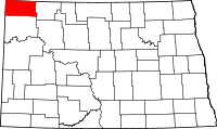 | |
| Townships |
| |
| Unincorporated communities | ||