Alwar
| Alwar अलवर | |
|---|---|
| Metropolis | |
|
Alwar is famous for its scenic landscape | |
 Alwar | |
| Coordinates: 27°20′N 76°23′E / 27.34°N 76.38°ECoordinates: 27°20′N 76°23′E / 27.34°N 76.38°E | |
| Country | India |
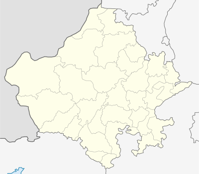
| State | Rajasthan |
| District | Alwar |
| Elevation | 268 m (879 ft) |
| Population (2011) | |
| • Metropolis | 315,310 |
| • Rank | 8th in Rajasthan |
| • Metro | 341,422 |
| Languages | |
| • Official | Hindi |
| • Regional | Hindi and Rajasthani |
| Time zone | IST (UTC+5:30) |
| PIN | 3010 01 |
| Telephone code | +0144 |
| Vehicle registration | RJ-02 |
| Website | http://alwar.rajasthan.gov.in/ |

Alwar is a city and administrative headquarters of Alwar District in the Indian state of Rajasthan. It is located around 160 km south of Delhi, and about 150 km north of Jaipur, the capital of Rajasthan. Alwar is part of National Capital Region (NCR). Alwar is a part of the Ahirwal regional. It is also famous for its Olive plantation in Tinkirudi.[1][2]
Alwar was formerly the capital of the princely state of Alwar which was ruled by kachwaha(Naruka) Rajputs. It was formerly spelt as "Ulwar" in British India. This placed it in last position in alphabetically ordered lists, so a king changed the spelling to "Alwar" to bring it to the top. Alwar is also known by the name "Matsya Nagar"


History
Alwar dates back to 1000 AD. The king of Amer (old seat of Jaipur state) ruled the area in the eleventh century and his territory extended up to the present city of Alwar. He founded the city of Alpur in 1106 Vikrami samvat (1049 AD) after his own name which eventually became Alwar.[3] From time to time, Different sub-clans of Rajputs ruled Alwar. Nikumbh Rajputs, Badgujar Rajputs and Last was Naruka (Kachwaha) Rajputs who took the control over this area. Marathas and Jats of Bharatpur also ruled this region for very short period. A brave Rajput Partap Singh took the Alawar Fort from Jat Raja of Bharatpur on an agreement and laid down the foundation for modern Alwar.
Great Hindu King Hemu also born into a Brahmin family in Machari (a village in Alwar) was, a Hindu emperor of North India during the 16th century, a period when the Mughals and Afghans were vying for power in the region. Hemu acceded to the throne of Delhi on 7 October 1556 after defeating Akbar's Mughal forces in the Battle of Delhi in the Tughlakabad area in Delhi, and became the de facto king. He won twenty-two battles in succession and became the last Hindu emperor of India. He is sometimes known as the Napoleon of India. He died on 5 November 1556.
The princely state of Alwar was ruled by Pratap Singh, a Rajput of the Kachwaha lineage, in 1770. He was earlier jagirdar of "dhai Gaon" means two and half villages near macheri. A few years later, His successor Bakhtawar Singh ventured an armed incursion into neighbouring Jaipur, the senior Kachwaha state, and the erstwhile overlord of his predecessor. He was defeated; a fresh engagement was made with him by the East India Company, prohibiting him from political intercourse with other states without British consent.
Alwar acceded unto the dominion of India following the independence of India in 1947. On 18 March 1948, the state merged with three neighbouring princely states (Bharatpur, Dholpur and Karauli) to form the Matsya Union. On 15 May 1949, it was united with neighbouring princely states and the territory of Ajmer to form the present-day Indian state of Rajasthan.
Culture
Ethnicity
The Residents of Alwar are from different communities. Alwar was a part of Matsya region.[4] The principal communities are the Rajputs, (Meena)s, Ahirs, Meos and Gujjars. The Naruka Sub-clan of Kachwaha Rajputs ruled Alwar till 1947. In past also, Nikumbh Rajputs and Yaduvanshi Rajputs ruled this region. As per Gazzetter of Ulwar published by Britishers, Alwar used to be divided in four regions as per dominance of castes/tribes.
- Rath Area(Now Behror and Neemrana) – Ruled by Chauhan Rajputs who were the ancestors of Prithvi Raj Chauhan.
- Wai Region(Now Thanaghazi and Bansur) – Shekhawat Zamindars were prominent local ruling clan at village levels.
- Rajawat- Naruka Territory(Narukhand)(Now Rajgarh, Lachmangarh etc.) – This region was dominated by Naruka Rajputs and gave Kings to Alwar State.
- Mewat Region – This region had maximum population of Mev Muslim caste.
Cuisine
Alwar is famous for its Kalakand (Milk-Cake), a world-famous dessert. This is a special dessert made of milk. Its demand from all over the world has given Alwar a special name on the map of world. Some other special shops for different items are as under-
Chole-Kulche : Bhagat ji Chole Wale at Kashiram Circle, Must try mutka kulfi with rabri at some shops situated at Tripolia
Ayurvedic Medicines
Alwar is famous for variety of Ayurvedic and Unani Medicinal Products.
Geography and climate
Alwar is located at 27°34′N 76°36′E / 27.57°N 76.6°E. It has an average elevation of 271 m (889 ft). The Ruparail River is a major river near the city. Alwar is fairly rich in mineral wealth. It produces marble, granite, feldspar, dolomite, quartz, lime stone, soap stone, barites, copper clay, copper ore and pyrophylite.[5]
Alwar was reputed to be the place where, on 10 May 1956, India's record high temperature of 50.6 °C (123.1 °F) was recorded, until the record was broken in May 2016 by Phalodi.[6]
Developments after becoming part of NCR
A 180-km rail route between Alwar and Delhi has been approved by the Board. As per the proposal, the route will connect Alwar to Delhi via Gurgaon and Rewari. Over Rs32 crore will be spent on this route. The travel time will be faster as the line will be connected to the Metro under regional rail rapid system giving better transport facilities to the locals.[7] Keeping in view the industrial importance of Alwar district, approval in principle was given to the Rs285 crore drinking water projects for the seven towns of Alwar district.[8]
Tourism


Alwar contains many interesting and historical monuments like Deewan ji ki lal haweli built in 1754 owned by Rajendra Kumar jain. The city has a beautiful lake and a picturesque valley. The Sariska Tiger Reserve is located in the Aravali hills only a few kilometres away from Alwar. The sanctuary, which is a Project Tiger reserve, also boasts of many other species, including rare birds and plants. The military cantonment of Itarana lies on the outskirts of Alwar. Hill Fort Kesroli now a heritage hotel is also near by.[9] Raj Rishi College has existed in Alwar for over a hundred years.
Bhangarh Haunted Fort
Bhangarh Fort is a haunted fort and the Archaeological Survey of India has put up a board on the fort gate that it is prohibited for tourists to stay inside the fort area after sunset and before sunrise.[10]
Bharthari Temple
Bharthari temple is dedicated to the king of Ujjain turned Saint and is popularly known as Baba Bharthari. He is sometimes identified with Bhartṛhari, a 7th-century poet. He is deeply revered and prayed and this temple is regularly visited by the local population and a fair is also organised known as 'Bharthari Baba ka Mela' every year.
Fairy Queen
The Fairy Queen is the oldest working locomotive engine in the world and a national treasure (cultural artifacts) of India. The engine was built in 1855 and acquired by the Eastern Indian Railways from a British firm. The train operates tourist journeys between Delhi and Alwar.
Agriculture
Alwar has an important place in Agriculture production in Rajasthan. Total geographical area of the district is 7,83,281 hectares which is about 2.5 per cent of the State. In 2010–2011 the net cultivated area is 5,07,171 hecters from which about 83 per cent area viz. – 4,51,546 is irrigated and remaining 17 per cent area viz. – 82,903 is unirrigated. Double cropped area is 252 hectares of which 32,230 hecter (12%) area is irrigated and remaining 2,19,819 hecter (88%) area is unirrigated. Thus, the total cropped area of the district is 8,12,873 hecters. In Kharif season Bajra, Maize, Jowar, Karif pulses, Arhar, Sesamum, Cotton, Guar etc. are sown in about 3,29,088 hectare (42%) and in Rabi season Wheat, Barley, Gram, Mustard, Taramira, Rabi pulses etc. are sown in about 4,52,527 hectare (58%). The main source of irrigation are wells and Tube Wells. By 26064 Tube Wells about 192861 hectare area is being irrigated and by 57196 Wells about 265169 hectares area is irrigated. By other sources like canals, tanks about 404 hectares area is irrigated. About 35470 electric motors and 66502 Diesel pump sets are being used for Irrigation purposes. The normal rainfall for the district is 657.3 mm. The average rainfall in last ten years in the district is 724 mm. The rainfall distribution in the district is uneven and scattered which resulted some times flood problems and some time draught position which affect the Agriculture production as well as cropping pattern in Kharif & Rabi season. Thus, the Agriculture in the district by and large depends on rainfall distribution. The average rainfall in 2011 up to September is 217 mm.
Education
Schools
- Silver Oak School
- Alwar Public School
- Chinar School
- V.L.M. School
- D.P.S. World School
- St. Anselm's Senior Secondary School
- M.G.M. Public School
- Army Public School
- Kendriya Vidyalaya 1 & 2
- Happy Public School
- Central Academy
- Mount Litera Zee School
- National Academy
- R BALIYAN PUBLIC SCHOOL
- Santos
- Bal Bharti School
Colleges
- Modern Institute of Technology & Research Centre.
- KCRI College of Science & Commerce
- KCRI IT College
- Raj Rishi College
- Laxmi Devi Institute of Engineering and Technology, Chikani, Alwar
- Institute of Engineering and Technology College
- Alwar Institute Of Engineering and Technology
- Siddhi Vinayak College
- Northern Institute of Engineering & Technology
- Dev internation pg college Alwar
Demographics
| Population Growth of Alwar City | |||
|---|---|---|---|
| Census | Pop. | %± | |
| 1891 | 52,400 | — | |
| 1901 | 56,700 | 8.2% | |
| 1911 | 41,300 | -27.2% | |
| 1921 | 44,800 | 8.5% | |
| 1941 | 54,100 | — | |
| 1951 | 57,900 | 7.0% | |
| 1961 | 72,700 | 25.6% | |
| 1971 | 100,800 | 38.7% | |
| 1981 | 140,000 | 38.9% | |
| 1991 | 210,100 | 50.1% | |
| 2001 | 266,203 | 26.7% | |
| 2011 | 341,422 | 28.3% | |
| source:[11] | |||
| Year | Population |
|---|---|
| 1891 | 52,400 |
| 1901 | 56,700 |
| 1911 | 41,300 |
| 1921 | 44,800 |
| 1941 | 54,100 |
| 1951 | 57,900 |
| 1961 | 72,700 |
| 1971 | 100,800 |
| 1981 | 140,000 |
| 1991 | 210,100 |
| 2001 | 266,203 |
| 2011 | 341,422 |
According to 2011 census the population of Alwar is 1,015,310.[13] city population of Alwar in 2011 is 341,422.
Main community living in Alwar are Ahir/Yadav, Rajput, and Jat. Yadav/Ahir comprises 35% of Alwar, dominating mainly northern and central part of the Alwar; further Rajput have 10% population in Alwar found mainly in southern Alwar and Jat in mainly the east of Alwar, with 5% population.
Administration
Alwar district has 16 tehsils:[15]
- Alwar
- Bansur
- Behror
- Govindgarh
- Kathumar
- Kishangarh Bas
- Kotkasim
- Laxmangarh
- Mundawar
- Rajgarh
- Ramgarh
- Thanagazi
- Tijara
- Neemrana
- Reni
- Malakhera
Villages in Alwar
- Gokulpur - native villege of journalist ashvini yadav
- Sherpur
- Dahmi
- Riwali
- Khedki
- Shyampur
- Shimla
- Gadoj
- tasing -villege of journalist laxman raghav
- Rawana
- Gunti
- kalsada (choudhary punya ram)
- Bhajeet (mini paris)
- Gandura
- Bhojpuri village
- Resti(short & sweet)
- Haldina (Capital of Chuorashi)
- Resti(Gandura
- Moonpur (chandralok)
- bhandwada
- Machari
- Vijaypur
- dhoolpuri
- roja ka bas
- jidoli
- Ajarka
- Barrod
- Khanpur Ahir
- Mundawar
- Dehmi
- Mahtawas
- Ghansoli
- Ramnagar, Bansur
- Bhajera[16]
- Harsauli
- Lidpuri, Kathumar
Toolera Para lapala Macharri Hamidpur Semli Dilawar AND Mohit kumar insan (mki) sir ka village JHIRANDIA
References
- ↑ http://gulfnews.com/about-gulf-news/al-nisr-portfolio/weekend-review/an-oasis-in-the-desert-1.1146298
- ↑ http://timesofindia.indiatimes.com/city/jaipur/Rajasthans-olives-to-hit-the-market-by-September/articleshow/8687259.cms
- ↑ "Welcome to Alwar, The Gateway of Rajastan > History Of District Alwar". Alwar.nic.in. Retrieved 19 November 2014.
- ↑ "History of Alwar, Origin of Alwar, Alwar History In Rajasthan India". Indiasite.com. Retrieved 2013-03-07.
- ↑ "Welcome to Alwar, The Gateway of Rajastan > Mineral Resources". Alwar.nic.in. Retrieved 19 November 2014.
- ↑ "Extreme Weather Events" (PDF). India Meteorological Department. Retrieved 19 November 2014.
- ↑ "Rs 1,000 crore for cluster development in Haryana". The New Indian Express. Retrieved 19 November 2014.
- ↑ "Bharatpur becomes NCR; Delhi Metro to chug into Alwar soon". daily.bhaskar.com. Retrieved 19 November 2014.
- ↑ "Account Suspended". Alwarcity.com. Retrieved 19 November 2014.
- ↑ "The Times of India: Latest News India, World & Business News, Cricket & Sports, Bollywood". The Times of India. Retrieved 19 November 2014.
- 1 2 "Historical Census of India". Populstat.info. Retrieved 19 November 2014.
- ↑ "Census of Alwar". Citypopulation.de. Retrieved 19 November 2014.
- ↑ "Alwar District Population Census 2011, Rajasthan literacy sex ratio and density". census2011.co.in. Retrieved 6 April 2013.
- ↑ http://www.census2011.co.in/census/city/70-alwar.html Alwar City Population Census 2011
- ↑ "Welcome to Alwar, The Gateway of Rajastan > Administrative Setup Of Alwar District". Alwar.nic.in. Retrieved 2013-03-07.
- ↑
Bibliography
- Powlett, P. W. (1838). Gazetteer of Ulwur (Alwar). Archive.org. Retrieved 19 November 2014.
External links
| Wikimedia Commons has media related to Alwar. |
| Wikivoyage has a travel guide for Alwar. |
| Outline |  | ||||||||||||||||||||||||||
|---|---|---|---|---|---|---|---|---|---|---|---|---|---|---|---|---|---|---|---|---|---|---|---|---|---|---|---|
| Governance | |||||||||||||||||||||||||||
| Divisions and Districts |
| ||||||||||||||||||||||||||
| Major cities | |||||||||||||||||||||||||||
| Related templates |
| ||||||||||||||||||||||||||