Altoona, Kansas
| Altoona, Kansas | |
|---|---|
| City | |
 Location within Wilson County and Kansas | |
 KDOT map of Wilson County (legend) | |
| Coordinates: 37°31′36″N 95°39′43″W / 37.52667°N 95.66194°WCoordinates: 37°31′36″N 95°39′43″W / 37.52667°N 95.66194°W | |
| Country | United States |
| State | Kansas |
| County | Wilson |
| Area[1] | |
| • Total | 0.55 sq mi (1.42 km2) |
| • Land | 0.55 sq mi (1.42 km2) |
| • Water | 0 sq mi (0 km2) |
| Elevation | 830 ft (253 m) |
| Population (2010)[2] | |
| • Total | 414 |
| • Estimate (2012[3]) | 397 |
| • Density | 750/sq mi (290/km2) |
| Time zone | Central (CST) (UTC-6) |
| • Summer (DST) | CDT (UTC-5) |
| ZIP code | 66710 |
| Area code | 620 |
| FIPS code | 20-01625 [4] |
| GNIS feature ID | 0475090 [5] |
Altoona is a city in Wilson County, Kansas, United States, along the Verdigris River. As of the 2010 census, the city population was 414.[6]
History
Altoona was originally called Geddesburg when it was founded in 1869. It was renamed Altoona in 1870, after Altoona, Pennsylvania.[7][8] The first post office in Altoona was established in April 1870.[9]
Altoona experienced growth when the railroad was built through the settlement about 1885.[10]
Geography
Altoona is located at 37°31′36″N 95°39′43″W / 37.52667°N 95.66194°W (37.526796, -95.661903).[11] According to the United States Census Bureau, the city has a total area of 0.55 square miles (1.42 km2), all of it land.[1]
Demographics
| Historical population | |||
|---|---|---|---|
| Census | Pop. | %± | |
| 1890 | 265 | — | |
| 1900 | 299 | 12.8% | |
| 1910 | 1,462 | 389.0% | |
| 1920 | 1,016 | −30.5% | |
| 1930 | 839 | −17.4% | |
| 1940 | 707 | −15.7% | |
| 1950 | 482 | −31.8% | |
| 1960 | 490 | 1.7% | |
| 1970 | 475 | −3.1% | |
| 1980 | 564 | 18.7% | |
| 1990 | 456 | −19.1% | |
| 2000 | 485 | 6.4% | |
| 2010 | 414 | −14.6% | |
| Est. 2015 | 381 | [12] | −8.0% |
| U.S. Decennial Census | |||
2010 census
As of the census[2] of 2010, there were 414 people, 165 households, and 111 families residing in the city. The population density was 752.7 inhabitants per square mile (290.6/km2). There were 194 housing units at an average density of 352.7 per square mile (136.2/km2). The racial makeup of the city was 95.2% White, 1.2% Native American, and 3.6% from two or more races. Hispanic or Latino of any race were 2.9% of the population.
There were 165 households of which 32.7% had children under the age of 18 living with them, 44.8% were married couples living together, 16.4% had a female householder with no husband present, 6.1% had a male householder with no wife present, and 32.7% were non-families. 27.9% of all households were made up of individuals and 9.7% had someone living alone who was 65 years of age or older. The average household size was 2.51 and the average family size was 2.98.
The median age in the city was 37.6 years. 27.5% of residents were under the age of 18; 6.4% were between the ages of 18 and 24; 23.9% were from 25 to 44; 27% were from 45 to 64; and 15.2% were 65 years of age or older. The gender makeup of the city was 47.3% male and 52.7% female.
2000 census
As of the census[4] of 2000, there were 485 people, 201 households, and 133 families residing in the city. The population density was 891.5 people per square mile (346.8/km²). There were 232 housing units at an average density of 426.5 per square mile (165.9/km²). The racial makeup of the city was 97.73% White, 1.24% Native American, 0.21% from other races, and 0.82% from two or more races. Hispanic or Latino of any race were 0.41% of the population.
There were 201 households out of which 31.8% had children under the age of 18 living with them, 47.8% were married couples living together, 13.4% had a female householder with no husband present, and 33.8% were non-families. 32.8% of all households were made up of individuals and 18.4% had someone living alone who was 65 years of age or older. The average household size was 2.41 and the average family size was 2.99.
In the city the population was spread out with 29.5% under the age of 18, 6.4% from 18 to 24, 24.3% from 25 to 44, 23.1% from 45 to 64, and 16.7% who were 65 years of age or older. The median age was 38 years. For every 100 females there were 90.2 males. For every 100 females age 18 and over, there were 86.9 males.
The median income for a household in the city was $23,906, and the median income for a family was $30,375. Males had a median income of $28,523 versus $22,500 for females. The per capita income for the city was $12,534. About 9.9% of families and 16.3% of the population were below the poverty line, including 21.2% of those under age 18 and 10.1% of those age 65 or over.
Notable people
- Oren E. Long, former governor and senator from Hawaii
References
- 1 2 "US Gazetteer files 2010". United States Census Bureau. Archived from the original on 2012-01-24. Retrieved 2012-07-06.
- 1 2 "American FactFinder". United States Census Bureau. Retrieved 2012-07-06.
- ↑ "Population Estimates". United States Census Bureau. Archived from the original on 2013-06-17. Retrieved 2013-05-29.
- 1 2 "American FactFinder". United States Census Bureau. Archived from the original on 2013-09-11. Retrieved 2008-01-31.
- ↑ "US Board on Geographic Names". United States Geological Survey. 2007-10-25. Retrieved 2008-01-31.
- ↑ "2010 City Population and Housing Occupancy Status". U.S. Census Bureau. Archived from the original on July 21, 2011. Retrieved January 30, 2012.
- ↑ Kansas State Historical Society (1916). Biennial Report of the Board of Directors of the Kansas State Historical Society. Kansas State Printing Plant. p. 314.
- ↑ Duncan, L. Wallace (1902). History of Neosho and Wilson Counties, Kansas. Monitor Printing Company. p. 881.
- ↑ "Kansas Post Offices, 1828-1961". Kansas Historical Society. Archived from the original on October 9, 2013. Retrieved 20 June 2014.
- ↑ Blackmar, Frank Wilson (1912). Kansas: A Cyclopedia of State History, Embracing Events, Institutions, Industries, Counties, Cities, Towns, Prominent Persons, Etc. Standard Publishing Company. pp. 66–67.
- ↑ "US Gazetteer files: 2010, 2000, and 1990". United States Census Bureau. 2011-02-12. Retrieved 2011-04-23.
- ↑ "Annual Estimates of the Resident Population for Incorporated Places: April 1, 2010 to July 1, 2015". Retrieved July 2, 2016.
External links
| Wikimedia Commons has media related to Altoona, Kansas. |
- City
- Schools
- USD 387, local school district
- Maps
- Altoona City Map, KDOT
Municipalities and communities of Wilson County, Kansas, United States | ||
|---|---|---|
| Cities | 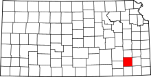 | |
| Unincorporated communities | ||
| Townships | ||