Almena, Wisconsin
| Almena, Wisconsin | |
|---|---|
| Village | |
 Location of Almena within Wisconsin | |
| Coordinates: 45°25′27″N 92°5′31″W / 45.42417°N 92.09194°WCoordinates: 45°25′27″N 92°5′31″W / 45.42417°N 92.09194°W[1] | |
| Country | United States |
| State | Wisconsin |
| County | Barron |
| Government | |
| • Mayor | Brad Rundhaug |
| Area[2] | |
| • Total | 1.14 sq mi (2.95 km2) |
| • Land | 1.14 sq mi (2.95 km2) |
| • Water | 0 sq mi (0 km2) |
| Elevation[3] | 1,211 ft (369 m) |
| Population (2010)[4] | |
| • Total | 677 |
| • Estimate (2012[5]) | 670 |
| • Density | 593.9/sq mi (229.3/km2) |
| Time zone | Central (CST) (UTC-6) |
| • Summer (DST) | CDT (UTC-5) |
| Area code(s) | 715 & 534 |
| FIPS code | 55-01350[6] |
| GNIS feature ID | 1582680[3] |
Almena is a village in Barron County in the U.S. state of Wisconsin. The population was 677 at the 2010 census.
Geography
Almena is located on the boundary between the Town of Almena and the Town of Clinton, about 60 miles (97 km) northeast of Minneapolis.
According to the United States Census Bureau, the village has a total area of 1.14 square miles (2.95 km2), all of it land.[2]
Demographics
| Historical population | |||
|---|---|---|---|
| Census | Pop. | %± | |
| 1950 | 406 | — | |
| 1960 | 398 | −2.0% | |
| 1970 | 423 | 6.3% | |
| 1980 | 526 | 24.3% | |
| 1990 | 625 | 18.8% | |
| 2000 | 720 | 15.2% | |
| 2010 | 677 | −6.0% | |
| Est. 2015 | 663 | [7] | −2.1% |
2010 census
As of the census[4] of 2010, there were 677 people, 297 households, and 178 families residing in the village. The population density was 593.9 inhabitants per square mile (229.3/km2). There were 337 housing units at an average density of 295.6 per square mile (114.1/km2). The racial makeup of the village was 96.2% White, 0.1% African American, 0.9% Native American, 0.3% Asian, 0.3% from other races, and 2.2% from two or more races. Hispanic or Latino of any race were 0.7% of the population.
There were 297 households of which 30.3% had children under the age of 18 living with them, 42.8% were married couples living together, 9.1% had a female householder with no husband present, 8.1% had a male householder with no wife present, and 40.1% were non-families. 30.6% of all households were made up of individuals and 15.5% had someone living alone who was 65 years of age or older. The average household size was 2.28 and the average family size was 2.79.
The median age in the village was 39.3 years. 23.5% of residents were under the age of 18; 8% were between the ages of 18 and 24; 25.9% were from 25 to 44; 26.4% were from 45 to 64; and 16.2% were 65 years of age or older. The gender makeup of the village was 50.2% male and 49.8% female.
2000 census
As of the census[6] of 2000, there were 720 people, 295 households, and 182 families residing in the village. The population density was 720.0 people per square mile (278.0/km²). There were 308 housing units at an average density of 308.0 per square mile (118.9/km²). The racial makeup of the village was 97.08% White, 0.14% Black or African American, 1.25% Native American, 0.83% from other races, and 0.69% from two or more races. Hispanic or Latino of any race were 1.53% of the population.
There were 295 households out of which 33.9% had children under the age of 18 living with them, 41.7% were married couples living together, 13.2% had a female householder with no husband present, and 38.3% were non-families. 29.5% of all households were made up of individuals and 13.9% had someone living alone who was 65 years of age or older. The average household size was 2.44 and the average family size was 2.99.
In the village the population was spread out with 29.9% under the age of 18, 8.6% from 18 to 24, 31.8% from 25 to 44, 15.8% from 45 to 64, and 13.9% who were 65 years of age or older. The median age was 32 years. For every 100 females there were 100.0 males. For every 100 females age 18 and over, there were 93.5 males.
The median income for a household in the village was $27,917, and the median income for a family was $34,028. Males had a median income of $25,833 versus $20,278 for females. The per capita income for the village was $13,928. About 10.8% of families and 14.9% of the population were below the poverty line, including 18.0% of those under age 18 and 15.6% of those age 65 or over.
Economy
- Almena Meat Market
References
- ↑ "US Gazetteer files: 2010, 2000, and 1990". United States Census Bureau. 2011-02-12. Retrieved 2011-04-23.
- 1 2 "US Gazetteer files 2010". United States Census Bureau. Archived from the original on 2012-01-24. Retrieved 2012-11-18.
- 1 2 "US Board on Geographic Names". United States Geological Survey. 2007-10-25. Retrieved 2008-01-31.
- 1 2 "American FactFinder". United States Census Bureau. Retrieved 2012-11-18.
- ↑ "Population Estimates". United States Census Bureau. Archived from the original on 2013-06-17. Retrieved 2013-06-24.
- 1 2 "American FactFinder". United States Census Bureau. Archived from the original on 2013-09-11. Retrieved 2008-01-31.
- ↑ "Annual Estimates of the Resident Population for Incorporated Places: April 1, 2010 to July 1, 2015". Retrieved July 2, 2016.
- ↑ "Census of Population and Housing". Census.gov. Archived from the original on May 11, 2015. Retrieved June 4, 2015.
Municipalities and communities of Barron County, Wisconsin, United States | ||
|---|---|---|
| Cities | 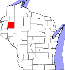 | |
| Villages | ||
| Towns | ||
| CDP | ||
| Unincorporated communities | ||
| Indian reservations | ||
| Footnotes | ‡This populated place also has portions in an adjacent county or counties | |