Almeida, Portugal
| Almeida | |||
|---|---|---|---|
| Municipality | |||
| |||
 | |||
| Coordinates: 40°43′N 6°54′W / 40.717°N 6.900°WCoordinates: 40°43′N 6°54′W / 40.717°N 6.900°W | |||
| Country |
| ||
| Region | Centro | ||
| Subregion | Beira Interior Norte | ||
| Intermunic. comm. | Beiras e Serra da Estrela | ||
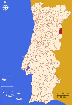
| District | Guarda | ||
| Parishes | 16 | ||
| Government | |||
| • President | António Ribeiro (PSD) | ||
| Area | |||
| • Total | 517.98 km2 (199.99 sq mi) | ||
| Population (2011) | |||
| • Total | 7,242 | ||
| • Density | 14/km2 (36/sq mi) | ||
| Time zone | WET/WEST (UTC+0/+1) | ||
| Website | http://www.cm-almeida.pt | ||


Almeida (Portuguese pronunciation: [ɐɫˈmɐjðɐ]) is a fortified village[1] and a municipality in the sub-region of Beira Interior Norte and the District of Guarda, Portugal. The town proper has a population of 1,300 people (2011). The municipality population in 2011 was 7,242,[2] in an area of 517.98 square kilometres (199.99 square miles).[3] It is located in Riba-Côa river valley. The present Mayor is António Baptista Ribeiro, elected by the Social Democratic Party. The municipal holiday is July 2.
Location
The village lies 7.2 kilometres (4.5 miles) west of the border with Spain and straddles the N332 road.[4] The Rio Côa run northwards a short distance to the west of the village. The town's castle fortress was completed in 1641[5] and is located to the north of the village and is approached through the two tunnel gates and dry moat named the Portas de São Francisco.

Twin town
History
In and around the environment of Almeida, evidence of Human occupation can be found back to the Bronze Age and Iron Age. Evidence has also been found of Roman occupation followed by the Suevi and the Visigoths. The first fortification constructed in the settlement were constructed by the Muslims who occupied the village until Christian reconquest of the Iberian Peninsula. It was during this time that the current name was first used, in the form of the Arabic al-Ma'ida ('the plateau').
Sancho I, The Populator
The village of Almeida was captured from the Moors by the second king of Portugal, Sancho I[6] in the 12th century because of its strategic position on the new country of Portugal's border with Spain. So important to the security of the country, Sancho had the village heavily fortified. the castle was refortified on three further occasions by King Dinis, King Manuel I and by King João VI. The present 12 pointed star fortification was constructed in 1641 to a Vaubanesque plan to which the French military engineer is believed to have personally worked[6] on, during the castle's final stages of completion.
Spanish occupation
During the Seven Years' War (1754 to 1763) which involved most of the great powers of Europe, Spain with the help of France launched an attack on Portugal due to its alliance with Great Britain. As a result of the invasion Almeida was captured by Spain in 1762.[7][8][9]
Almeida Castle
The fortress around the town guards an important cross-border road from Spain, and underwent several sieges. The siege of 1810, during the Peninsular War,[10] ended spectacularly when a chance shell ignited the main gunpowder magazine, which exploded, killing 500 defenders and destroying most of the town.[11]
Parishes
Administratively, the municipality is divided into 16 civil parishes (freguesias):[12]
- Almeida
- Amoreira, Parada e Cabreira
- Azinhal, Peva e Vale Verde
- Castelo Bom
- Castelo Mendo, Ade, Monte Perobolço e Mesquitela
- Freineda
- Freixo
- Junça e Naves
- Leomil, Mido, Senouras e Aldeia Nova
- Malhada Sorda
- Malpartida e Vale de Coelha
- Miuzela e Porto de Ovelha
- Nave de Haver
- São Pedro de Rio Seco
- Vale da Mula
- Vilar Formoso
References
- ↑ Evans, David (2004). Portugal - Cadogan guides. New Holland Publishers. pp. 199 to 200. ISBN 1860111262.
- ↑ "Instituto Nacional de Estatística". Retrieved 28 October 2014.
- ↑ Direção-Geral do Território
- ↑ Tourist & Motoring Atlas – Spain & Portugal. Publisher: Michelin Edition 2014. Work: page 42. ISBN 9782067192430
- ↑ St Louis - Coordinating Author, Regis (2009). Portugal - Lonely planet guide (7th ed.). lonely planet Publishers. pp. 380 to 381. ISBN 9781741790153.
- 1 2 Evans, David (2004). Portugal - Cadogan guides. New Holland Publishers. pp. 200, Dom Sancho I conquers Almeida. ISBN 1860111262.
- ↑ An Account of Portugal, as it Appeared in 1766 to Dumouriez, Lausanne, 1775, pp. 247 and 254; See also García Arenas (2004), pp. 41, 73 and 74.
- ↑ The Royal Military Chronicle, vol V, London, 1812, pp. 50-51; See also Dull, Jonathan (2009) The Age of the Ship of the Line: the British and French navies, 1650–1851. University of Nebraska Press, p. 88.
- ↑ Terrage, Marc de Villiers du (1904). Les dernières années de la Louisiane française (in French), E. Guilmoto, p. 151.
- ↑ The Peninsular War. Author: Esdaile, Charles. Publisher:Penguin Books, 2002 Edition. Work:Chapter 12, Torres Vedras, Pagr 323, reference to the explosion .ISBN 9780140273700
- ↑ "Siege of Almeida, 25 July-27 August 1810". Retrieved 28 October 2014.
- ↑ Diário da República. "Law nr. 11-A/2013, pages 552 10-11" (pdf) (in Portuguese). Retrieved 16 July 2014.