Allende Municipality, Chihuahua
| Allende Municipality | |
|---|---|
| Municipality | |
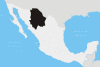
 Location of Allende in Chihuahua | |
|
Allende Municipality Location of Allende in Chihuahua | |
| Coordinates: 26°56′N 105°24′W / 26.933°N 105.400°WCoordinates: 26°56′N 105°24′W / 26.933°N 105.400°W | |
| Country |
|
| State | Chihuahua |
| Municipal seat | Valle de Allende |
| Government | |
| • Municipal president | Mauro Pablo Vázquez Ramírez (PRI) |
| Area | |
| • Total | 2,471.3 km2 (954.2 sq mi) |
| Population (2010) | |
| • Total | 8,409 |
| Time zone | MST (UTC-7) |
| • Summer (DST) | MDT (UTC-6) |
| Website | http://www.mpioallende.gob.mx/ |
Allende Municipality (Spanish: Municipio de Allende) is one of 67 municipalities in the Mexican state of Chihuahua, located in the southeastern portion of the state. Valle de Allende is its municipal seat and largest city.
Demographics
As of 2010, the municipality had a total population of 8,409,[1] up from 8,263 as of 2005.
Localities
The municipality had 146 localities, the largest of which (with 2010 populations in parentheses) were: Valle de Ignacio Allende (4,185), classified as urban, and Pueblito de Allende (1,381), classified as rural.[1]
Towns and villages
| Name | Population (2005) |
|---|---|
| Valle de Allende | 3 976 |
| Pueblito de Allende | 1 460 |
| Talamantes | 496 |
| Colonia Búfalo | 307 |
| Total Municipality | 8,263 |
References
- 1 2 "Allende". Catálogo de Localidades. Secretaría de Desarrollo Social (SEDESOL). Retrieved 23 April 2014.
See also
This article is issued from Wikipedia - version of the 11/3/2016. The text is available under the Creative Commons Attribution/Share Alike but additional terms may apply for the media files.