Allen, Kentucky
| Allen, Kentucky | |
|---|---|
| City | |
 Location of Allen, Kentucky | |
| Coordinates: 37°36′48″N 82°43′33″W / 37.61333°N 82.72583°WCoordinates: 37°36′48″N 82°43′33″W / 37.61333°N 82.72583°W | |
| Country | United States |
| State | Kentucky |
| County | Floyd |
| Incorporated | 1913 |
| Government | |
| • Type | City Commission |
| • Mayor | Sharon S. Woods |
| Area | |
| • Total | 0.19 sq mi (0.50 km2) |
| • Land | 0.18 sq mi (0.46 km2) |
| • Water | 0.02 sq mi (0.04 km2) |
| Elevation | 643 ft (196 m) |
| Population (2010) | |
| • Total | 193 |
| • Density | 1,081/sq mi (417.2/km2) |
| Time zone | Eastern (EST) (UTC-5) |
| • Summer (DST) | EDT (UTC-4) |
| ZIP code | 41601 |
| Area code(s) | 606 |
| FIPS code | 21-00946 |
| GNIS feature ID | 0485866 |
Allen is a 6th-class city in Floyd County, Kentucky, in the United States. The population was 193 at the 2010 census,[1] up from 150 at the 2000 census.
History
Allen was first settled in the early nineteenth century. The first post office was named "Mouth of Beaver" and was established on August 21, 1854 (Thomas P. Johns, postmaster). The town began to develop rapidly c. 1904-1905 after the establishment of a Chesapeake and Ohio Railroad station. The station was interchangeably known as "Beaver Creek" and "Beaver Creek Junction".[2] In 1905, another post office opened and was named "Allen" after local resident T.J. Allen. The town was formally incorporated by the state assembly in 1913.[3] In 1936, the railroad station was renamed to prevent confusion during mail delivery. An area outside the city limits known as "New Allen" began to develop in 1937 after a bridge was constructed across the Levisa Fork River.[2]
Geography
Allen is located north of the center of Floyd County at 37°36′48″N 82°43′33″W / 37.61333°N 82.72583°W (37.613421, -82.725826).[4] It sits at the confluence of Beaver Creek with the Levisa Fork, a north-flowing tributary of the Big Sandy River and part of the Ohio River watershed.
U.S. Routes 460 and 23 pass just north of Allen, leading northwest 5 miles (8 km) to Prestonsburg, the county seat, and southeast 24 miles (39 km) to Pikeville.
According to the United States Census Bureau, Allen has a total area of 0.2 square miles (0.5 km2), of which 0.02 square miles (0.04 km2), or 7.06%, is water.[1]
Demographics
As of the census[5] of 2010, there were 193 people, 67 households residing in the city. There were 67 housing units. The racial makeup of the city was 99.48% White, 0.00% African American, 0.00% Hispanic or Latino, 0.00% Asian or Pacific Islander, 0.00% Native American and 0.52% from two or more races.
| Historical population | |||
|---|---|---|---|
| Census | Pop. | %± | |
| 1920 | 216 | — | |
| 1930 | 284 | 31.5% | |
| 1940 | 368 | 29.6% | |
| 1950 | 421 | 14.4% | |
| 1960 | 370 | −12.1% | |
| 1970 | 724 | 95.7% | |
| 1980 | 338 | −53.3% | |
| 1990 | 229 | −32.2% | |
| 2000 | 150 | −34.5% | |
| 2010 | 193 | 28.7% | |
| Est. 2015 | 186 | [6] | −3.6% |
In the city the population was spread out with 22.8% under the age of 18, 63.73% from 18 to 64, and 13.47% who were 65 years of age or older. The median age was 35.4 years.
The median income for a household in the city was $45,104, and the median income for a family was $26,875. The per capita income for the city was $13,247. There were 19.7% of the population living below the poverty line.
Education
- Wesley Christian School
- Allen Elementary
- Prestonsburg High School
- Big Sandy Community & Technical College
Recreation
- John M. Stumbo Park
- Paul Hunt Thompson Golf Course
- Jenny Wiley State Resort Park
References
- 1 2 "Geographic Identifiers: 2010 Census Summary File 1 (G001), Allen city, Kentucky". American FactFinder. U.S. Census Bureau. Retrieved May 20, 2016.
- 1 2 Rennick, Robert M. (1988). "Place Names". Kentucky Place Names. Lexington, Kentucky: The University Press of Kentucky. ISBN 0-8131-0179-4. Retrieved on 2010-04-10
- ↑ Commonwealth of Kentucky. Office of the Secretary of State. Land Office. "Allen, Kentucky". Accessed 15 July 2013.
- ↑ "US Gazetteer files: 2010, 2000, and 1990". United States Census Bureau. 2011-02-12. Retrieved 2011-04-23.
- ↑ "American FactFinder". United States Census Bureau. Archived from the original on September 11, 2013. Retrieved 2008-01-31.
- ↑ "Annual Estimates of the Resident Population for Incorporated Places: April 1, 2010 to July 1, 2015". Retrieved July 2, 2016.
- ↑ "Census of Population and Housing". Census.gov. Archived from the original on May 11, 2015. Retrieved June 4, 2015.
Municipalities and communities of Floyd County, Kentucky, United States | ||
|---|---|---|
| Cities | 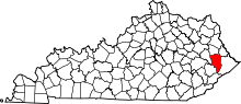 | |
| CDPs | ||
| Other unincorporated communities |
| |