Alleghany, California
| Alleghany | |
|---|---|
| census-designated place | |
|
Main Street in Alleghany | |
 Alleghany Location within the state of California | |
| Coordinates: 39°28′00″N 120°50′28″W / 39.46667°N 120.84111°WCoordinates: 39°28′00″N 120°50′28″W / 39.46667°N 120.84111°W | |
| Country |
|
| State |
|
| County | Sierra |
| Area[1] | |
| • Total | 0.349 sq mi (0.904 km2) |
| • Land | 0.349 sq mi (0.904 km2) |
| • Water | 0 sq mi (0 km2) 0% |
| Elevation[2] | 4,229 ft (1,289 m) |
| Population (2010) | |
| • Total | 58 |
| • Density | 170/sq mi (64/km2) |
| Time zone | Pacific (PST) (UTC-8) |
| • Summer (DST) | PDT (UTC-7) |
| GNIS feature ID | 2582931 |
| U.S. Geological Survey Geographic Names Information System: Alleghany, California | |

Alleghany is a small census-designated place in Sierra County, California, United States[2] in the Sierra Nevada. It is situated in the Gold Country and continues to be a significant locale for gold mining. The famous Sixteen-to-One Mine has been in operation since the days of the California Gold Rush. The town is 20 miles (32 km) from the nearest highway (California State Route 49) and consists largely of a single main street. The town is home to a post office, a bar (Casey's Place),[3] and a mining museum. The population was 58 at the 2010 census.
The community was named in 1859 for the Alleghany Tunnel mine that fueled the growth of the town when it struck gold four years earlier. The mine itself was named for the Allegheny River.[4]
Geography
According to the United States Census Bureau, the CDP covers an area of 0.3 square miles (0.9 km²), all of it land.
Demographics
The 2010 United States Census[5] reported that Alleghany had a population of 58. The population density was 166.2 people per square mile (64.2/km²). The racial makeup of Alleghany was 58 (100.0%) White. Hispanic or Latino of any race were 1 persons (1.7%).
The Census reported that 58 people (100% of the population) lived in households, 0 (0%) lived in non-institutionalized group quarters, and 0 (0%) were institutionalized.
There were 27 households, out of which 5 (18.5%) had children under the age of 18 living in them, 12 (44.4%) were opposite-sex married couples living together, 3 (11.1%) had a female householder with no husband present, 2 (7.4%) had a male householder with no wife present. There were 5 (18.5%) unmarried opposite-sex partnerships, and 0 (0%) same-sex married couples or partnerships. 5 households (18.5%) were made up of individuals and 1 (3.7%) had someone living alone who was 65 years of age or older. The average household size was 2.15. There were 17 families (63.0% of all households); the average family size was 2.35.
The population was spread out with 8 people (13.8%) under the age of 18, 2 people (3.4%) aged 18 to 24, 5 people (8.6%) aged 25 to 44, 36 people (62.1%) aged 45 to 64, and 7 people (12.1%) who were 65 years of age or older. The median age was 53.0 years. For every 100 females there were 123.1 males. For every 100 females age 18 and over, there were 117.4 males.
There were 40 housing units at an average density of 114.6 per square mile (44.3/km²), of which 16 (59.3%) were owner-occupied, and 11 (40.7%) were occupied by renters. The homeowner vacancy rate was 5.9%; the rental vacancy rate was 0%. 37 people (63.8% of the population) lived in owner-occupied housing units and 21 people (36.2%) lived in rental housing units.
Politics
In the state legislature, Alleghany is in the 1st Senate District, represented by Republican Ted Gaines,[6] and the 1st Assembly District, represented by Republican Brian Dahle.[7]
Federally, Alleghany is in California's 1st congressional district, represented by Republican Doug LaMalfa.[8]
References
- ↑ U.S. Census Archived 2012-01-24 at WebCite
- 1 2 U.S. Geological Survey Geographic Names Information System: Alleghany, California
- ↑ http://www.caseys-place.com
- ↑ Gudde, Erwin; William Bright (2004). California Place Names (Fourth ed.). University of California Press. p. 9. ISBN 0-520-24217-3.
- ↑ "2010 Census Interactive Population Search: CA - Alleghany CDP". U.S. Census Bureau. Retrieved July 12, 2014.
- ↑ "Senators". State of California. Retrieved March 10, 2013.
- ↑ "Members Assembly". State of California. Retrieved March 2, 2013.
- ↑ "California's 1st Congressional District - Representatives & District Map". Civic Impulse, LLC. Retrieved March 3, 2013.
Further reading
- History of Sierra County, by James J. Sinnott, vol.3: Allegheny and Forest City: Treasure Towns, published by California Traveler, Volcano, California, 1975.
External links
- Original Sixteen to One Mine website
- Underground Gold Miners of California Museum
- Alleghany's Hidden Church
- Pliocene Ridge Community Services District
Municipalities and communities of Sierra County, California, United States | ||
|---|---|---|
| City | 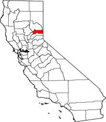 | |
| CDPs | ||
| Unincorporated communities | ||
| Ghost towns |
| |