Alexandria, Pennsylvania
| Alexandria, Pennsylvania | |
|---|---|
| Borough | |
|
Library | |
 Alexandria, Pennsylvania | |
| Coordinates: 40°33′28″N 78°05′56″W / 40.55778°N 78.09889°WCoordinates: 40°33′28″N 78°05′56″W / 40.55778°N 78.09889°W | |
| Country | United States |
| State | Pennsylvania |
| County | Huntingdon |
| Government | |
| • Type | Borough Council |
| Area | |
| • Total | 0.1 sq mi (0.3 km2) |
| Elevation | 699 ft (213 m) |
| Population (2010) | |
| • Total | 346 |
| • Density | 3,460.0/sq mi (1,335.9/km2) |
| Time zone | Eastern (EST) (UTC-5) |
| • Summer (DST) | EDT (UTC-4) |
| Zip code | 16611 |
| Area code(s) | 814 |
| School District: | Juniata Valley School District |

Alexandria is a borough in Huntingdon County, Pennsylvania, United States. The population was 346 at the 2010 census.
Geography
According to the United States Census Bureau, the borough has a total area of 0.1 square miles (0.3 km2), all of it land.
Demographics
| Historical population | |||
|---|---|---|---|
| Census | Pop. | %± | |
| 1800 | 138 | — | |
| 1810 | 156 | 13.0% | |
| 1820 | 280 | 79.5% | |
| 1840 | 575 | — | |
| 1850 | 601 | 4.5% | |
| 1860 | 534 | −11.1% | |
| 1870 | 556 | 4.1% | |
| 1880 | 484 | −12.9% | |
| 1890 | 438 | −9.5% | |
| 1900 | 406 | −7.3% | |
| 1910 | 432 | 6.4% | |
| 1920 | 440 | 1.9% | |
| 1930 | 443 | 0.7% | |
| 1940 | 442 | −0.2% | |
| 1950 | 443 | 0.2% | |
| 1960 | 381 | −14.0% | |
| 1970 | 495 | 29.9% | |
| 1980 | 435 | −12.1% | |
| 1990 | 411 | −5.5% | |
| 2000 | 346 | −15.8% | |
| 2010 | 346 | 0.0% | |
| Est. 2015 | 330 | [1] | −4.6% |
| Sources:[2][3] | |||
As of the census[4] of 2000, there were 346 people and 139 households within the borough. The population density was 3,460.0 people per square mile (1,407.5/km²). There were 160 housing units at an average density of 1,580.0 per square mile (561.6/km²). The racial makeup of the borough was 98.55% White, 0.29 African American, 0.29% Asian, 0.29% from other races, and 0.58% from two or more races. Hispanic or Latino of any race were 1.45% of the population.
There were 139 households, out of which 32.4% had children under the age of 18 living with them, 47.0% were married couples living together, 16.1% had a female householder with no husband present, and 28.2% were non-families. 25.5% of all households were made up of individuals, and 10.7% had someone living alone who was 65 years of age or older. The average household size was 2.58 and the average family size was 3.00.
In the borough the population was spread out, with 23.1% under the age of 18, 2.3% from 18 to 19, 4.9% from 20 to 24, 13.9% from 25 to 34, 21.4% from 35 to 49, 19.9% from 50-64, and 14.5% who were 65 years of age or older. The median age was 37 years. The population was 49.42% male, and 50.58% female.
History
The year 1744 is the first record of John Hart’s “logg”, near where Alexandria is located now. During the land purchase of 1755 James Sterrat of Carlisle purchased 400 acres including the sleeping place called John Hart’s log on the Juniata River, which is now Alexandria.
Some time in the years before 1785 the first mention of a religious group called Hartslog Presbyterian Congregation was formed. A log worship house, Old Hartslog Church, stood upon the hill one mile (1.6 km) north of the present site of the town of Alexandria, where a burial ground was later made. This was a primitive structure but by 1787 a floor was laid, six large windows set in, a large door constructed, and a pulpit and a communion table made. In 1794 it was laid off into four sections, and fitted with pews. In 1826, the old Hartslog congregation moved to a brick building, referred to by Senator John Scott in his memoirs as the "Brick Church", which seems to have been located near to the site of the present Reformed Church. The old log worship house was taken down the same year, and some of its logs were used in one or two of the dwellings of Alexandria.
In the late 18th century the primary transportation to and from Alexandria was the Juniata River, suitable only during summer and when the water depth permitted. On May 3, 1808 the new road from Harrisburg to Alexandria opened, permitting a more reliable connection with the outside world. In 1833 the Juniata Division of the Pennsylvania Canal was opened, the promise of better transportation started a mini housing boom in Alexandria. By 1875 the canal was abandoned and the Pennsylvania Railroad managed the transportation needs of the area. Around this time the growth of the area slowed, the while the populations of Huntingdon and Hollidaysburg grew.
-

Old railway station
Hartslog Heritage Day Festival
Alexandria hosts the annual "Hartslog Heritage Day" celebration each year on the second Saturday of October. The day-long event recognizes the early days of the small borough, when, in 1744, a licensed Indian trader named John Hart used a large hollowed-out log to feed and salt his horses while he conducted his trading.
Early settlers used this log as a landmark to describe the location of their claims and referred to this area as Hartslog Settlement. In 1793 this area was laid out into town lots and named Alexandria, with the street near the site of the log name Hartslog Street.
Today the name remains for Hartslog Street as well as the region — "Hartslog Valley." There's also the Hartslog Grange, and of course, the festival, Hartslog Day. It's not your ordinary old fashioned heritage folk festival. It's much more than that, featuring music, crafts, games and lots of food, but you have to attend Hartslog Day to understand what makes this festival different from the rest.
The Hartslog Museum located on the second floor of the library in Alexandria is only open one weekend a month but it's always open for Hartslog Day.
You'll find the history of Huntingdon County and John Hart. If you're a history buff you'll find the Hartslog Museum a place of rare history. In particular, you'll find the history behind the Canal Basin, Indian tribes, Indian traders and John Scott. John was born and raised in Alexandria. He was the only man born in Alexandria and elected to the U.S. Senate.
While visiting the museum you'll see many artifacts and antiques from this area and the era when Pennsylvania was still inhabited by Indian tribes. You'll also find many rare books and pictures.
Hartslog Day helps to support the museum.
-

Fire Department
-

Christ Reformed Church
-

Old hotel on Main Street
Notable people
- Rev. George MacPherson Docherty (May 9, 1911 to November 27, 2008) - pastor who helped to get the phrase "Under God" added to the Pledge of Allegiance.
- Agnes Irvine Scott - Agnes Scott College is named for her.
- John Scott, Sr (December 25, 1784 – September 22, 1850) - Member of the U.S. House of Representatives
- John Scott, Jr (July 24, 1824 – November 29, 1896) - Member of the United States Senate
References
- ↑ "Annual Estimates of the Resident Population for Incorporated Places: April 1, 2010 to July 1, 2015". Retrieved July 2, 2016.
- ↑ "Census of Population and Housing: Decennial Censuses". United States Census Bureau. Retrieved 2012-03-04.
- ↑ "Incorporated Places and Minor Civil Divisions Datasets: Subcounty Resident Population Estimates: April 1, 2010 to July 1, 2012". Population Estimates. U.S. Census Bureau. Archived from the original on 17 June 2013. Retrieved 11 December 2013.
- ↑ "American FactFinder". United States Census Bureau. Archived from the original on 2013-09-11. Retrieved 2008-01-31.
External links
Municipalities and communities of Huntingdon County, Pennsylvania, United States | ||
|---|---|---|
| Boroughs | 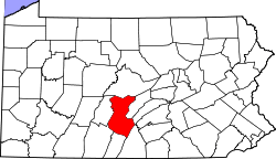 | |
| Townships | ||
| CDPs | ||
| Unincorporated communities | ||