Albany, Wisconsin
| Albany, Wisconsin | |
|---|---|
| Village | |
|
Downtown: North Water Street | |
| Nickname(s): Pearl of the Sugar River | |
 Location in Green County and the state of Wisconsin. | |
| Coordinates: 42°42′20″N 89°26′9″W / 42.70556°N 89.43583°WCoordinates: 42°42′20″N 89°26′9″W / 42.70556°N 89.43583°W[1] | |
| Country | United States |
| State | Wisconsin |
| County | Green |
| Area[2] | |
| • Total | 1.31 sq mi (3.39 km2) |
| • Land | 1.28 sq mi (3.32 km2) |
| • Water | 0.03 sq mi (0.08 km2) |
| Population (2010)[3] | |
| • Total | 1,018 |
| • Estimate (2012[4]) | 1,016 |
| • Density | 795.3/sq mi (307.1/km2) |
| Time zone | Central (CST) (UTC-6) |
| • Summer (DST) | CDT (UTC-5) |
| Area code(s) | 608 |
| FIPS code | 55-00750[5] |
| Website | Village of Albany |

Albany is a village in Green County, Wisconsin, United States. The population was 1,018 at the 2010 census. The village is located within the Town of Albany.
Geography
According to the United States Census Bureau, the village has a total area of 1.31 square miles (3.39 km2), of which, 1.28 square miles (3.32 km2) of it is land and 0.03 square miles (0.08 km2) is water.[2]
Demographics
| Historical population | |||
|---|---|---|---|
| Census | Pop. | %± | |
| 1880 | 267 | — | |
| 1890 | 698 | 161.4% | |
| 1900 | 797 | 14.2% | |
| 1910 | 669 | −16.1% | |
| 1920 | 741 | 10.8% | |
| 1930 | 728 | −1.8% | |
| 1940 | 741 | 1.8% | |
| 1950 | 839 | 13.2% | |
| 1960 | 892 | 6.3% | |
| 1970 | 875 | −1.9% | |
| 1980 | 1,051 | 20.1% | |
| 1990 | 1,140 | 8.5% | |
| 2000 | 1,191 | 4.5% | |
| 2010 | 1,018 | −14.5% | |
| Est. 2015 | 1,018 | [6] | 0.0% |
As of 2000 the median income for a household in the village was $44,594, and the median income for a family was $46,071. Males had a median income of $30,966 versus $21,061 for females. The per capita income for the village was $19,186. About 0.3% of families and 3.5% of the population were below the poverty line, including none of those under age 18 and 7.4% of those age 65 or over.
2010 census
As of the census[3] of 2010, there were 1,018 people, 434 households, and 274 families residing in the village. The population density was 795.3 inhabitants per square mile (307.1/km2). There were 493 housing units at an average density of 385.2 per square mile (148.7/km2). The racial makeup of the village was 96.5% White, 0.5% African American, 0.7% Asian, 1.1% from other races, and 1.3% from two or more races. Hispanic or Latino of any race were 2.4% of the population.
There were 434 households of which 31.3% had children under the age of 18 living with them, 46.3% were married couples living together, 10.6% had a female householder with no husband present, 6.2% had a male householder with no wife present, and 36.9% were non-families. 28.8% of all households were made up of individuals and 9.9% had someone living alone who was 65 years of age or older. The average household size was 2.35 and the average family size was 2.87.
The median age in the village was 39.8 years. 22.6% of residents were under the age of 18; 7.3% were between the ages of 18 and 24; 28% were from 25 to 44; 30.5% were from 45 to 64; and 11.9% were 65 years of age or older. The gender makeup of the village was 48.3% male and 51.7% female.
Notable people
- John Litel, actor
References
- ↑ "US Gazetteer files: 2010, 2000, and 1990". United States Census Bureau. 2011-02-12. Retrieved 2011-04-23.
- 1 2 "US Gazetteer files 2010". United States Census Bureau. Archived from the original on 2012-01-24. Retrieved 2012-11-18.
- 1 2 "American FactFinder". United States Census Bureau. Retrieved 2012-11-18.
- ↑ "Population Estimates". United States Census Bureau. Archived from the original on 2013-06-17. Retrieved 2013-06-24.
- ↑ "American FactFinder". United States Census Bureau. Archived from the original on 2013-09-11. Retrieved 2008-01-31.
- ↑ "Annual Estimates of the Resident Population for Incorporated Places: April 1, 2010 to July 1, 2015". Retrieved July 2, 2016.
- ↑ "Census of Population and Housing". Census.gov. Archived from the original on May 11, 2015. Retrieved June 4, 2015.
External links
- Village of Albany
- Albertson Memorial Library
- Sanborn fire insurance maps: 1894 1900 1912
Municipalities and communities of Green County, Wisconsin, United States | ||
|---|---|---|
| Cities | 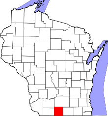 | |
| Villages | ||
| Towns | ||
| CDP | ||
| Unincorporated communities | ||
| Ghost towns | ||
| Footnotes | ‡This populated place also has portions in an adjacent county or counties | |