Alaca
| Alaca | |
|---|---|
| Town | |
|
Alaca Hüyük | |
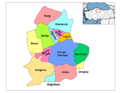 Location of Alaca within Turkey. | |
 Alaca Location of Alaca within Turkey. | |
| Coordinates: TR 40°10′06″N 34°50′33″E / 40.16833°N 34.84250°E | |
| Country |
|
| Region | Black Sea |
| Province | Çorum |
| Government | |
| • Mayor | Muhammet Esat Eyvaz (AKP) |
| Area[1] | |
| • District | 1,361.42 km2 (525.65 sq mi) |
| Population (2012)[2] | |
| • Urban | 21,113 |
| • District | 35,324 |
| • District density | 26/km2 (67/sq mi) |
| Time zone | EET (UTC+2) |
| • Summer (DST) | EEST (UTC+3) |
| Postal code | 19x xx |
| Area code(s) | 364 |
| Climate | Dsb[3] |
| Website | |

Alaca is one of the largest districts of Çorum Province in the Black Sea region of Turkey. It is located 52 km (32 mi) from the city of Çorum, on a road from the Black Sea coast to central Anatolia. Population is 22,092 as of 2010.[4]
The ancient Hittite settlement of Alacahöyük is located in Alaca district.
Population
| Population | |||
|---|---|---|---|
| Year | Center | Villages | Total |
| 2007 | |||
| 2000 | 24.983 | 28.210 | 53.193 |
| 1997 | |||
| 1990 | 20.646 | 32.757 | 53.403 |
| 1985 | 18.056 | ||
| 1980 | 15.649 | 41.075 | 56.724 |
| 1975 | 12.552 | ||
| 1970 | 9.674 | 46.983 | 56.657 |
| 1965 | 9.745 | ||
| 1960 | 7.168 | 47.147 | 54.315 |
| 1955 | |||
| 1950 | 3.843 | 42.601 | 46.444 |
| 1945 | |||
| 1940 | |||
| 1935 | |||
| 1927 | 2.066 | 24.721 | 26.787 |
| 1907 | |||
| 1902 | |||
| 1893 | |||
References
- ↑ "Area of regions (including lakes), km²". Regional Statistics Database. Turkish Statistical Institute. 2002. Retrieved 2013-03-05.
- ↑ "Population of province/district centers and towns/villages by districts - 2012". Address Based Population Registration System (ABPRS) Database. Turkish Statistical Institute. Retrieved 2013-02-27.
- ↑ Alaca Climate-Data.org
- ↑ Statistical Institute
External links
- District governor's official website
- District municipality's official website
- AlacaNET.com - City Web Portal
This article is issued from Wikipedia - version of the 8/15/2015. The text is available under the Creative Commons Attribution/Share Alike but additional terms may apply for the media files.