Al-Hasakah Governorate
| Al-Hasakah Governorate محافظة الحسكة | |
|---|---|
| Governorate | |
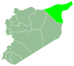
.svg.png) Map of Syria with Al Hasakah highlighted | |
| Coordinates (Al-Hasakah): 36°30′N 40°54′E / 36.5°N 40.9°ECoordinates: 36°30′N 40°54′E / 36.5°N 40.9°E | |
| Country |
|
| Capital | Al-Hasakah |
| Manatiq (Districts) | 4 |
| Government | |
| • Governor | Major General Jaiz Swadet al-Hamoud al-Musa |
| Area | |
| • Total | 23,334 km2 (9,009 sq mi) |
| Population (31/12/2011) | |
| • Total | 1,512,000[1] |
| Time zone | EET (UTC+2) |
| • Summer (DST) | EEST (UTC+3) |
| ISO 3166 code | SY-HA |
| Main language(s) | Arabic, Kurdish, Syriac, Armenian |
| Ethnicities | Arabs, Kurds, Assyrians, Armenians & Yazidis |
Al-Hasakah Governorate (Arabic: محافظة الحسكة / ALA-LC: Muḥāfaẓat al-Ḥasakah, Kurdish: پارێزگای حەسیچە/Parêzgeha Hesîçe, Syriac: ܓܙܪܬܐ Gozarto) is a governorate in the far north-east corner of Syria. It is distinguished by its fertile lands, plentiful water, picturesque nature, and more than one hundred archaeological sites. It was formerly known as Al-Jazira province. Prior to the Syrian Civil War nearly half of Syria's oil was extracted from the region.[2]
History
Three soldiers were killed by armed militants in Al-Hasakah in an ambush during the Syrian Civil War on 24 March 2012.[3] About a year later, Kurdish forces launched the 2013 Al-Hasakah offensive.
After the battle of al-Hasakah in August 2016 between Kurds and the Bashar al-Assad regime, the area was mostly in Kurdish control.[4]
Demographics and population
The inhabitants of al-Hasakah governorate are composed of different ethnic and cultural groups, the larger groups being Arabs and Kurds in addition to a significant large number of Assyrians and a smaller number of Armenians.[5] The population of the governorate, according to the country's official census, was 1,275,118, and was estimated to be 1,377,000 in 2007, and 1,512,000 in 2011.
| Historical population | ||
|---|---|---|
| Year | Pop. | ±% |
| 1931 | 44,153 | — |
| 1933 | 64,886 | +47.0% |
| 1935 | 94,596 | +45.8% |
| 1937 | 98,144 | +3.8% |
| 1938 | 103,514 | +5.5% |
| 1939 | 106,052 | +2.5% |
| 1940 | 126,508 | +19.3% |
| 1942 | 136,107 | +7.6% |
| 1943 | 146,001 | +7.3% |
| 1946 | 151,137 | +3.5% |
| 1950 | 159,300 | +5.4% |
| 1953 | 232,104 | +45.7% |
| 1960 | 351,661 | +51.5% |
| 1970 | 468,506 | +33.2% |
| 1981 | 669,756 | +43.0% |
| 2004 | 1,275,118 | +90.4% |
| 2011 | 1,512,000 | +18.6% |
According to the National Association of Arab Youth, there are 1717 villages in Al-Hasakah province: 1161 Arab villages, 453 Kurdish villages, 98 Assyrian villages and 53 with mixed populations from the aforementioned ethnicities.[6]
| Arab villages | 1161 |
| Kurdish villages | 453 |
| Assyrian villages | 98 |
| Mixed Arab-Kurdish villages | 48 |
| Mixed Arab-Assyrian villages | 3 |
| Mixed Assyrian-Kurdish villages | 2 |
| Total | 1717 |
Censuses of 1943 and 1953
| Religious group | Population (1943) |
Percentage (1943) |
Population (1953) |
Percentage (1953) | |
|---|---|---|---|---|---|
| Muslims | Sunni Muslims | 99,665 | 68.26% | 171,058 | 73.70% |
| Other Muslims | 437 | 0.30% | 503 | 0.22% | |
| Christians | Assyrians | 31,764 | 21.76% | 42,626 | 18.37% |
| Armenians | 9,788 | 6.70% | 12,535 | 5.40% | |
| Other churches | 944 | 0.65% | 1,283 | 0.55% | |
| Total Christians | 42,496 | 29.11% | 56,444 | 24.32% | |
| Jews | 1,938 | 1.33% | 2,350 | 1.01% | |
| Yazidis | 1,475 | 1.01% | 1,749 | 0.75% | |
| TOTAL | Al-Jazira province | 146,001 | 100.0% | 232,104 | 100.0% |
Among the Sunni Muslims, mostly Kurds and Arabs, there were about 1,500 Circassians in 1938.[9]
In 1949, there were officially 155,643 inhabitants. The French geographers Fevret and Gibert estimated that there were about 50,000 Arabs, 60,000 Kurds, a few thousands Jews and Yezidis, the rest being Christians of various denominations.[10]
Cities, towns and villages
This list includes all cities, towns and villages with more than 5,000 inhabitants. The population figures are given according to the 2004 official census:[11]
| English Name | Arabic Name | Population | District |
|---|---|---|---|
| Al-Hasakah | الحسكة | 188,160 | Al-Hasakah District |
| Al-Qamishli | القامشلي | 184,231 | Al-Qamishli District |
| Ras al-Ayn | رأس العين | 29,347 | Ras al-Ayn District |
| Amuda | عامودا | 26,821 | Al-Qamishli District |
| Al-Malikiyah | المالكية | 26,311 | Al-Malikiyah District |
| Al-Qahtaniyah | القحطانية | 16,946 | Al-Qamishli District |
| Al-Shaddadi | الشدادي | 15,806 | Al-Hasakah District |
| Al-Muabbada | المعبدة | 15,759 | Al-Malikiyah District |
| Al-Sabaa wa Arbain | السبعة وأربعين | 14,177 | Al-Hasakah District |
| Al-Manajir | المناجير | 12,156 | Ras al-Ayn District |
| Al-Darbasiyah | الدرباسية | 8,551 | Ras al-Ayn District |
| Tell Tamer | تل تمر | 7,285 | Al-Hasakah District |
| Al-Jawadiyah | الجوادية | 6,630 | Al-Malikiyah District |
| Mabrouka | مبروكة | 6,325 | Ras al-Ayn District |
| Al-Yaarubiyah | اليعربية | 6,066 | Al-Malikiyah District |
| Tell Safouk | تل صفوك | 5,781 | Al-Hasakah District |
| Tell Hamis | تل حميس | 5,161 | Al-Qamishli District |
| Al-Tweinah | التوينة | 5,062 | Al-Hasakah District |
| Al-Fadghami | الفدغمي | 5,062 | Al-Hasakah District |
Districts and sub-districts
The governorate has 4 districts (Mintaqa's). These are further divided into 16 sub-districts (nawahi):
Archaeology
The Khabur River, which flows through al-Hasakah for 440 kilometres (270 mi), witnessed the birth of some of the earliest civilizations in the world, including those of Akkad, Assyria, the Hurrians and Amorites. The most prominent archaeological sites are:
- Hamoukar:considered by some archaeologists to be the oldest city in the world
- Tell Halaf: Excavations have revealed successive civilization levels, Neolithic glazed pottery and beautiful basalt sculptures.
- Tell Brak: Situated halfway between al-Hasakah city and the frontier town of al-Qamishli. Excavations in the tell have revealed the Uyun Temple and King Naram-Sin's palace-stronghold.
- Tell el Fakhariya
- Tell Hittin: 15 layers of occupation have been identified.
- Tell Leilan: Excavations began in 1975 and have revealed many artefacts and buildings dating back to the 6th millennium BC such as a bazaar, temple, palace, etc.
References
- ↑ http://cbssyr.org/yearbook/2011/Data-Chapter2/TAB-3-2-2011.htm
- ↑ Al Monitor, Syria's Oil Crisis, 2013, http://www.al-monitor.com/pulse/ru/originals/2013/02/syria-oil-crisis.html#
- ↑ Fresh clashes break out in Damascus
- ↑ Barnard, Anne (August 23, 2016). "Kurds Close to Control of Northeast Syria Province, Portending a Shift in the War". NYT. Retrieved August 24, 2016.
- ↑ Syria - Sunnis
- ↑ National Association of Arab Youth, 2012. Arab East Centre, London, 2012. Study of the demographic composition of al-Hasakah Governorate (in Arabic). Accessed on 26 December 2014.
- ↑ Hourani, Albert Habib (1947). Minorities in the Arab World. London: Oxford University Press. p. 76.
- ↑ Etienne, de Vaumas (1956). "La Djézireh". Annales de Géographie (in French). 65 (347): 64–80. Retrieved 2012-03-29.
- ↑ M. Proux, "Les Tcherkesses", La France méditerranéenne et africaine, IV, 1938
- ↑ Fevret, Maurice; Gibert, André (1953). "La Djezireh syrienne et son réveil économique". Revue de géographie de Lyon (in French) (28): 1–15. Retrieved 2012-03-29.
- ↑ http://www.cbssyr.org/General%20census/census%202004/pop-man.pdf
External links
- ehasakeh The First Complete website for Al-Hasakah news and services
 |
|
| ||
| Al-Raqqah Governorate | |
| ||
| ||||
| | ||||
| Deir ez-Zor Governorate |