Akron, Indiana
| Town of Akron, Indiana | |
|---|---|
| Town | |
|
Akron from the air, looking West | |
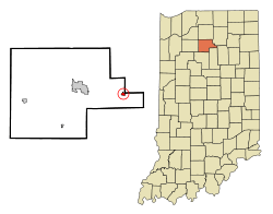 Location in the state of Indiana | |
| Coordinates: 41°2′20″N 86°1′29″W / 41.03889°N 86.02472°WCoordinates: 41°2′20″N 86°1′29″W / 41.03889°N 86.02472°W | |
| Country | United States |
| State | Indiana |
| County | Fulton |
| Township | Henry |
| Area[1] | |
| • Total | 0.46 sq mi (1.19 km2) |
| • Land | 0.46 sq mi (1.19 km2) |
| • Water | 0 sq mi (0 km2) |
| Elevation[2] | 850 ft (259 m) |
| Population (2010)[3] | |
| • Total | 1,167 |
| • Estimate (2012)[4] | 1,161 |
| • Density | 2,537.0/sq mi (979.5/km2) |
| Time zone | EST (UTC−5) |
| • Summer (DST) | EST (UTC−5) |
| ZIP code | 46910 |
| Area code | 574 |
| FIPS code[2][5] | 18-00748 |
| GNIS ID[2][5] | 430038 |

Akron is a town in Henry Township, Fulton County, Indiana, United States. The population was 1,167 at the 2010 census. Akron hosts a nationally famous All-Americana 4th of July parade and fireworks. Students attend Akron Elementary and Tippecanoe Valley Middle and High Schools.
History
Akron was originally named Newark by settlers from Newark, Ohio; the name was changed to Akron in 1855, for the Ohio city.[6] It was founded by Dr. Joseph Sippy on July 4, 1836[7] when he brought a group of settlers to what was then the crossing of the Potawatomi and Miami Indian trails. The first building was constructed where the Methodist church stands now. Dr. Sippy's house, which once stood across the street from Viking Foods, was a stop on the Underground Railroad.
Geography
Akron is located at 41°2′20″N 86°1′29″W / 41.03889°N 86.02472°W (41.038850, -86.024784).[8] Akron is at the crossroad of SR 14 and SR 19.
According to the 2010 census, Akron has a total area of 0.46 square miles (1.19 km2), all land.[1]
Demographics
| Historical population | |||
|---|---|---|---|
| Census | Pop. | %± | |
| 1880 | 193 | — | |
| 1910 | 768 | — | |
| 1920 | 930 | 21.1% | |
| 1930 | 932 | 0.2% | |
| 1940 | 990 | 6.2% | |
| 1950 | 946 | −4.4% | |
| 1960 | 958 | 1.3% | |
| 1970 | 1,019 | 6.4% | |
| 1980 | 1,045 | 2.6% | |
| 1990 | 1,001 | −4.2% | |
| 2000 | 1,076 | 7.5% | |
| 2010 | 1,167 | 8.5% | |
| Est. 2015 | 1,133 | [9] | −2.9% |
2010 census
As of the 2010 Census,[3] there were 1,167 people, 411 households, and 296 families residing in the town. The population density was 2,537.0 inhabitants per square mile (979.5/km2). There were 472 housing units at an average density of 1,026.1 per square mile (396.2/km2). The racial makeup of the town was 74.2% White, 1.9% Native American, 22.5% from other races, and 1.5% from two or more races. Hispanic or Latino of any race were 30.1% of the population.
There were 411 households of which 42.1% had children under the age of 18 living with them, 55.7% were married couples living together, 10.9% had a female householder with no husband present, 5.4% had a male householder with no wife present, and 28.0% were non-families. 24.6% of all households were made up of individuals and 15.8% had someone living alone who was 65 years of age or older. The average household size was 2.84 and the average family size was 3.40.
The median age in the town was 33 years. 29.6% of residents were under the age of 18; 9.1% were between the ages of 18 and 24; 26.9% were from 25 to 44; 19.6% were from 45 to 64; and 14.7% were 65 years of age or older. The gender makeup of the town was 48.8% male and 51.2% female.
2000 census
As of the 2000 Census,[11] there were 1,076 people, 404 households, and 290 families residing in the town. The population density was 2,365.8 people per square mile (923.2/km²). There were 434 housing units at an average density of 954.3 per square mile (372.4/km²). The racial makeup of the town was 91.45% White, 0.28% African American, 0.28% Native American, 7.16% from other races, and 0.84% from two or more races. Hispanic or Latino of any race were 14.68% of the population.
Of the 404 households, 36.1% had children under the age of 18 living with them, 55.0% were married couples living together, 10.6% had a female householder with no husband present, and 28.0% were non-families. 25.0% of all households were made up of individuals and 15.8% had someone living alone who was 65 years of age or older. The average household size was 2.66 and the average family size was 3.13.
In the town the population was spread out with 29.6% under the age of 18, 11.3% from 18 to 24, 28.5% from 25 to 44, 14.9% from 45 to 64, and 15.7% who were 65 years of age or older. The median age was 33 years. For every 100 females there were 98.2 males. For every 100 females age 18 and over, there were 89.5 males.
The median income for a household in the town was $12,406, and the median income for a family was $18,833. Males had a median income of $12,250 versus $10,170 for females. The per capita income for the town was $14,878. About 5.6% of families and 7.6% of the population were below the poverty line, including 4.7% of those under age 18 and 16.3% of those age 65 or over.
References
- 1 2 "G001 - Geographic Identifiers - 2010 Census Summary File 1". United States Census Bureau. Retrieved 2015-07-13.
- 1 2 3 "Feature ID 430038". Geographic Names Information System. United States Geological Survey. Retrieved June 28, 2014.
- 1 2 "American FactFinder". United States Census Bureau. Retrieved 2012-12-11.
- ↑ "Population Estimates". United States Census Bureau. Archived from the original on 2013-06-17. Retrieved 2013-06-25.
- 1 2 "FIPS55 Data: Indiana". FIPS55 Data. United States Geological Survey. February 23, 2006. Archived from the original on June 18, 2006. Retrieved June 28, 2014. External link in
|work=(help) - ↑ Baker, Ronald L.; Carmony, Marvin (1975). Indiana Place Names. Bloomington, Indiana: Indiana University Press. p. 2.
- ↑ "Places to see, things to do in Fulton Co.". The Rochester Sentinel. Archived from the original on November 27, 2013. Retrieved 10 September 2014.
- ↑ "US Gazetteer files: 2010, 2000, and 1990". United States Census Bureau. 2011-02-12. Retrieved 2011-04-23.
- ↑ "Annual Estimates of the Resident Population for Incorporated Places: April 1, 2010 to July 1, 2015". Retrieved July 2, 2016.
- ↑ "Census of Population and Housing". Census.gov. Archived from the original on May 11, 2015. Retrieved June 4, 2015.
- ↑ "American FactFinder". United States Census Bureau. Archived from the original on 2013-09-11. Retrieved 2008-01-31.
Municipalities and communities of Fulton County, Indiana, United States | ||
|---|---|---|
| City | ||
| Towns | ||
| Townships | ||
| Unincorporated communities | ||
| Footnotes | ‡This populated place also has portions in an adjacent county or counties | |