Akobo, South Sudan
| Akobo | |
|---|---|
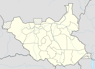 Akobo Location in South Sudan | |
| Coordinates: 7°47′N 33°3′E / 7.783°N 33.050°ECoordinates: 7°47′N 33°3′E / 7.783°N 33.050°E | |
| Country |
|
| State | Eastern Bieh |
| County | Akobo County |
| Elevation | 1,600 ft (500 m) |
| Population (2011 Estimate) | |
| • Total | 1,000 |
| Time zone | EAT (UTC+3) |
| Climate | Aw |
Akobo is a town in South Sudan.
Location
It is located in Akobo County, Eastern Bieh,[1] in the northeastern part of South Sudan, near the International border with Ethiopia. Its location lies approximately 450 kilometres (280 mi), by road, northeast of Juba, the capital and largest city in the country.[2]
History
AKOBO HISTORY- LAND AND PEOPLE.
Akobo:- The River, Land, Town, and County (District)
Introduction
Akobo town: Is an attractive fertile piece of land surrounded by four major Rivers and they are . 1. Agweiy, 2. Dikony, 3. Dikon, and the Akobo River. Anywaa is the original name for the Anywaa tribe. Anywaa comes from the word “nywaak”. This means sharing. In other words, sharing together they joy and agony, best or worst. King Agada described Anyuak as: fought against by so many [other tribes]. Akobo is the river that runs from Tiernam due west to join Dikony at Ciro. At the confluence, Akobo post was founded by the British in 1911. This river is now running irregularly because the course changed at Oboth and joins the Agwei River. The present name of Akobo Ciro is derived from River Akobo.
Anywaa (Anyuak) Kingdom
Anywaa Tribe is divided by the then colonial rulers administratively into two, namely: Sudanese Anyuak and Ethiopian Anywaa taking Akobo River as a major cosmetic boundary line of division. Anywaa on Northern bank of River Akobo are Ethiopian Anywaae. And Anywaa on Southern side of Akobo River are Sudanese Anywae.
Anywaa Kingdom Sub Tribes
Anywaa country is divided into eleven (11) sub tribes as follows:-
Ciro, Adongo, part of Ternam; Ojwaa and part of Nyikaani, are Sudanese Anywae (Anyuak), whereas, Openo, Lul, Joor, part of Thim, Rwanye, Piny-Udo and part of Nyikaani are Ethiopian Anywaae. Ciro Anywae Ciro Anywaa Sub Tribe, are inhabitants of Akobo Land. Dikony, Agwei and Dikon rivers give water to Akobo land which is the County of today. Akobo District was the first District to be recognized by the British Colonial rulers as the seat to administer Ciro Anyuak affairs and to oversee the Lou Nuer at Waat beyond Dwa-Achan. Akobo was established as a post in 1911 at the site known today as Akobo Gedim at the confluence of Dikony [Pibor] and River Akobo. Due to floods the town was moved to Agii on the other side of Dikony west of old Akobo in 1912. The Anywaa then occupied both sides of the Dikony from Wanga-Ading to Burmath just at the confluence with Agwei. From there the Dikony becomes Keng flowing from the Murle country.
The British did not make Akobo a strong post for their administrative convenience only but mainly to protect the Nuer from being slaughtered by the Anyuak. It was not possible to stop the raids while the British stayed at Malakal. The Anywaa of Ciro, including the Adongo people under King Akway Wa Cham, raided the Nuer for cattle, women and children which they brought back from Padoi and the country beyond near the Zaraf River.
As the British permanently settled at Akobo, borders were demarcated between Lou and Akobo at Dwa-Achan and Wanga-Ading; and between Murle and Anywaa at Biem. These borders are known as the 1956 borders recognized by the Sudan governments after the British left. Thus the Anywaa were administered with iron fist for taxation and free labor to clear the roads and scrutiny to protect the Nuer. The Arabs adopted the same policy of hard scrutiny of the Anywaa until the CPA was signed. At this time it is the Nuer showing the iron fist.
Akobo was a place of joyful life until the early 1960s. From this time line on, the Anywaa entered a gloomy period to the present day. This time line also marks the influx of the Lou Nuer migration and accelerated aggression as described elsewhere in this exposition.
Ciro Anywaa Clans. Ciro Anyuak sub tribe is divided into eight (8) clans as follows:-
Nyikwaar Dekole Ogilo Nyium Bet Alil Ojwaa Omill Nyikwaar Clan Nyikwaar Clan is the inhabitant of Dikon, Borawiil, Arini, Agulbool and Borajanga Northeast of Akobo town.
Dekole Clan Dekole clan is the inhabitant old Akobo, Nyikaani on the Eastern side of Akobo Town; , Okalla, Tungdol, and Agii on the Northern side of Akobo Town; Chan, Abworo, [part of Dikon south west], of Akobo town.
Ogilo Clan Ogilo Clan is the inhabitant of Dimma, and Othil on the Southeast of Akobo town
Oboo Clan Oboo Clan is the inhabitant of Ciban, Owit, Buodo, Alawi and whole Agwei and Burmath areas, South and Southeast of Akobo town.
Nyium Clan Nyium Clan is the inhabitant of Pakang area Northeast of Akobo town. A lot of Nyium people can still be found in Nasir and down the Sobat River to Jekaw and areas between Nasir and Akobo. Though assimilated by the Nuer their roots can be traced easily.
Bet Clan Bet clan is the inhabitant of Ogalo and part of Pakang
Alil Clan. Alil clan occupied Alali, Wibura, Baba, Ojoki, Burtuor, Abuk, Nyikuola, and Odee.
Ojwaa Clan. Ojwaa clan is the inhabitant of Ogak, Omeda, Anyang, Dier, and Debango, to the extreme Southeast of Akobo along the Agwei River up to parts of Obooth.
Obeer Clan Obeer clan occupied Aluali, Kudobwor, Burabala [Meer] and] Bur Ojou [Konyi] areas South of town Akobo
Omiila Clan Omilla clan occupied Omilla area, Odiek, Awal and Ojaalo east of Akobo town in Nyikaani Anywaa sub tribe
Historical realities of Akobo contemporary gloomy period.
How did the Anywaa chose to flee to Ethiopia for protection? During Anyanya I civil war, most of the Anywaa villages around Akobo town were disturbed and burned down to the ground by the then Sudan Government army, which considered the whole of Ciro Anywaae members as collaborating and supporting Anyanya I movement. During this period, when Anywaae left their villages in mass to the Ethiopian side for protection, the rule of law or the administration of Akobo district was still in the hands of Abubakar El Wagia. Abubakar El Wagia was the last person to put the last drop of fuel to burn Arini village of Nyikwaar clan in 1964. A chief, who had fled his domain into Ethiopia, was reported to have been seen at Arini village. The chief was implicated to be a participant in the movement. This District commissioner was known for his brutality and savagery. Upon hearing the report, he ordered the army garrison commander in Akobo to go with him to the said village well armed. On arriving the village, the innocent villagers flocked out of their huts to receive their master. He ordered them together at one place. In addition, he had their hands tied behind them with cycle rope. The chief was found, clubbed and shot dead immediately. Then he ordered the army to open fire on unarmed citizens to death. The news of Arini massacre, spread all over the Ciro Anywaa villages. Out of genuine fear, the Ciro Anywaa chose to flee to Ethiopia looking for save place and protection. This was the first golden chance for some of MOR of Lou to move and built in some Ciro Anywaa villages particularly at Arini village. Anyanya I dragged on till 1972 when the premature agreement was concluded. Having not been sure of the hurried agreement, some Ciro Anywaa people chose to wait and see. But most of the Anywaa came back to their original villages and life went on normally.
Following the signing of Addis Ababa agreement the then High Executive Council of the South Sudan was created. Mainly, it was the Southern Front Party in which some prominent leaders of Lou Nuer (MOR) were strong members and leaders. They managed to convince the then government of South Sudan to change the 1956 border of Akobo and Waat from Dwa-Achan to about seven (7) miles from Waat for their own political aspiration and to squeeze and dilude Akobo Anywaa population out of proportion. Kaykwienyi and Walgak became part of Akobo. This created the population imbalance. The Lou Nuer poured into Akobo town and environs in their numbers.
From 1973-1980 Akobo district was administered by Anywaa executive officers without prejudice or segregation to non-Anywaa in respect of the law. The 1980 elections, in which late Paul Anade Othow defeated Michael Wal Dwany and John Lok Jok, provoked the feelings of most intellectuals of Lou Nuer (MOR) in Akobo. In fact, Paul Anade Othow won the election not because of Akobo Anywaa majority only but also it was a general concern of all people in Akobo including non-Nuer and non-Anywaa that the right person to lead has to be from the land. The vote was a real democratic move. But most of the Nuer did not like the Anywaa to lead Akobo in the Regional Assembly. After this, a plot was planned. First it was the change of the Commissioner designed from the top in Khartoum and Juba by the Nuer politicians. Next, the Anywaa executive officers were transferred including the Anywaa police, prison, and game warders. Some Lou Nuer (MOR) officials were brought in as replacement to carry out the plan through. Early 1981 Lou Nuer armed villagers supported by Nuer police, prison, and army (Nuer Sudan Army), and game warders attacked Anywaa villages all over Akobo land. It was a well-planned attack including other Nuer [none Lou Nuer]. But the Nuer was given an unforgettable lesson in their life in spite of their great numbers and equipment. This defeat annoyed the Nuer leaders and the option is to revenge upon innocent Anywaa in Akobo town who did not have arms as the villagers.
Akobo massacre In 1983, in broad day light, in the very eye of the Government, the army and organized forces brutally massacred the Anywaa people in hundreds. Men, women, and children were killed indiscriminately. Children were ushered into the huts and set ablaze. Others were shot or speared to death. Others were hacked with pangas or stabbed with knives. Prominent Lou Nuer (MOR) officials were assigned the Task of executing the plan with support of the Nuer policemen, prison, and game warders, to direct and supervise the massacre. Look at how ruthlessly the Nuer can kill the nephews and neighbors including uncles of their children in cold blood. It was a disregard of the bond of intermarriages. The commissioner of Jonglei Province, Mr. Michael Mario (Nuer), pretended to rescue the situation by taking the survivors of Anywaa from Akobo town, including teachers and other government officials to Pibor town instead of controlling the situation. Actually, it was an attempt to vacate Akobo for the Nuer and to accelerate the occupation of the Ciro lands without the Anywaa intellectuals seeing what was taking place. The proper way was to bring the killers to justice or take them away to Lou if it was not a plan. The then South Sudan government did nothing. The influential Lou politicians were there. They were the ones who masterminded the whole thing in the first place. Akobo town completely remained without any single Anywaa except for those in far away villages hiding from the government killers.
The War within The War The atrocities of Anya-Nya I period repeated itself again. The year 1983 the SPLM/A established itself as a strong force against the Arabs. The Arabs targeted the Anywaa again for hosting the SPLA. The Nuer had the opportunity of double dealing again. They asked the Arabs to provide guns to guard and fight against the SPLA. It was a cheap token foken but an opportunity for the Nuer to use that gun against the Anywaa. It started harshly and sadly for Ciro Anywaa sub tribe but it was also a year where Ciro Anywaa identified their heroism to struggle for marginalized people of Sudan to be free, equal, and dignified. While Anywaa were engaged in SPLA/M, and others hiding in refuge, the Nuer were planning a revenge to compensate for the lives lost in the failed attack of 1981 once again.
Through Arab Governments, that facilitated the Nuer encroachment on the Anywaa land over the years and with Arab guns, the Lou Nuer militia pursued the Ciro Anywaa everywhere. The continuous Lou Nuer militia attacks on Anywaa villages over the years of SPLA/M fighting with Sudan Governments pushed Ciro Anywaa out of their villages to Ethiopia. This had a far-reaching effect on the Anywaa till the present day. At present the Nuer occupy Akobo County calling it their land by force. Prominent Nuer leaders are the ones pushing this domination ahead using their positions in the GoSS and the GoNU.
Now the long civil war of Sudan is over and the South Sudan has attained the long-awaited objectives and will soon decide its own destiny. The CPA grants to all nationalities of South Sudan the right to exist and to develop their own culture within its border of 1956. The IDPS and Refugees of all South Sudan nationalities are returning to their original homeland to rebuild their lives. Anywaa of Akobo have nowhere to return. Lou Nuer occupy their homesteads. As a result of this occupation, the Anywaa voice cannot be heard at all levels of government. Look at this: Akobo commissioner is a Nuer. Akobo representatives in Bor, Juba and Khartoum are all Nuer. All these appointments happened without consultation with the Anywaa. Anywaa proposed names for appointment. All names were deleted by the Nuer. Where is the coexistence and equality that the Nuer preach all the time?
The above is the grim reality of Akobo and the Anywaa lives at this time.
------------------
Source and Contribution: Community Elders.
References: Collins, Rober O. -Shadows in the Grass, 1983, Yale University. Collins, Rober O. -Land Beond the Rivers, 1971, Yale University Press. E.E. Evans-Pritchard – The Political System of the Anyuak of the Anglo-Egyptian Sudan,
                                     2004, Beg: Oxford-New York
                                      Previously by The London School of Economics and Political
                                       Science, 1940, London, UK.
Related Articles:
Is Akobo a controversial issue? Let's rewrite its history.
Why is the Anywaa disadvantaged and marginalized in peace time?
Anywaa Past Sufferings in the Hands of Governments and the Lou Nuer.
War Does Not Pay: It is Time for Law and Order.
The Nuer also fight for property rights.
The Nuer Monopoly against the Anuak
Presenting concerns to the President is not Tribalism.
The Current wave of Nuer migration
Population
As of July 2011, the population of Akobo, the town, is approximately 1,000.[3] According to the Sudanese census, which was boycotted by the South Sudanese government, Akobo County's population was 136,210 in 2008.
Transportation
From Akobo, one road leads northwest to Faddoi and Waat. Another road leads south to Tong Tong and Pibor. The town is also served by Akobo Airport.
Notable landmarks
Notable landmarks in the town of Akobo, include the following:
- The offices of Akobo Town Council
- The headquarters of Akobo County Administration
- Two rivers - The Pibor River to the west of Akobo and the Akobo River to the east of town. River Akobo empties into River Pibor at the border town of Diboc.
- Akobo has a clinic which was built in 1911 and a hospital which was built between 1976 and 1983. Akobo has three primary schools and one intermediate high school.
- Akobo Heritage and Memorial University - An institution of higher learning
- Akobo Airport - A civilian airport
See also
References
- ↑ "Appointed govt of 'Eastern Bieh' to send advance team to Akobo". Radio Tamzuj. 31 May 2016. Retrieved 20 August 2016.
- ↑ Map Showing Juba And Akobo With Distance Marker
- ↑ Estimated Population of Akobo In 2011