Akçaabat
| Akçaabat | |
|---|---|
| Town | |
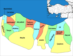
 Location of Akçaabat within Turkey. | |
 Akçaabat Location of Akçaabat within Turkey. | |
| Coordinates: 41°01′N 39°33′E / 41.017°N 39.550°ECoordinates: 41°01′N 39°33′E / 41.017°N 39.550°E | |
| Country |
|
| Region | Karadeniz |
| Province | Trabzon |
| Government | |
| • Mayor | Şefik Türkmen (AKP) |
| Area[1] | |
| • District | 353.66 km2 (136.55 sq mi) |
| Elevation | 10 m (30 ft) |
| Population (2012)[2] | |
| • Urban | 40,589 |
| • District | 113,117 |
| • District density | 320/km2 (830/sq mi) |
| Time zone | EET (UTC+2) |
| • Summer (DST) | EEST (UTC+3) |
| Postal code | 61300 |
| Area code(s) | (+90)462 |
| Licence plate | 61 |
| Climate | Cfa |
| Website |
www |
Akçaabat is a town and district of Trabzon Province in the Black Sea region of Turkey. It is located on the west of the city of Trabzon. It covers an area of 385 km² and the elevation is 10 m. The town has an estimated population of 48,315 (2007).[3] Akçaabat is a coastal town famous for its local soccer team Akçaabat Sebatspor, its traditional dish Akçaabat köfte (a variant of kofta) and its unique dance of Akçaabat Horonu. Akçaabat has hosted an international folklore festival since 1990,[4] and it was a venue for Archery and Athletics competitions of the First Black Sea Games held in 2007.[5]
Name
The first settlers of the town came from Aegean shores and named the town "Platana" because of the abundance of plane trees (Greek Plàtanos, Πλάτανος, Latin Platanus). Later on, the name evolved into Pulathane, meaning "the land of iron". According to the Ottoman sources, the town center was called “Pulathane”, which belonged to the county of “Akçeabad”, meaning "the abundance of money".
Climate
The climate in this area is characterized by relatively high temperatures and evenly distributed precipitation throughout the year. The Köppen Climate System classifies this climate as humid subtropical, abbreviated Cfa.[6]
| Climate data for Akçaabat | |||||||||||||
|---|---|---|---|---|---|---|---|---|---|---|---|---|---|
| Month | Jan | Feb | Mar | Apr | May | Jun | Jul | Aug | Sep | Oct | Nov | Dec | Year |
| Average high °C (°F) | 10 (50) |
10 (50) |
11 (51) |
15 (59) |
18 (64) |
23 (73) |
26 (78) |
26 (78) |
24 (75) |
20 (68) |
16 (60) |
13 (55) |
17 (62) |
| Average low °C (°F) | 3 (37) |
3 (37) |
4 (39) |
8 (46) |
12 (53) |
16 (60) |
19 (66) |
19 (66) |
16 (60) |
12 (53) |
8 (46) |
5 (41) |
10 (50) |
| Average precipitation mm (inches) | 79 (3.1) |
56 (2.2) |
46 (1.8) |
48 (1.9) |
43 (1.7) |
46 (1.8) |
28 (1.1) |
43 (1.7) |
58 (2.3) |
99 (3.9) |
91 (3.6) |
94 (3.7) |
729 (28.7) |
| Source: Weatherbase[7] | |||||||||||||
History
Founded as a trade colony of Miletus around the 7th century BC, the town came under Persian rule around the 6th century BC. After a brief rule under Alexander the Great, Akçaabat was incorporated into the Kingdom of Pontus established by Mithridates I of Pontus around the 3rd century BC. After the dissolution of the Kingdom of Pontus around 60 BC, the Romans took control of the region surrounding Trabzon. Serving as a natural port for Trabzon, Akçaabat was one of the important towns of eastern Black Sea region, and thus Pontus region of the Roman Empire.
Although attacked several times by different nations and tribes Akçaabat remained under Byzantine control until a branch of the Byzantine dynasty, Komnenos family established their own kingdom with the help of Georgian queen Tamara after the Latin capture of Constantinople in 1204. This new state, called the Empire of Trebizond, survived as a vassal kingdom under the Seljukid Empire until Sultan Mehmet II "the conqueror" of the Ottoman Empire added Trabzon to his territories in October 1461. The first battle between the Ottoman Navy and the Komnenos Navy occurred to the west of Akçaabat port, around Akçakale where the Pontus Romans lost eight ships. As Akçaabat lies to the west of Trabzon, Mehmet II used Akçaabat as his base for the final conquest of Trabzon. Akçakale tower "the White Castle" held its defense until 1468 when the Ottomans finally succeeded in their siege.[8]
During the centuries of Ottoman rule, Akçaabat remained the main and most important town center of Trabzon after the city of Trabzon itself. After the establishment of Akçaabat municipality in 1880, Akçaabat officially gained the status of "town" according to the municipal and administrative reform of 1884 which reorganized the administrative structure in the provinces of the Ottoman Empire.
In 1810 the Russian Navy landed troops on Akçaabat's shores around Salacik where the defense of the townspeople repulsed the Russian landing after several days.[8]
During the First World War, Tsarist Russian armies occupied Akçaabat on 20 April 1916. As the Russian forces withdrew after the Russian Revolution, Ottoman forces recaptured Akçaabat on 17 February 1918. After the establishment of Turkish Republic in 1923, Akçaabat was designated as one of the towns of the city of Trabzon according to the new administrative organization. Akçaabat has remained as the biggest town of Trabzon until today. Until the 1980s Akçaabat did not witness major changes in its natural and social composition despite being the closest town to Trabzon city center, however, with the return of the German Turks people to their hometowns and flow of rural [village] population to the town center, the composition of the town center changed. The population of the town skyrocketed from 15000 in the 1980s to 50000 in 2008. The unique old-style houses [Akçaabat evleri] were replaced by huge apartment blocks, the sea has been constantly filled in order to gain land to meet rising demand for expansion of inter-city roads and recreational lands. The dissolution of the USSR in 1990 brought the influx of former Soviet citizens who mainly involved in small trades and sex tourism, and this brought major changes in social composition. Added to this, the flood of June 1990, which claimed the lives of dozens of people and lots of material damage necessitated the rebuilding of the town. Today, Akçaabat is one of the most densely populated towns on the Black Sea coast.
Chronology
- 700 BC: Akçaabat becomes one of the extensions of Miletos Trade Colonies.
- 312 BC: Akçaabat was incorporated to Pontus kingdom of Mithridates.
- 63 BC: Akçaabat was conquered by the Roman Empire.
- 330 AC: Akçaabat became part of the Byzantine Empire.
- 1024 AC: Akçaabat becomes part of the Empire of Trebizond.
- 1461: Akçaabat and Trabzon were added to Ottoman Empire territories by Mehmed II the Conqueror.
- 1810: Russian naval attack on the town was repulsed.
- 1880: Akçaabat Municipality was established.
- 1884: Akçaabat was awarded with Township according to the new regulations in administrative organization.
- 20 April 1916: Russian forces capture and occupy Akçaabat.
- 17 February 1918: Ottoman forces recapture Akçaabat.
- 1923: Akçaabat Sebatspor was founded under the name of Idman Sebatyurdu as one of the first three soccer teams from Trabzon.
- 19–20 June 1990: Akçaabat suffered a major flood due to heavy rain and flooding of the rivers.
- 2002: Akçaabat Sebatspor became the first Turkish soccer team from a town center (except the towns of Istanbul, Ankara, and Izmir) promoted to Süper Lig.
Neighborhoods
- Çolaklı
- Dürbinar
- Kayalar
- Nefsipulathane
- Ortamahalle
- Osmanbaba
- Sarıtaş
- Yenimahalle
- Yaylacık[9]
Counties
- Adacik
- Akçakale
- Akçakoy
- Akpinar
- Darica
- Derecik
- Dogankoy
- Dortyol
- Isiklar
- Kavakli
- Sogutlu
- Yildizli[9]
Notable people from Akçaabat
- Erol Günaydın, actor
- Metin Aktaş, footballer
- Mehmet Bölükbaşı, footballer
- Hasan Saka, politician
References
- ↑ "Area of regions (including lakes), km²". Regional Statistics Database. Turkish Statistical Institute. 2002. Retrieved 2013-03-05.
- ↑ "Population of province/district centers and towns/villages by districts - 2012". Address Based Population Registration System (ABPRS) Database. Turkish Statistical Institute. Retrieved 2013-02-27.
- ↑ "World Gazetteer - Akçaabat". Archived from the original on 2012-02-25.
- ↑ ::AKÇAABAT HABER::.. Güzel İlçemiz Akçaabat'tan Haberiniz Olsun.. [18. Festival Düzenlenecek ] Archived April 7, 2014, at the Wayback Machine.
- ↑ The 1st Black Sea Games Calendar Archived February 13, 2012, at the Wayback Machine.
- ↑ Climate Summary for Akçaabat
- ↑ "Weatherbase: Historical Weather for Akcaabat, Turkey". Weatherbase. 2011. Retrieved on November 24, 2011.
- 1 2 Akçaabat-H.Gedikoğlu/Akçaabat Belediyesi Kültür Yayını I
- 1 2 :: Akçaabat Kaymakamligi - Trabzon :: Archived May 16, 2014, at the Wayback Machine.
External links
- District governor's official website (Turkish)
- District municipality's official website (Turkish)
- Platana (Akçaabat)
- Trabzon Akççabattaki Başmelek Mikhail Kilisesi (book) https://www.morebooks.de/store/gb/book/trabzon-ak%C3%A7aabat-taki-ba%C5%9Fmelek-mikhail-kilisesi/isbn/978-3-639-81102-5